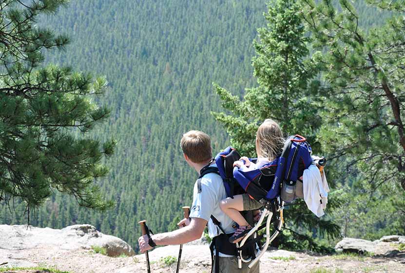
The Maxwell Falls hike is our most popular hike near Denver. Why? Because it’s a perfect Colorado family hike with a variety of terrain, and it takes you to one of the closest waterfalls to Denver. Below, you’ll find three different hike options: a one-mile hike, a three-mile loop, and a four-mile trek–all taking you to Maxwell Falls.
IMPORTANT NOTES:
#1: While this is a moderate hike, a significant number of novice and unprepared hikers have found themselves in challenging circumstances while hiking these trails: dehydration, heat exhaustion, altitude sickness, etc., and have had to call for emergency and rescue services. Evergreen Fire and Rescue urges novice and out-of-town hikers to seriously consider your fitness level before attempting the hike, to wear shoes that will help you navigate loose gravel, and to pack water for your trip.
#2: In the last few years, Maxwell Falls has become one of the most popular destination hikes near Denver, and it’s having a negative impact. In other words, Maxwell Falls is being loved to death. Please read through the Help Care for Maxwell Falls segment for basic trail etiquette that will help protect this beautiful place.
Trail Snapshot: Maxwell Falls Hike
| Hike Distance | 1.6 to 4 Miles |
|---|---|
| Difficulty | Moderate |
| Duration | 45 min to 2 hr 30 min+ |
| Trail Type | Out & Back and Loop |
| Seasons | Summer through Fall |
| Dogs | Allowed on Leash |
| Denver Drive Time | 50 min |
| Directions | Lower Parking Area – Upper Parking Area |
| Town Nearest Hike | Conifer, Colorado |
| Beauty | Waterfall, overlooks, creek, woodlands |
| Activities | Picnicking, hiking trails |
When we were moving to Denver, we were looking for a great house and for great hikes, and our favorite hikes end with a waterfall. Waterfalls close to Denver, Colorado don’t have a lot of wow-factor, but they make great for great destination hikes. There are 3 ways to hike to Maxwell falls. Our favorite is the Cliff Trail loop because it gives you the falls a reward at the end. The falls are more of a series cascades, but are worth the hike. If you want to explore more waterfalls near Denver, check out our Waterfall Hikes Near Denver page.
Hike Options for Maxwell Falls Trails.
1. The Short Version:
Less than 1 mile round trip – Begin at the Upper Trailhead and follow the signs to the falls. It’s just under half a mile, one way.
2. The Cliff Trail Loop:
3 Miles – Start at the upper trailhead lot. The trail will split a couple times and you’ll want to bear left, following the signs that point you down the Cliff Trail. You’ll climb a bit to a rock promontory that gives you beautiful views of the valley below. You will begin a descent to the creek bed, then the trail will turn and head upstream. Follow it until you hear the falls. After the falls, follow the trail back up to the upper lot.
3. Lower Maxwell Falls Hike
– 4 Miles Round Trip – Begin at the lower parking area and hike up the valley and along Maxwell Creek for about 2 miles. About 1.7 miles along the trail, you’ll cross to the other side of the creek. Shortly after that, you’ll hear the falls. Return the same way you came.
We’ve had some inquiries about whether or not there is camping at Maxwell Falls. Because this area gets so much traffic, we recommend camping elsewhere. It is permissible to camp on USFS land, but it’s important to take into consideration our impact, and the Maxwell Falls area is getting loved to death. I’d recommend checking out Reserve America for other camping ideas.
So, strap on your hiking boots, grab a picnic lunch and your trekking poles, then hit the trail to Maxwell Falls.
Help Care for Maxwell Falls Area
Maxwell Falls and the surrounding trails get an incredible amount of traffic, and in recent years, hikers have really harmed the area. So, during your visit (and as always), follow Leave No Trace principles and the following:
- Pick up trash on your hike (especially your own). There is no trash service at this trailhead.
- Pack out dog droppings
- Keep Dogs on a Leash
- No fires or digging fire-pits. Fires pose an extreme danger to nearby residents.
- If parking is full, come back later, or find a different hike. Roadside parking is causing erosion and safety hazards.
Tips & Resources for Hiking Maxwell Falls:
- TIP: This trail gets a ton of use, so make an effort to pick up a few pieces of trash while you are making your trek to the falls.
- TIP: Be on alert for the signage. It’s easy to miss, and sometimes in disrepair. I’d recommend reading through the comments section below for details.
- After the Hike: Beaujos Pizza in Evergreen
- Colorado Road Conditions: Colorado Road Conditions
Weather
Map & Driving Directions
Click for Driving Directions for Upper Lot

Looking for more waterfalls near Denver? Explore our more than 50 Colorado Waterfall Hikes, our favorite Waterfall Hikes in Rocky Mountain National Park, or 7 Waterfalls within One Hour of Denver.


The map directions from your site on my iPhone were spot on. Trail directions were so-so. But I don’t blame you…
Unfortunately, this park needs some loving care. The trails split off a lot without signage. We were stopped many times by people asking where the falls were or how to get back to the parking lot. There was a pole that had directions on it in Sharpie writing! We got a little mixed up ourselves and ended up with a pretty crappy view of the falls.
This is a nice hike, but if it’s your first time, be prepared to get a little lost. The park is small, so don’t panic!
Amanda,
Thanks for the comment on the trail signage.
I’d like to invite you and others visiting this page to contact the forest service about it. The squeaky wheel gets the grease :)
Here is the email contact page for the Arapahoe/Roosevelt forest district hhttp://www.fs.usda.gov/contactus/arp/about-forest/contactus
Happy Trails,
Aaron
Very successful short, easy hike. I agree with Amanda, the signage was AWFUL, so I have reported following the link above. We did the loop trail,and like Amanda said, ask people you pass if you are going the right way. Given the low water level this year, it was very difficult to see the falls. We followed what we though were the instructions and hung a left at the first opportunity, taking the trail in clockwise fashion. I think it would have been better go have gone around to counter clockwise, as the clockwise directions meant we passed the “falls” after only a tiny bit of walking, and we weren’t yet ready to stop and take a break.
If someone uses the national geographic maps, this trail shows on map #100. The myriad of trails that go off the main loop are NOT shown, so, like Amanda says… ASK people who are on the trail where to go.
Some friends just hiked to Maxwell Falls on 5/11/13 and the creek and falls are still covered with snow. Because the weather is warming up significantly this week, we are hoping that the snow may melt away by Friday 5/17/13. However, it may not be until the 24th that you’ll really be able to see the waterfall.
Welcoming updates from you all.
Drove up to the Maxwell Falls lower trail entrance. I would have missed it, had my GPS not directed me. It was a mid July Saturday morning about 11:AM. Temperature was in the low 70’s. It was a beautiful day for a hike. Passed on the trail about 50 people, and 25 dogs. I am age 60, not in the best shape with two bad knees. But I still made it. I would recommend bringing water, and a hiking pole for those of us no longer in our 20’s. My GPS said the hike one way from the lower trail to the falls was 1.84 miles. This took an 1 hour 15 minutes, each way, and that is including a few rest stops. I came from a sea level locale, so 8000+ feet altitude left me breathless a few times. It is a beautiful hike in the woods. The signage has not improved.
First time to Maxwell Falls. Parked on upper level, as suggested. This route makes for about a little under a half-mile trek to the falls.
The water fall made enough of a splash to sit on the rocks and feel the spray. Some hikers met along the trail expressed disappointment, as the falls were not up to their expectations, but based on feedback from 2012, the water is certainly running somewhat better for 2013, but do not expect jaw-dropping waterfalls.
From there, we stayed on the trail to the lower-level parking lot. The terrain has a series of up and down climbs, so makes for a moderate hike. Be aware of some areas of grit that make for a little slippery footing.
Returning the same way, passing the falls once again before heading back to the upper-level lot for about an 8-mile, roundtrip hike. Next time, we definitely plan to do the cliff loop’s spectacular view, as we are close enough in driving distance to Maxwell Falls.
Signage on the trails still consists primarily of wooden posts with directions to each trail written with what appears to be a marks-a-lot pen. The URL above to contact the Forestry Service has changed to:
http://www.fs.fed.us/
A “contact us” hyperlink is on the page. Perhaps more feedback may prompt the signage to be upgraded.
The exception is the first wooden post that points to the falls trail. The post has a professional sign, but the problem is either the post was positioned incorrectly in the ground, or the sign was affixed to the wrong side of the post. The sign is such that the arrow appears to point to the left, when the sign/post should be positioned to point the arrow straight ahead.
However, the trails have fairly well-worn paths of usage, so although there are offshoots, looking out and ahead of the paths as one walks, one should be able to stay on the trails without difficulty or fear of going off-trail.
All in all, a beautiful, serene hike!
we took the 3 mile loop from the upper parking. It was a great day hike from denver – just hard enough to get our mountain legs under us, from being at sea level – but not to tough at all. would recommend this for almost anyone in 1/2 way decent shape.
We hiked the cliff trail loop (3 mi) this morning from the upper trailhead and had a wonderful time! I have a broken ankle (in a boot) and didn’t have any trouble, except on some of the larger rocks to climb around the falls (not on the trail itself). We also had a 3-month old puppy with us, and she had no problems. We saw lots of friendly people and dogs, but it wasn’t too crowded. The signs seem to have improved, because we never had any trouble and saw plenty of signs to go to the cliff loop, the falls, and both trailheads. I recommend eating lunch on top of the cliffs if you do the cliff loop; it’s a little more crowded near the falls. Happy hiking!
I hit this trail today and it was great! I parked at the lower trailhead and then proceeded past the falls to catch the far end of the cliff loop and then come back around. I only saw one person on the whole hike which was really nice (hiking during the week in december has its advantages). Take a picture of the map at the trailhead with your phone to avoid getting turned around. Going this route is a lot of fun as you go uphill and downhill several times throughout the trip. Definitely take the time to go up the cliff loop.
This is doggie heaven on earth! Our babies have never been off leash on any trail and they were the happiest we have ever seen! We only came across one disgruntled dog. otherwise, all the owners and doggies were awesome! DOGGIE HEAVEN!!
Dom, this trail used to be off-leash, but it now requires a all dogs to be on leashes. Though it is a forest service trail, the Jeffco law is enforced: see the USFS site: http://www.fs.usda.gov/recarea/arp/recreation/ohv/recarea/?recid=28444&actid=50
The hike was very pretty and easy to navigate. However, it isn’t an off-leash area for the pups and most people do follow the rules, some don’t. On multiple occasions it was frustrating to hold my two dogs on their leashes, while dogs that were not leashed were circling and getting intertwined. Also, carry your poop bags out of the park!! It was obscene the amount of dog waste bags that littered the trail. The forestry preserve does need to provide trash dispensers of sorts at the trail head to dispose of these.
Otherwise the trail is fantastic! Go early because it gets crowded.
We hiked the Maxwell falls trail from the upper trailhead and it was wonderful! We took our two kids (ages 16 and 12) and we hiked to the falls- sat and enjoyed for a while- then hiked back in about an hour. It was fantastic! The signage is poor, but from the upper falls trailhead you hike along the creek and can easily find the falls. They were pretty and well worth the trip. Great hike for any family!!!
We did the hike from the lower parking to the falls and back with our 3 kids: 4, 5, and 8 years old. It ended up being a pretty difficult hike for them because the footing is slippery. Probably not the best one for us to do as newcomers to Colorado from the East Coast. It was beautiful though.
Great medium difficulty hike. We did the loop from the Lower Lot all the way up to the top lot and back down through the cliff loop. It ended up being 5.14 Miles total distance. We had 4-5 very nice point at which to get a different great view (the waterfall being one of course).
If you have young kids of newer hikers starting at the top lot and working your way down seems to be the best choice, you can always keep going from up there, but the falls are very close to the top lot.
This was an very enjoyable hike! I am 15 and im used to doing 14ers so this hike was super easy. If you are new to colorado or above the age of 50 then the hike could get a little bit hard. In the end of the hike the waterfall was super beautiful and the round trip wasnt to terrably bad. The signing was terrible but it was worth the while to try and figure out your way to the top to see the waterfall. I would recomend that you go early because if you go any later than like 7 or 8 people start rolling in and it gets to be kinda like a party.
Did not see any waterfalls, but beside that it was an amazing trail and me and my boyfriend enjoyed it a lot. We also got lost so stay on the same trail you came on.
Aaron, thanks for reviewing this beautiful hike. We are from out-of-town and were looking for a nice hike close to Denver for a quick 1/2 day hike. Just the drive to the trailhead was worth the trip!
We went there yesterday and it was awesome. We hiked from the lower to the upper trail head and had a nice picknick on the falls. Met some really nice people on the trail and it was just a great day. The hike was easy enough, so you could enjoy the scenery, but hard enough that you felt like you did some exercise. It took us about 4.0 hours total, but with a long break at the falls and a few breathers/picture taking stops on the way. Total hiking time was around 2 3/4 hours.
Great hike to a pretty waterfall and rock area. Great for dogs! Mostly shaded and easy to do. When you get to the top of the hill where it is open, go straight to stay on the trail (you’ll start to go down again).
Beautiful Colorado day to enjoy this trail. We hiked with two 6 year olds, an 8 and a 10 year old and did the 4 mile loop from the lower trailhead. The path was easy to follow and with a few breaks along the way our kids did really well. Some footing was slippery but the trail is safe for kids. It is steep for little legs in some places so you’ll want to leave plenty of time to get to the falls and back which is no problem if you take it slowly. Thanks for your review, can’t wait to try other CO day hikes!
Perfect day hike, and great tips and directions! Will definitely be using this site to find many more hikes!
Twenty-nine years ago, we moved into a house a half a mile up from the upper trail head. Back then, the area was absolutely beautiful. There was a lot of wildlife, the trails were excellent, and I rarely came across other people. It has become so tremendously popular, that I stopped going about four years ago. Today I decided to make the trek down to see if it had changed any. My observations horrified me. There are more camping spots than there used to be, and they were all worn completely down to dirt. The area around the falls is no longer pretty like it was back when. So many people scramble around in the small area that the vegetation in gone. The rocks have that ugly worn down look to them. Then there was the trail itself. I could not believe how much the trail had eroded. Rocks were rising up where in the past there were no rocks at all. I used to ride my horses all through the area. Now I would not want to try it for fear my horse would get hurt going over the horrendous rocks. The single trail has grown into a double trail in many areas. People ignore the barriers that were set up to keep them out of certain areas, and have even removed the barriers. Dogs were running off leash in spite of all the signs saying to keep them on leash. I would not recommend this area to anyone, and I don’t understand why it is so popular. The waterfall is rarely a real waterfall. The footing is bad, and it is over crowded and becoming torn up and ugly.
Kathy, I’ve had a talk with the Forest Service and they have observed the same things and feel the same way. I’m with both of you. Part of the solution is for the visitors to begin leaving the trail and surrounding area better than it was when they came. But it’s going to take more than that, a real concerted effort. I don’t foresee traffic slowing down on the trail, so the other options are 1) for the USFS to develop better parking, signage and ranger presence–this is difficult because of funding, 2) the other option (and this is not and either/or) is for a group of concerned citizens to adopt Maxwell Falls, its trails and environs, and to have an educational presence there along the trails during high impact times, particularly weekends. This has been done at many similar sites around the US, and in my opinion, it’s the best option. In my post, I will raise the signal and invite folks to rally to this point. It’s much needed. If you are a reader and are interested, contact the USFS offices to see what you can do to get something like this moving: (303) 275-5610.
The trail was awesome, but some disrespecting dog owners tried to ruin our experience. Signs everywhere say to keep your dog on a leash, but when my wife and I sat next to the creek, two off leash dogs ran up to us. One jumped on my back with muddy feet and the other went in the water and shook off on my wife. I figure that there were probably 20 bags of dog crap left on or near the trail. It would be nice if the park rangers would show up to enforce the leash law.
The trail was beautiful, views were not all that good. Irresponsible and disrespectful dog owners almost ruined our experience. I understand that budgets are tight, but if a ranger were to show up and fine dog owners the budget would improve dramatically. Off leash dogs and bags of dog crap all along the trail were numerous.
Hiked from the upper falls with my three year old, two year old, and newborn. Good hike for kiddies. Held their hands for part of it for safety. Fall colors were lovely. I would do again-though I can see how run down this area has gotten. I appreciated and specifically chose this hike though for its high traffic since I wanted to be safe and smart while hiking with toddlers on my own. walked by another hiker every 10 minutes or less which was just what I was looking for. Thanks for the great directions!
An off-leash dog attacked our dogs on this trail today. Shortly afterward we noticed one of our dogs was limping. Just got back from the vet. She needs surgery ($2,200). This trail is very crowded with lots of off-leash dogs. Would not recommend for anyone with small dogs or small children. :-(
Michelle, I’m really sorry to hear this. Officially, since this is Jeffco, the dogs need to be leashed at Maxwell Falls–even thought it’s USFS. County leash laws over-ride.
I hear more and more stories like this, more than one just from a few weeks past up on Mt. Bierstadt. I hope to write an article on off-leash dogs and hiking soon. I’m a dog lover myself, but there is a growing problem that definitely needs addressed. I’m sorry that it’s had such an impact on your dogs and family.
Still a bit snowy up there but still a great hike…will do it again around June and maybe the trail will be dry.
Did the hike today from the Upper lot. Hiked the cliff loop trail to the falls and back up. Great hike. About 3 miles. Thanks Day Hikes Near Denver for the tip on this one. Trails were mostly dry and not too many places with snow. We will do this one again!
I didn’t listen to the bad reviews of this hike, I usually am not picky about my trails and I don’t mind foot traffic… But this was a huge joke. People smoking cigarettes, eating Cheetos, throwing their trash onto the trail. SOOOO many kids, screaming, yelling and crying. People were overall rude. When you get to the “waterfall” you can’t even see it/enjoy it because there is literally 50 gawking tourists/people blocking any view you would want. If you are the kind of person that enjoys hiking for solitude and to enjoy nature – this is not the hike for you. It’s almost as busy as downtown Denver.
I love Maxwell Falls and do not understand how soooo many irresponsible hikers and dog owners use this trail and have no respect for it or others. I have never seen anyplace where people leave plastic bags of poop and trash everywhere. What kind of person would even think that is acceptable? The signs state before you get on the trail that all trash must be packed out including poop, yet every day it is awful. If you cannot be respectful of the land do not come here (or anywhere) and/or leave your dog at home!
Had a great hike up there yesterday, though we encountered a large black bear along the way so be advised. We backed away and waited for it to move on and finished our hike in a larger group who we joined up with. Know what to do if you encounter a bear!
We hiked the loop trail today with an out-of-town guest. Beautiful! Not too crowded at all on a weekday morning. We saw plenty of wildflowers in bloom, including (few) columbine and (abundant) sweet-smelling wild pink roses. The water level was a little lower than I expected. Near the top of the trail (upper parking) the path has been blocked by an enormous dead tree recently blown (?) over. Clearly most people have hiked around to the uphill (west?) side which has caused significant erosion on that side. In our party the younger kids had a ball crawling under and the older folk decided to hop over but I’m sure it will be removed by the end of the season clearing crew. We took out a little bit of trash but there are still places where irresponsible dog owners have left remains(!!!) Also, my imperfect pedometer put the whole loop trail (going clockwise) at only 2.6 miles, just a data point. I’m sure my son did over three, walking out to every lookout point and scampering around the water.
Great hike. It can be confusing on how to get to the falls. We somehow went to a dead end on private property. We should have taken a right, not a left. Good shade. Very busy trail.
Thanks so much for putting big and bold what is going wrong at Maxwell Falls and how to correct it. I love the honesty of this page!
I live on the edge of it, it is basically my backyard, and all the locals here can’t stand what’s happened to this area and rarely ever go to use it since it is being ruined daily. It sure seems that you care and want to protect this area. I’d like to encourage you to add/change your info for it to help further:
1) please put big and bold that it is EXTREME fire hazard are and that the neighborhoods surrounding it are depending on the users of this forest to be smart and safe. None of us can afford a fire up here and we’ll all lose our homes.
2) The address you list is actually Conifer, not Evergreen. If we are going to see such an increase of visitors to the area, it would be appreciated if Conifer could get some of the prestige and $$ from tourists coming to realize that we have things to do here too, not just Evergreen. ;-) Evergreen does not suffer from folks coming to their town but not spending money like Conifer does. Maybe on your town nearest hike you put both town names if it fits?
3) Please add to your orange box that there is NO trash service here. There are a couple of locals who volunteer to put bags out and do pick up but that’s it and should not be counted. Pack it out must be the motto of all who visit.
4) Please also add to the orange box to NOT add or create any fire pits. There used to be none here and they are multiplying like rabbits. See point 1.
5) Maybe put ” ” around falls. ;-)
Thanks again!
Thanks Maxwell Falls Local! It saddens me to hear of and see how the area has been treated in the last five years. All of us Coloradans need to encourage one another to be stewards of outdoor beauty we are so privileged to have all around us. I’ve incorporated your recommendations into the updates on the post.
I saw you recommended this from Spring–Fall. I would change it to Summer-Fall because Spring is just too iffy. We routinely get most of our snow in April and May now so folks would need to know that crampons are a NECESSITY in Spring as we get tons of ice then too.
Hi all: local neighbor here. While I appreciate this is a great hike and all… please do us all a favor and remember that people live here. Some common decency please. Brook Forest is NOT a parking lot, it’s a road. With through traffic. Don’t park on it. Don’t stop in the middle of it. Don’t STAND in the middle of it and just like when you were a kid, look both ways before you wander out into it to cross the street. Also, there are no trash cans: pack everything out!! That means all of your beer boxes and doggie poop bags that I see left everywhere by Monday morning. Please be a decent human. And by all means, come back and visit. Thanks.