Hikes In Denver, Colorado
Why drive far when there are a lot of great parks and hiking trails right in Denver, Colorado. If you are on a business trip and want to experience some Colorado trails, then explore these hikes right out our backdoor. We narrow the hikes in this set to hikes that fall within the I-470 perimeter. Explore the hiking trail profiles below and come back to see what new hikes have been added as we continue to build the best collection of hikes in and near Denver.
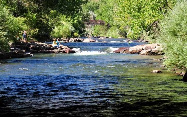
Clear Creek Trail in Downtown Golden
Want a hike to please everyone?The Clear Creek Trail in Golden, Colorado is it! It's got shade, the kids can bring their bikes, and you can finish your hike with a stroll around downtown. We might get some flack for calling this a hike, because it runs through the business district of Golden, CO.But you can wear the soles of ...
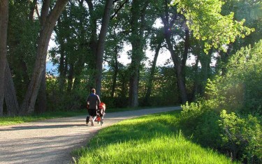
High Line Canal Hike – County Line to Fly’n B Park
The High line Canal starts in the foothills and meanders over 60 miles through Denver, creating a treelined hiking and biking thoroughfare in the middle of the city. This stretch in Littleton, Colorado takes you past Fly'n B Park. Take the path south and you'll find yourself in Writer's Park. Scroll down for the trail snapshot, and for further details ...
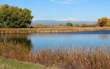
Lakes Loop Trail at Rocky Mountain Arsenal
An arsenal turned into a Wildlife Refuge. What a great idea! The refuge boasts over 15,000 acres and over 300 species of wildlife. It also hosts three lakes and Denver lake hikes. The Lakes Loop Trail at the Rocky Mountain Arsenal Wildlife Refuge is a 1.7 mile loop that winds along the shores of two lakes in the park, Lake ...
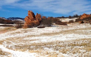
South Valley Park Trails
The trails of South Valley Park are perfect for an after work hike or run in South Denver. The expansive valley near the neighborhood of Ken Caryl is enclosed on its eastern side by the exposed red rock formations of the hogback and the green foothills to the west. Views to the south are incredible, making South Valley Park especially ...