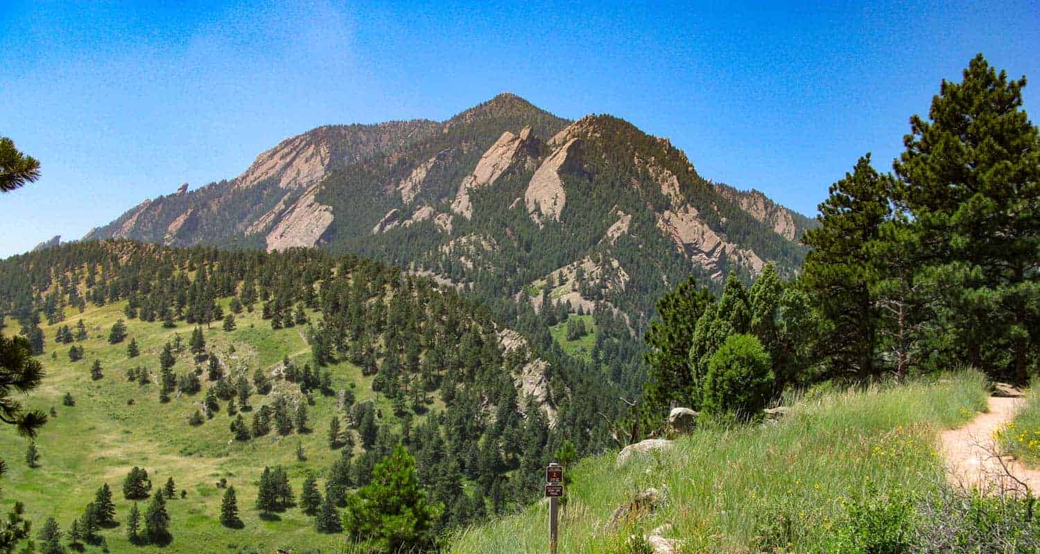
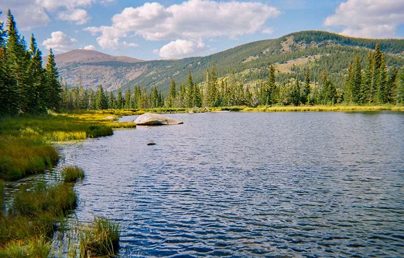
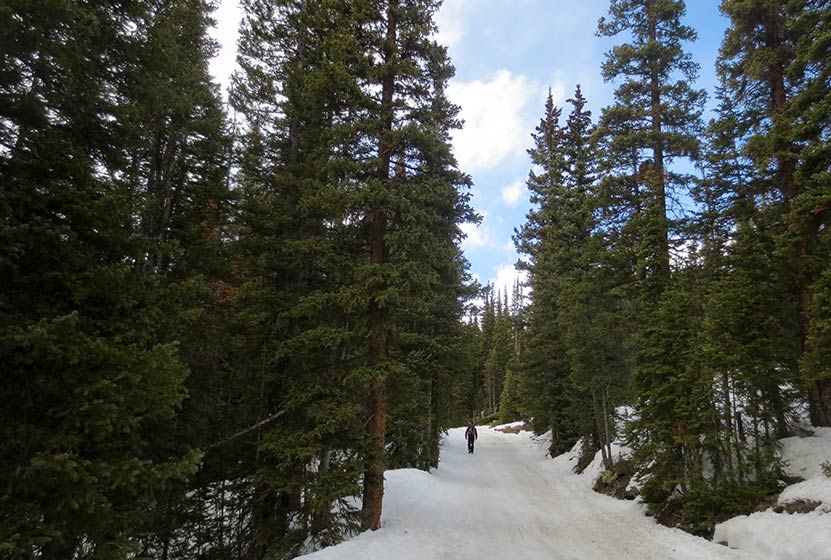
Mallory Cave Hike in Boulder
Mallory Cave is a 1.4-mile, moderate hike up into red rock formations of the Boulder Flatirons to a gated cave. Just 40 minutes from Denver, the trail to Mallory Cave was one of the earliest established recreational trails along the Front Range of Colorado. Explore the full trail profile for trail map, driving direcitons, photos, and tips for his hike in Boulder.
Trail Snapshot: Mallory Cave
| Hike Distance | 2.8 miles Round Trip |
|---|---|
| Difficulty | Moderate - Requires Scramble |
| Duration | Approx 2-3 hrs |
| Trail Type | Out-and-Back |
| Starting Elevation | 6080′ |
| Elevation Gain | Approx +1000′ |
| Seasons | Trail open Year Round, Cave Entrance has permanent closure, Buffer area near cave closures April 1 - Sept. 1 |
| For Closure Updates: | Boulder Open Space Closures |
| Dogs | Allowed On Leash, but Not Recommended because of difficult terrain |
| Hike Trail Map | Click for Trail Map of Mallory Cave |
| Denver Drive Time | 40 min |
| Driving Directions to NCAR Trailhead | Click for Google Map |
| Town Nearest Hike | Boulder, Colorado |
| Beauty | Cave, Canyon, Creek, Wildflowers, Meadows, Wildlife: Mule deer |
| Activities | Hiking, Photography, Birding, Running |
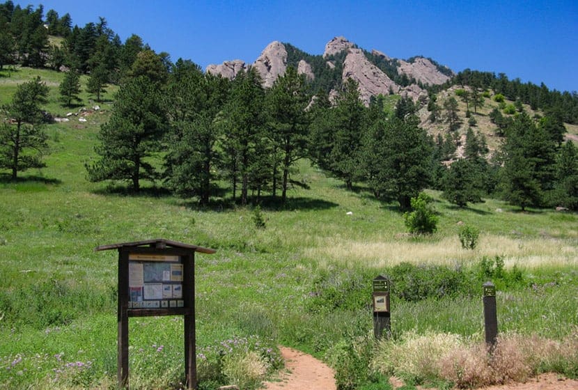
Parking & Trailhead Information for Mallory Cave
The National Center for Atmospheric Research (NCAR) Trailhead is located about 40 minutes North of Denver. From Denver, follow U.S. Route 36 to Boulder. Take the exit for Table Mesa Drive and follow it West. It will wind through a neighborhood to the end as it winds through the neighborhood and past Bear Creek Elementary School. The road will turn into the Drive for NCAR which winds up and around to a large parking area at the lab.
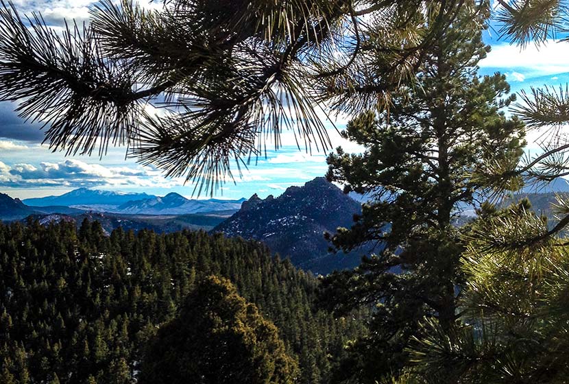
The Hike: Mallory Cave
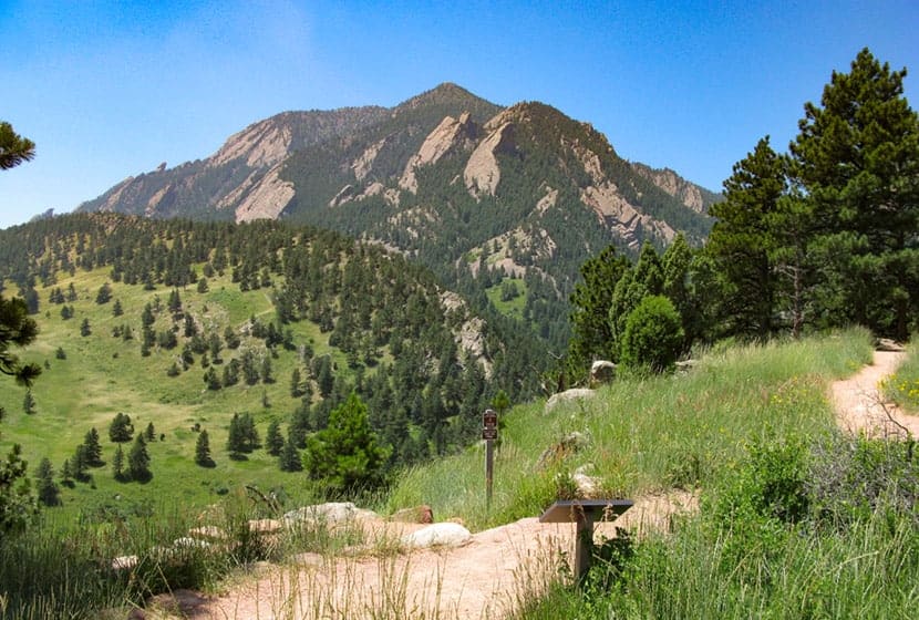
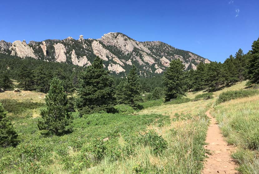
The hike to Mallory Cave begins on the Watler Orr Roberts Trail on the west side of the NCAR parking area. Take the trail west for about 1/2 a mile until it intersects with the Mesa Trail. The Mesa trail runs along the base of the foothills and is the north/south major artery for most of the trails in the Flatirons. For a more detailed trail profile of this southern segment Mesa Trail, check out our South Mesa Trail to Bear Canyon trail profile.
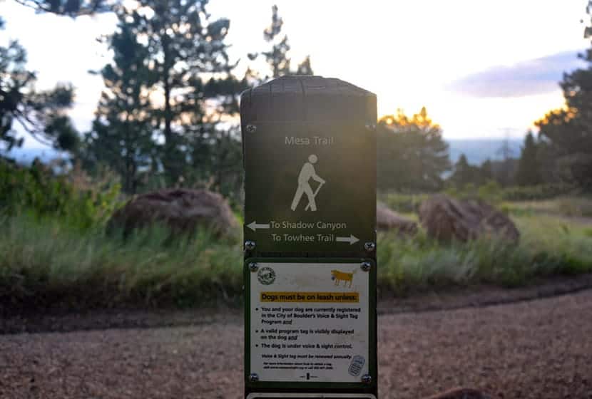
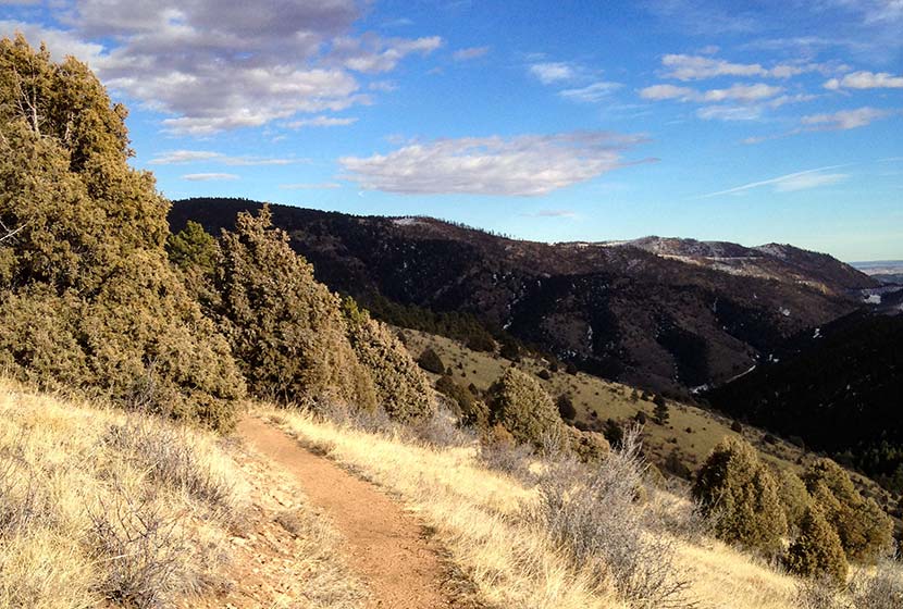
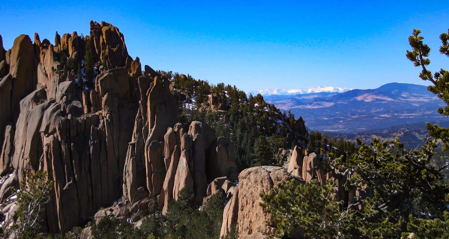
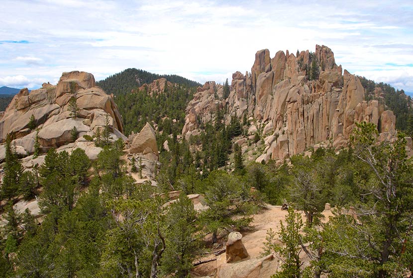
Take a left (heading south) onto the Mesa Trail. Soon you'll encounter the Mallory Cave Trail on your right (west). The Mallory Cave trail is uphill all the way to the cave, becoming more demanding on your legs as it climbs the broad rigde into the Flatirons. You'll encounter red rock formations along the trailas it makes its way deeper and higher up into the foothills.
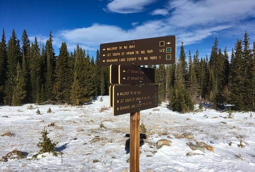
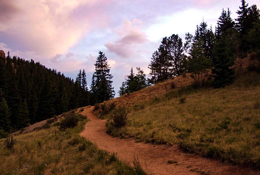
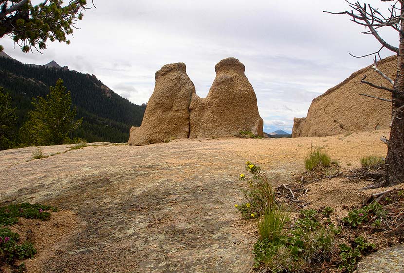
The trail is well-marked, so be alert for signs. The last segment of the hike is a scramble, and one that can be quite dangerous if there is snow, ice, or or water on the rock. Be sure to test the grip of the shoes, just like you might test your braking and tires on your car in snowy or icy weather. And remember, the scramble down is almost always more difficult than the way up. Signage will point you in the right direction (see photo below).
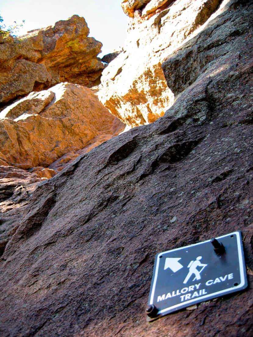
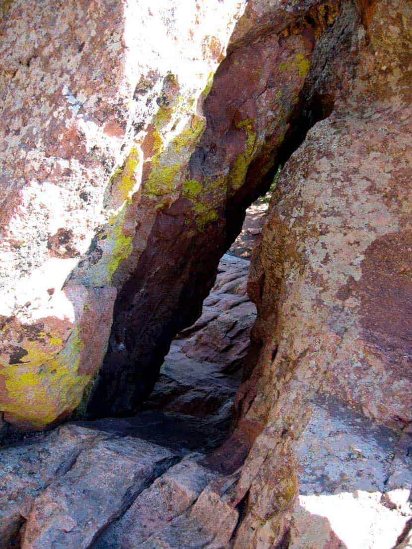
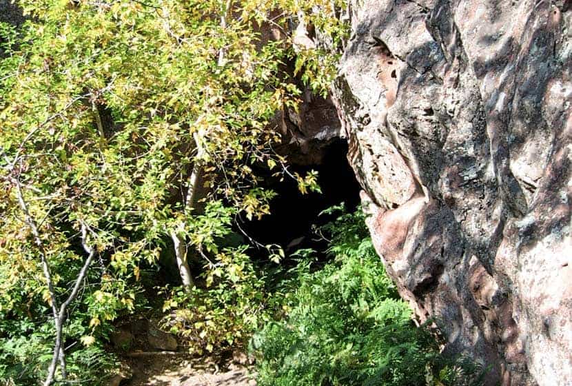
At the cave, you'll be able to peer into the gated entrance. Why is Mallory Cave Closed? Many caves across the state have been closed because of a strange fungal disease that's had an adverse impact on the bat populations of Colorado and the West. It appears humans are the ones somehow bringing the disease into the caves. (Cave entrance pictured below).
Hike back to NCAR via the same route you took up to Mallory Cave. Give care to your scramble down the slick rock. A final note: we don't recommend hiking this with your dog because of this final scramble up to the cave.
Tips & Resources for Hiking Mallory Cave
- Wildlife Aware: Like many of the trails in the Boulder area, keep alert because mountain lions and black bears frequent the area. Know what to do if you encounter a Mountain Lion or a Black Bear.
- Trail Map: Mallory Cave Trail Map
- Packing List: Always pack the 10 Essentials. Download our Hiking Guide to get the list and dayhiking packing checklist.
- Explore More Flatirons Hikes in Boulder: First Flatiron Hike, Gregory Canyon Hike, Green Mountain, Enchanted Mesa Hike, and Royal Arch Trail.
- Colorado Road Conditions: Colorado Road Conditions
- Photo: We would like to express our gratitude to Eric Wendelin and McWillimediafor sharing photographs of this hike to Mallory Cave.
- After the Hike: The Parkway Cafe
Weather
Map & Driving Directions
Click for Driving Directions
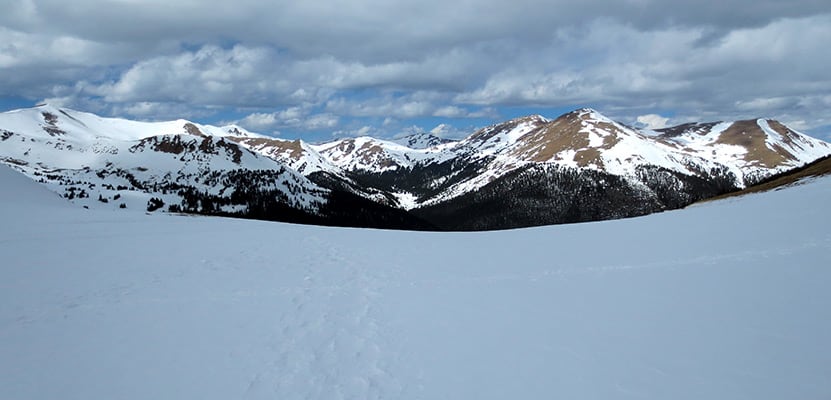
Brainard Lake CMC Cabin Hike
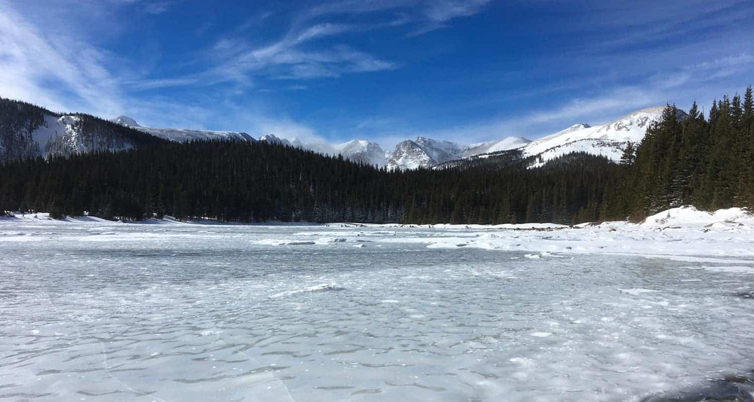
The CMC Cabin at Brainard Lake makes for a perfect winter snowshoe, a challenging ski in, or an easy Summer hike from the Gateway Trailhead. It's a 3-mile route in to the cabin to take in views of the beauty of Brainard Lake and surrounding snow-capped Rocky Mountains. This trail profile looks at two different 6-mile round-trip routes: a winter route via the Snowshoe Trail, and a summer route via the Waldrop Trail.
Trail Snapshot: Brainard Lake CMC Cabin Hike
| Hike Distance | 6 Miles Round Trip |
|---|---|
| Difficulty | Easy |
| Duration | Approx 2-4 depending on conditions |
| Trail Type | Out-and-Back |
| Starting Elevation | 10,080′ |
| Elevation Gain | Approx +400′ |
| Seasons | Snowshoe Trail: Winter Only Trail; Waldrop/St. Vrain Spring to Fall |
| Dogs | Only allowed on Brainard Lake Road from Nov. 15 through April 30 |
| Hike Trail Map: Winter Trails | Click for Trail Map of Brainard Lake Winter Trails |
| Hike Trail Map: Summer Trails | Click for Trail Map of Brainard Lake Summer Trails |
| Denver Drive Time | 1hr 20min |
| Driving Directions to Brainard Lake, Gateway Trailhead | Click for Google Map |
| Town Nearest Hike | Nederland, Colorado |
| Beauty | Mountain and Lake Views |
| Activities | Cross Country Skiing and Snowshoeing in Winter Months, Hiking in Spring to Fall |
Parking & Trailhead Information for Brainard Lake CMC Cabin
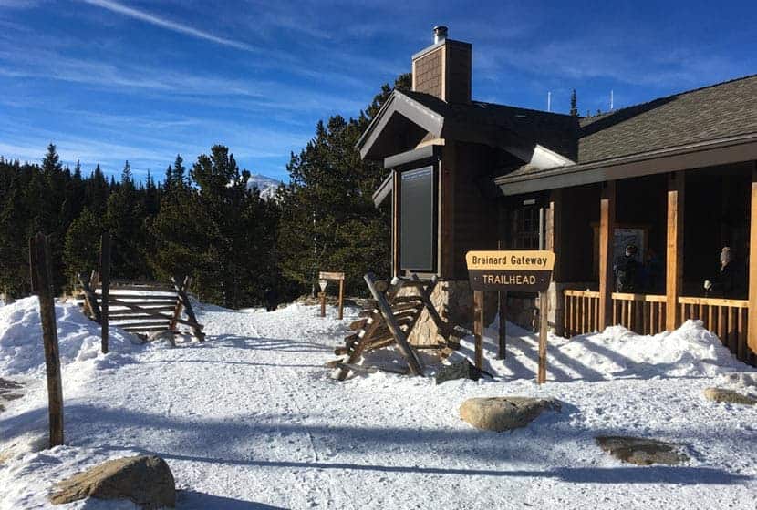
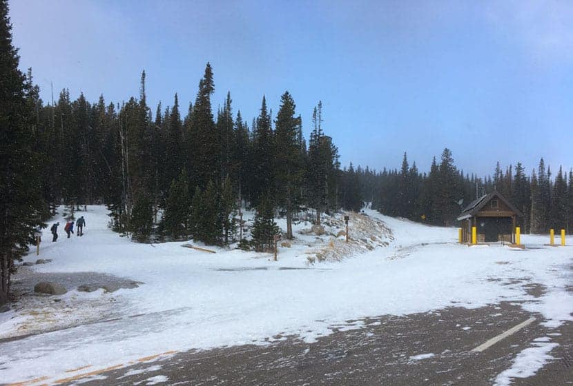
Both of these Winter and Summer adventures start at the Gateway Trailhead, also known as the Brainard Lake Winter Lot. I've found that guidebooks and maps get confused with the name. But from hiking here a few times, this is the most current info. The trailhead is massive, with tons of parking and year-round restroom facilities. However, parking in the Winter months can fill by around 9am on the weekends because this trail system around Brainard Lake is probably the most popular snowshoe and non-groomed cross-country skiing destination near Denver. There are no fees to park at the Gateway Trailhead. There are fees during the Summer months for going through the gate station to the lots nearer to Brainard Lake.
From Denver, take Interstate 25 North to 36 West toward Boulder. You'll drive through Boulder on 36/28th Street as it goes North, then taking a left onto Lee Hill Road. This leads west where it makes a hard bend left and climbs into the foothills. Eventually, after about 6 miles it will dead end at a junction with Lefthand Canyon Drive. Take a left onto Lefthand Canyon and get ready for a winding drive for about 10 miles. Drive carefully here and be on alert for cyclists and motorcycles. Because it's in shadow most of the day, the road can get pretty icy and packed with snow in sections during the Winter. You'll pass through the little town of Ward, Colorado, that looks a lot like an 1800's Colorado mining settlement. There is a roadside art gallery and a coffee and ice cream place. Lefthand Canyon Drive stops where it meets up with CO-72. Take a right onto CO-72, then make an almost immediate left onto Brainard Lake Road. Proceed for about 2.5 miles and you'll find the Gateway Trailhead on your right.
The Hike: Gateway Trailhead to CMC Cabiin
Winter Snowshoe Trail to CMC Cabin
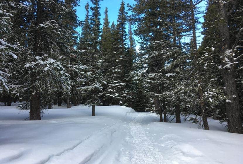
In the Winter, snowshoers will follow the Snowshoe Trail for 3 miles to the CMC Cabin. This is a Winter-only trail and dogs are prohibited. Many of the other trails in this area are Ski-only. The trails can be a bit of a maze, so I recommend printing off a trail map or having an app with you (no service, so download the map) so that you can stay oriented.
Finding the trail may be the most difficult part. Hike or snowshoe back out to the main road and head toward the gatehouse. When facing the gatehouse, the trail begins just before it on the left/south side of the road (see photo above). But why not just hike the road in, especially if it's covered with snow? The road is definitely an option and more direct route. Dogs are also allowed on the road, but the road is broad and open to wind, which can be chillng. The difference between the road and trail can be dramatic when it comes to keeping warm in the shield of the trees.
The trail will run past Red Rock Lake as it stays on the south side of Brainard Lake Road. This segement is about 1 mile before it turns North and merges with the road. You'll go left on the road proceeding for a short distnaceon it until you see signs on your right/north for the Snowshoe Trail. Keep your eyes peeled for signange at the next junction that will point your left/west to continue on the northern segment of the Snowshoe Trail.
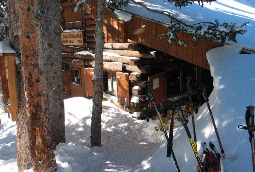
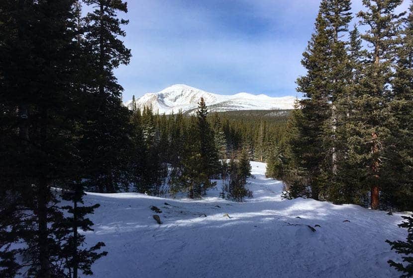
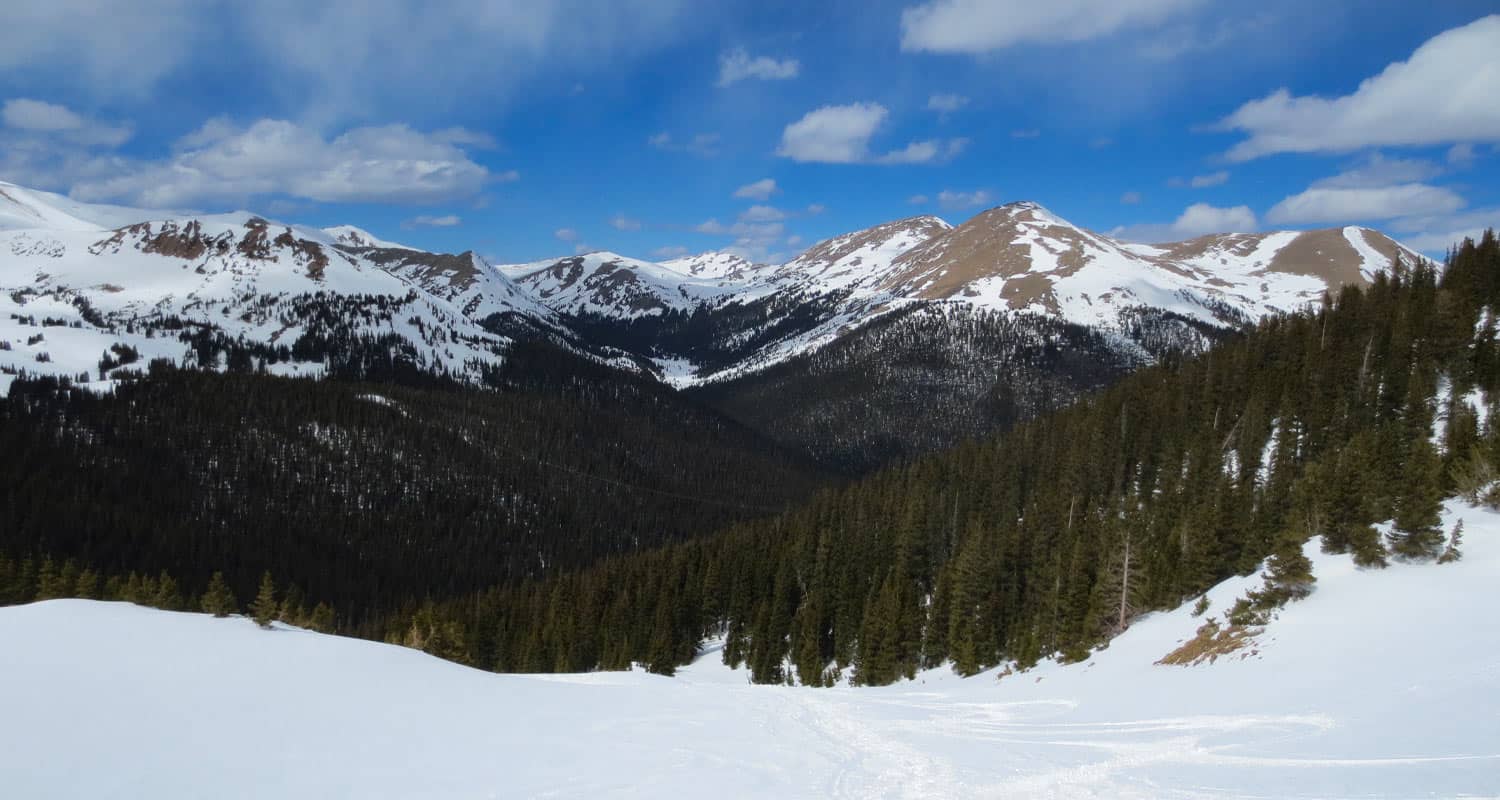
The trail will eventually emerge back out onto the road crossing the bridge over Mitchell Creek. Here is where you'll be able to take in views of Brainard Lake and the snow-covered mountains of Indian Peaks. Look for signage tht will point you to the last segment of the Snowshoe Trail which will be on your right/north. This final trail segment will take you to the CMC Cabin. In the Winter months, the cabin is availabe as a warming hut to thaw out your cold toes and spend time getting refreshed before snowshing the 3 miles back to your car.
Summer Waldrop Trail to CMC Cabin
This next route can be taken in the Summer as a hike. In the Winter months, it's a ski-only trail, and quite demanding. If you plan on cross-country skiing this, it's not for beginners and you probably should have a backcountry cross-country ski so that you have a wider base to allow you to navigate all the ups and downs. In the Spring, their will likely still be a lot of snow on the trail, but in the Summer, this Waldrop route to the CMC cabin is a nice easy to moderate hike.
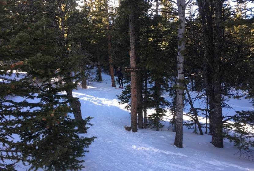
To pick up the Waldrop Trail, hike or ski out to Brainard Lake Road, follow the to the Gatehouse entrance area. You willfind signage for the Waldrop Trail on the right side of the road after passing the gatehouse and before Red Rock Lakes. The trail first heads almost directly North before bending back to the west through dense forest.
After about 2 miles, you'll encounter an open area with a junction with several other trails. This will point you to continue on the Waldrop Trail and notes that it's 1/2 mile to the South St. Vrain Trail.
Hike or Ski this 1/2 mile segment on the Waldrop until it intersects with the South St. Vrain Trail, then go left/west onto the South St. Vrain Trail. This final segment will bend south toward the lake and the cabin. Follow the signs to the cabin. If you are skiing in, then warm up at the CMC Cabin. If it's Summer, you have a lot of return options, so check out the Brainard Lake Summer Trail Map to decide your route. If hiking back the way you came in, this makes for a total distance of about 6 miles.

Tips & Resources for Hiking at Brainard Lake
- CMC Cabin: The CMC cabin can be reserved for overnights. See details on the CMC Boulder page for the Brainard Cabin.
- Time: Winter travel can take longer than the usual 2 miles per hour hiking speed, so plan on it taking longer than usual..
- Winter Conditions: Weather can change in an instant at this altitude in the mountains and this can be especially deceptive during the Fall and Spring months when its warmer. Be sure to pack and dress for extreme winter conditions. Check the weather and keep an eye on the sky.
- Winter Trail Ettiquette: On multi-use trails where you see ski tracks, avoid snowshoing or hiking over top of the ski tracks. Instead, hike to the side to preserve these tracks for skiers. It makes a big difference for them. Allow skiers traveling downhill the right of way.
- Packing List: Always pack the 10 Essentials. Download our Hiking Guide to get the list and dayhiking packing checklist.
- Colorado Road Conditions: Colorado Road Conditions
- Photo: We would like to express our gratitude to Laura Scudder for sharing her photo of the Brainard Lake CMC Cabin.
- After the Hike: Woodfired Pizza at Crosscut Pizza and Taphouse in Nederland
Weather
Map & Driving Directions
Mesa Trail to Bear Canyon Creek
The Mesa Trail south of Boulder, Colorado, rambles across wild open country at the base of the iconic Flatirons. Hike a 4.1 mile loop or an 8.4 mile out-and-back option through pine woods, verdant creek draws, and flowering meadows. Explore the full Mesa Trail profile for this southern segment of one of our favorite dog-friendly hikes near Denver.
Trail Snapshot: Mesa Trail South
| Hike Distance | 8.4 miles Round Trip |
|---|---|
| Difficulty | Easy to Moderate |
| Duration | Approx 4 hours |
| Trail Type | Out-And-Back |
| Starting Elevation | 5650′ |
| Elevation Gain | Approx +900′ |
| Seasons | Year Round |
| For Closure Updates: | Boulder Open Space Closures |
| Dogs | Allowed On Leash |
| Hike Trail Map | Click for Trail Map of the Mesa Trail near Boulder |
| Denver Drive Time | 45 min |
| Driving Directions to South Mesa Trailhead | Click for Google Map |
| Town Nearest Hike | Boulder, Colorado |
| Beauty | Wildflowers, Sunrise, Meadows, Rock Formations, Wildlife: Deer, Bear, Birding. |
| Activities | Hiking, Trail Running, Photography |
Parking & Trailhead Information for the South Mesa Trailhead
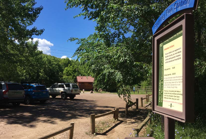
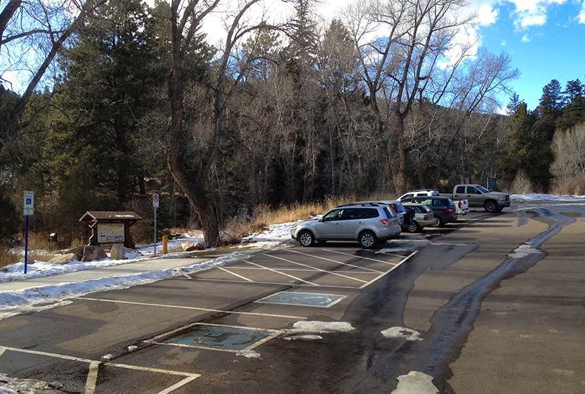
Access to South Mesa is from the South Mesa Trailhead off of Eldorado Springs Drive just South of Boulder. From Denver, drive North on interstate 25 to 36 toward Boulder. Take the McCaslin Blvd exit and then go south/west onto McCaslin. At the intersection of McCaslin and Marshall, take a right onto Marshall Road. Marshall will intersect with Eldorado Springs Drive. Here, take a left onto Eldorado Springs Drive. About two miles down the road, you’ll find the South Mesa Trailhead on your right. The South Mesa Trailhead is a part of the Boulder County Open Space and requires a daily parking fee, or an annual pass. I went online and bought an annual parking pass through the Open Space website. This gives you access to all the southern fee parking areas as well as the parking areas on Flagstaff Mountain. There are restrooms at the trailhead.
Alternatively, you can park at NCAR and hike south to the South Mesa Trailhead. If you want to hike this one-way without a return, you can park a car at NCAR or the South Mesa Trailhead. The National Center for Atmospheric Research (NCAR) Trailhead is located about 40 minutes North of Denver. From Denver, follow U.S. Route 36 to Boulder. Take the exit for Table Mesa Drive and follow it west. It will wind through a neighborhood to the end as it winds through the neighborhood and past Bear Creek Elementary School. The road will turn into the Drive for NCAR which winds up and around to a large parking area at the lab.
Waypoints and Hike Options for the South Mesa Hike
- South Mesa Trailhead to NCAR Trailhead 4.7 Miles - One-Way
- South Mesa Trailhead to Bear Canyon Creek and Back - 8.4 Miles
- South Mesa to Bluestem Loop 4.1 Miles - One-Way
- South Mesa to Chautauqua Park 6.75 Miles - One-Way
The Hike: Mesa Trail to Bear Canyon Creek
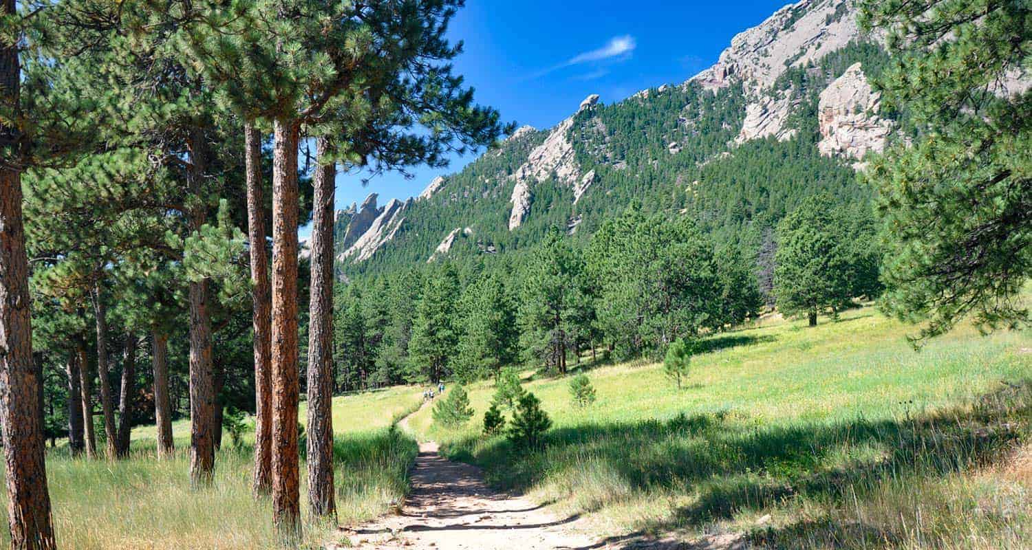
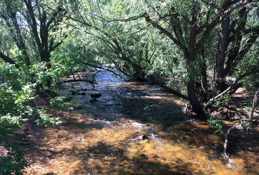
From the South Mesa Trailhead just East of Eldorado Springs, this hike begins along the banks of Boulder Creek (pictured above). Cross the bridge and pause to take in the willow trees bending over the creek and creating a tunnel of green above the silver waters. You'll cross another footbridge and emerge onto a broad trail. Soon, you'll come to the first trail junction with the Towhee and Homestead Trails. The Towhee cuts off a bit of distance and will take you back to the Mesa Trail, or just keep following the signs for the Mesa Trail as it wraps around to the west. Either way, the trails will both merge back onto the main Mesa Trail.
The Homestead trail heads west to Shadow Canyon and takes hikers up toward South Boulder and Bear Peaks. Both are more challenging hikes and provide incredible views out to the plains and west to snowcapped peaks.
This area of the South Mesa has a lot of side trails and options, so the most important thing to keep in mind is that the Mesa Trail, over its course runs north/south all the way up to Chautauqua Park.
Before you hike, be sure to review the map to get a feel for the area. The trails weave round, so it's easy to just meander around and take in the meadows and surrounding peaks. The trails are all well-marked, so when in doubt, just look for signs indicating the Mesa Trail and continue hiking north (with the foothills on your left). There are a lot of options for shorter hikes, but we will detail the journey up the Bear Creek Canyon and back.
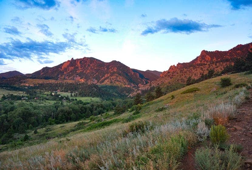
Early on, you'll gain a great view down into the entrance to Eldorado Canyon. The morning light brings out the pink granite of this range of sharp and angular foothill rock.
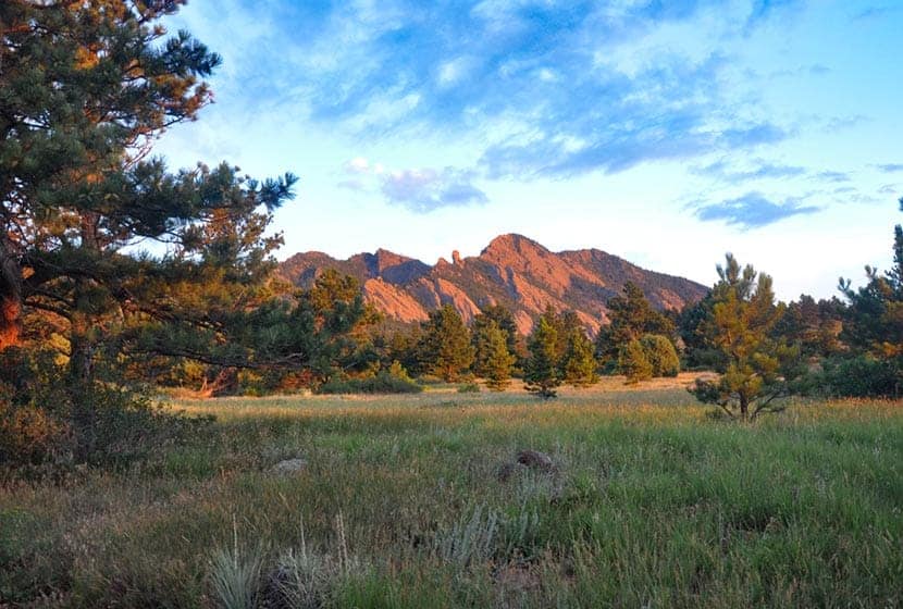
The Mesa trail then heads west and up along a gentle slope, then bends north to run parallel with the eastern flanks of the Flatiron range. Along the foothills to the left, you'll see Devils Thumb and the summit of Bear Peak.
As the Mesa Trail continues north, open sky gives way to the shade and scents of ponderosa pine trees then opens back to meadows again. In the Spring, wildflowers push up through the meadow grasses and unique fuana thrives in the unique zone where the foothills of the Front range meet the meadows. It feels humind in verdant creeks draws and dry when you emerge back onto the open Mesa.
If you would like to shorten your hike and make this into a loop hike, at around mile 2, you can take the Bluestem Trail back toward the trailhead. Otherwise, continue north on the Mesa Trail.
This is one of our favorite dog-friendly hikes near Boulder, and it's quite popular with dog owners on the weekends. In fact, just south of the intersection with the Bluestem, just shy of mile 2, there is a spring you'll find a small spring. It's a great place for your pup to get a drink to refuel for the rest of the hike. These trails also allow you to hike with your dog off-leash, if you've taken the Voice and Sight class and have a current Voice and Sight tag issued by Boulder county. You can get more info on this at the Boulder County Open Space site.
The trail will go up and down through several draws, then eventually cross Bear Creek. Here you are about a mile from the NCAR parking lot. If you've parked a car at NCAR, you can then shuttle back for your other vehicle, making this a 4.7 mile hike.
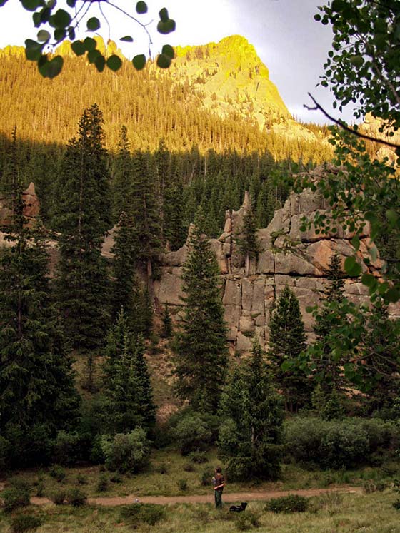
Bear Creek is the turn around point for this trail profile, making it an 8.4 mile out-and-back journey. However, if you want to add a cave to your adventure, continue north, then west for about 1.2 miles following the signs to Mallory Cave. If you have your dog with you, I would not recommend this extra jaunt as the terrain is rocky and steep.

Return south on the Mesa Trail and take the Bluestem Trail to cut off a bit of extra hiking.
Tips & Resources for Hiking the Mesa Trail
- Sunscreen: We added this hike to our list of hikes with shade, but there are still open segments, so sunscreen is still needed.
- Go on a Weekday: The South Mesa Trail system is busy on the weekends. So, if you are looking for some solitude, try a weekday
- Trail Map: South Mesa Trail System Map
- Packing List: Always pack the 10 Essentials. Download our Hiking Guide to get the list and dayhiking packing checklist.
- Colorado Road Conditions: Colorado Road Conditions
- After the Hike Cafe: Walnut Cafe in Boulder
- After the Hike Brewery: Sanitas Brewing Company
Weather
Map & Driving Directions
Click for Driving Directions
Eagles View Hike in Reynolds Park
The Eagles View Loop hike in Reynolds Park is a 4-mile, moderate, loop trail to a scenic outlook. The trail ascends through meadows and ponderosa pine forest to views of Pikes Peak and the sawtooth spires and peaks of the Rampart Range. Explore the full Reynolds Park Eagle View Loop hike profile below for trail map, driving directions, and more tips and details to help you enjoy this adventure near Conifer, Colorado.
Trail Snapshot: Reynolds Park Eagle View Loop
| Hike Distance | 4 or 4.4 miles Round Trip |
|---|---|
| Difficulty | Moderate |
| Duration | Approx. 2 hours |
| Trail Type | Loop |
| Starting Elevation | 7,250'′ |
| Elevation Gain | Approx +900′ |
| Seasons | Year Round |
| Dogs | Allowed On Leash |
| Hike Trail Map | Click for a Map of Eagles View Loop at Reynolds Park |
| Denver Drive Time | Approx. 50 min |
| Driving Directions to Reynolds Park | Click for Google Map |
| Town Nearest Hike | Conifer, Colorado |
| Beauty | Scenic Overlook, Aspen woodlands, Views of Pikes Peak and Cathedral Spires |
| Activities | Hiking, Trail Running, Equestrian Trails, Photography |
Parking & Trailhead Information for Reynolds Park
I really enjoy the drive into Reynolds Park, particularly for the last stretch descending to the trailhead. The trailhead is about 50 minutes from downtown Denver. From Denver, take 285 South to Conifer, Colorado taking the Kennedy Gulch exit. At the exit, you'll take a left onto Kennedy Gulch Road, which will go under the 285 overpass. At the next stop sign, you'll see a red barn in front of you and an entrance to 285 on your right. Here, you'll take a left onto Foxton Road. This is where that beautiful stretch of road begins. Drive for about 5 miles and the Reynolds Park parking area will be on your right. The parking area can hold about 45 vehicles. There are restrooms, picnic tables, and grills at the trailhead.
The Hike: Eagles View Loop at Reynolds Park
This loop hike gives hikers the most extensive exploration of the larger West side of Reynolds park. Begin by taking the main trail found on the south end of the parking lot (near the restrooms). It's wider than the other trails. At the first junction, take a right onto the Elkhorn Trail. This will lead through a mix of wooded areas and meadow.
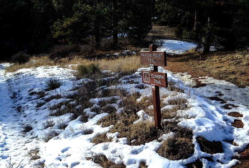
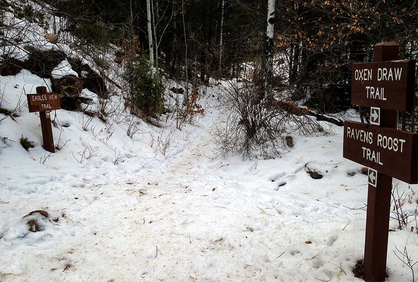
Hikers will travel about 0.3 mile on this segment of the Elkhorn Trail until it intersects with the Ravens Roost Trail. Here, take the Ravens Roost trail which is more steep, ascending for 0.6 of a mile up to the next junction with the Eagles View Trail. Both the Ravens Roost and Eagles View trails are Hiker and Equestrian Only (no bikes, but dogs are allowed). You'll travel through stands of ponderosa pine. Look for Clarks Nutcracker and Stellar Jays as you hike. At the junction, the Eagles View Trail will bear to the right (pictured below).
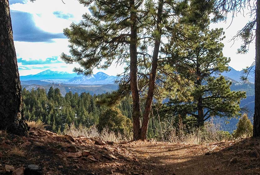
The trail will eventually open up to panoramic views, with the Eagles View scenic viewpoint being the best.
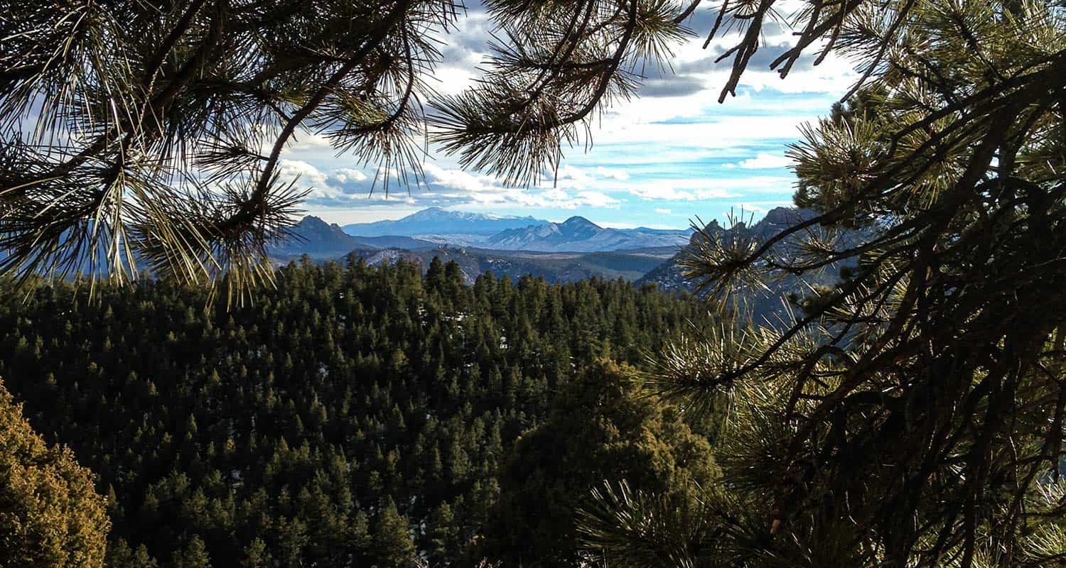
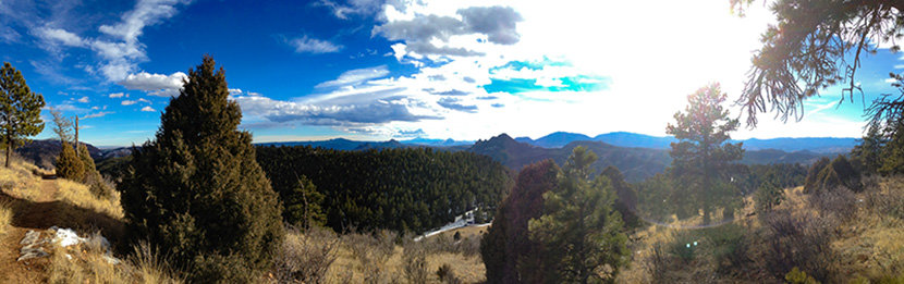
At the viewpoint, there are expansive views of the Rampart Range, and pikes Peak to the South. The Rampart Range is a low mountain range that stretches from south of Denver to Colorado Springs. The range is characterized by scraggy granite peaks jutting out of green forested foothills. At sunrise the granite rock formations light up orange and pink, and look like a series of castles or the rampart wall of a giant ancient fortress. My favorite view of the Rampart Range is from the Devils Head trail and from the Fire Lookout Tower up on Devils Head. It's the tallest peak in the range with an elevation of 9632 feet.
From the scenic point at Eagles View, the trail begins to descend and wind its way north. Pause on this segment to take in the views into the valley below and out to the distant plains in the East.
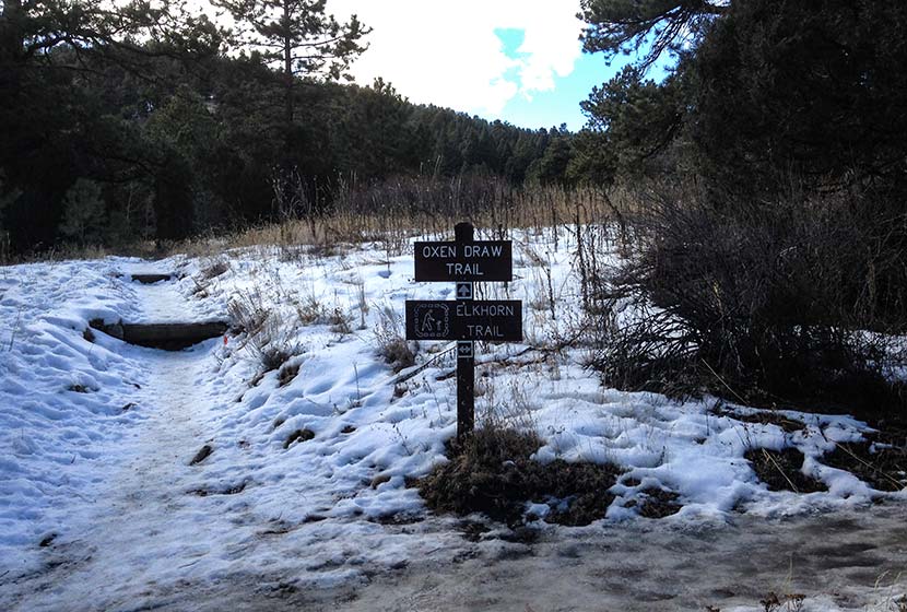
Eventually, the trail will come to another juncture with the Ravens Roost (south segment) and the Oxen Draw Trail. Both are options back to the Trailhead. Taking the Ravens Roost trail makes for a longer 4.4 miles total. Taking the Oxen Draw trail will make your total trip around 4 miles.
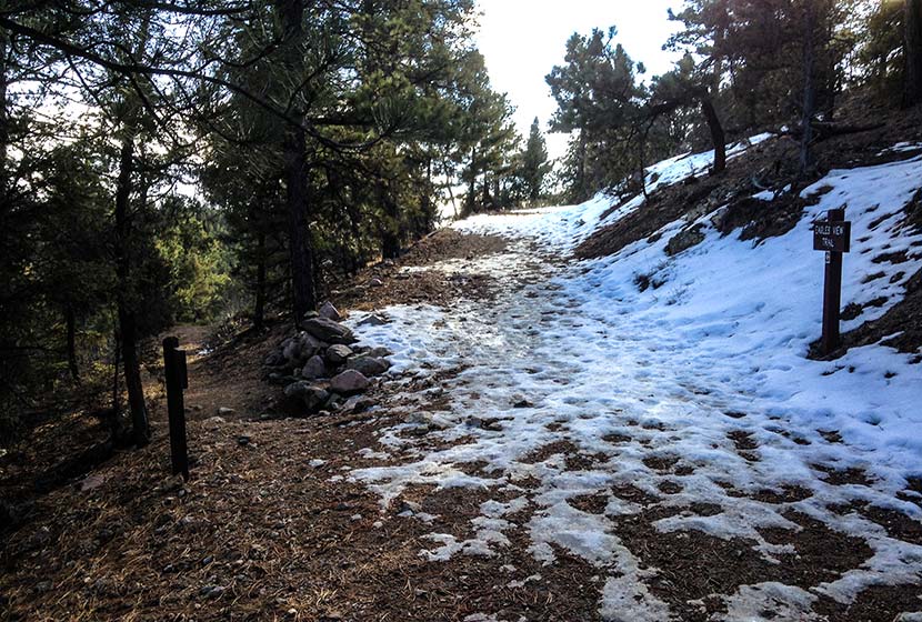
When I hikes this in the Winter, the Oxen Draw Trail got quite icy from a recent thaw and freeze. I'm assuming this is pretty normal for this shaded area of the park during the cold months. I wish I had brought my traction devices because the trail had some steep and sketchy, ice-coated segments. I had my trekking poles, and they helped, but it was difficult to navigate.
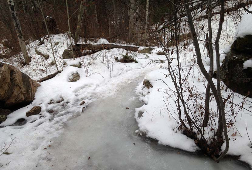
You may notice that I've marked this as a dog-friendly hike. Most of the year that's true, but these icy segments of the Oxen Draw Trail in the Winter may not be the best for your best friend. Overall, though this hike has proven to be one of the lesser traveled trails near Denver--especially on a weekday. Be sure to watch the video below to get a feel for the hike.

Tips & Resources for Hiking at Reynolds Park in Jefferson County
- Trekking Poles and Traction: If you are hiking in the Winter or Spring, the this trail (as you can see from the photos above) can get icy and muddy. Trekking Poles and Traction Devices are recommended for these seasons. I'm a huge fan of trekking poles because they take so much impact off the knees when hiking and backpacking, and they allow us to navigate more demanding terrain. Check out Trekking Pole options at REI.
- Camping: There are 5 tent camping areas on the East end of Reynolds Park that require only a short hike in and make for a good way to introduce your kids or family to a weekend camping trip without having to travel far from Denver. You can reserve a campsite at the Idylease Campground at the Jefferson County Parks Reservations Page. The campground is just a 1/2 mile hike in and has restrooms--but no drinking water--available at the site.
- Trail Map: Reynolds Park in Jefferson County Park Map
- Packing List: Always pack the 10 Essentials. Download our Hiking Guide to get the list and dayhiking packing checklist.
- Colorado Road Conditions: Colorado Road Conditions
- After the Hike: Scooters Smokehouse BBQ
Weather
Map & Driving Directions to Reynolds Park
Click for Driving Directions
Crags Hike Near Colorado Springs
The Crags Trail takes hikers up a 2-mile gradual hike to the the dramatic granite pinnacles on the shoulders of Pikes Peak to take in views of snowcapped peaks. A shaded creekside hike great for families and out-of-town guests, the Crags shows off summer wildflowers in mountain meadows. Explore the full Crags hike profile below for trail map, driving directions, and more tips and details to help you enjoy this adventure in the Pikes Peak region.
Trail Snapshot: The Crags near Colorado Springs
| Hike Distance | 4.5 miles Round Trip |
|---|---|
| Difficulty | Moderate |
| Duration | Approx 2 hours |
| Trail Type | Out and Back |
| Starting Elevation | 10,900′ |
| Elevation Gain | Approx +800′ |
| Seasons | Year Round/Snow in Winter |
| Dogs | Allowed On Leash |
| Hike Trail Map | Click for a Map of The Crags |
| Denver Drive Time | 2 hr |
| Driving Directions to The Crags Trailhead | Click for Google Map </a |
| Town Nearest Hike | Divide, Colorado |
| Beauty | Rock Formations, Views to Snowcapped Mountains, Vistas, Wildflowers, and Creek. |
| Activities | Hiking, trail running, snowshoeing, photography |
Parking & Trailhead Information for The Crags
From Denver, you can get to the Crags by driving a direct route via I25 and HWY 24 or you can take a more Scenic Route through the foothills on 67.
The Direct Route
Take interstate 25 south to Colorado Springs, exit at 141 onto US 24 West. You'll drive for about 25 miles into the mountains and through the small town of Divide. Turn left/south onto Hwy 67. Signs should point the way to Mueller State park, which is also on this stretch of road. Just after the entrance to Mueller (on the left), the road you need for the Crags is on the left, CO RD 62. Taking a left onto 62, and drive for about 3 miles. The parking area for the Crags will be on the right side of the road and the trail will start on the left side of the road. Note that this last segment of road is improved dirt road, so the quality of the drive will depend on the current conditions, and may require 4WD in the Winter months.
The Scenic Route
From Denver, take Hwy 285 South toward Pine Junction. Take a left onto Pine Valley road. Here your journey becomes scenic and the roads curvy. Pay close attention while driving and be prepared for the drive to take longer than the 2 hours and 15 minutes posted by mapping software. You'll have some beautiful segments in here, especially the drive along the South Platte River. Cell service is spotty out here, so I always recommend having on hand the Colorado Gazetteer Map printed by DeLorme. The Road changes names to Deckers Road when it passes through the Buffalo Creek area. Eventually, it Deckers road will weave its way down into Deckers. There is a small restaurant here where we've stopped for ice cream. In Deckers, you'll continue straight (south) on 67, passing through Westcreek, until it ends at a stoplight in Woodland Park. Go right at the light, West on 24, until you come again to Hwy 67 just outside of Divide. Then follow the directions above on 67 to the Crags Trailhead.
The Hike: The Crags
This is my favorite hike in the Pikes Peak Region because it's relatively easy, shows off a variety of landscapes, and has incredible views at the top. The trail starts off at the end of the Crags Campground loop and follows the drainage of Fourmile creek. Early on, hikers will come to a fork in the trail. The left-side branch is a more demanding hike, gaining elevation more quickly and has less shade. This trail profile will follow the right-branch, which is more gradual and offers more shade than the left branch. The left branch and right branch can be connected via a scramble at the top to form a loop trail. If taking this route, be aware of the conditions (snow and ice accumulate October through June). Scrambling is fun, but it's also easy to find yourself in a difficult and dangerous circumstance.
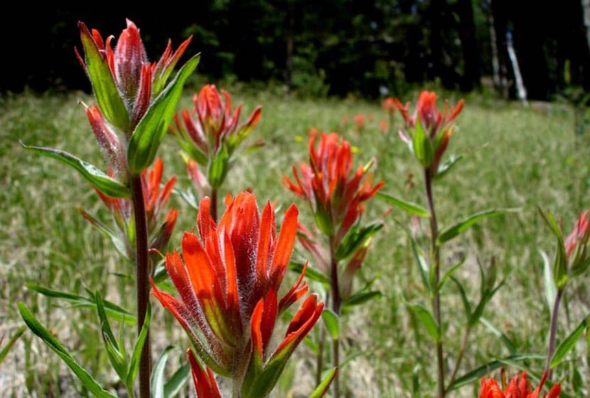
Taking the right branch, the trail will follow alongside Fourmile creek through evergreens and aspens until it opens out into a broad valley surrounded by orange and pink granite cliffs. Wildflowers, like the Indian Paintbrush, bloom in these meadows during the summer months. An interesting fact about Indian Paintbrush: the "flowers" are actually its leaves and there are oranges, reds, and even yellow types of this plant in Colorado.
In the valley, the trail will come to another fork. The main route goes straight up a gradual ascent to the crags and the right-branch is more steep, leading to another vista point. Continuing on the main route, the trail makes its way up gentle slopes, the grassy terrain giving way to cubic granite rock.
The pink and orange granite pinnacles come into view and the ground eventually opens up to a broad area where hikers gain views of the Sangre De Cristo Mountains in the south, of Pikes Peak, and Mueller State Park. This hike is great for families, but do keep a close eye on children as the rock gives way to steep segments of cliffs at the edges.
I'm not sure what the locals have named this formation pictured below, but I think of it as the Twin Bears, because it looks like a couple bears sitting on their haunches taking in the views.
I considered grading this an easy hike because the trail is so gradual, the total elevation gain is under 1000 feet. However, those who are hiking with kids or out-of-town guests, should consider it more moderate because it's almost 5 miles total and does gain 800 feet. It makes for a perfect picnic hike with friends.
If hiking in the later hours of the day, it's important to know that because most of the hike is in the folds of the mountain, it gets dark quickly. I always pack my headlamp, but it's especially relevant if you are hiking during these hours.


Tips & Resources for Hiking The Crags
- Dogs: While a dog friendly hike, the granite rock up top is jagged and can impact your dogs padded feet.
- Options: See the different trail options above to take in different unique views of the surrounding landscapes.
- Trail Map: The Crags Trail Map
- Packing List: Always pack the 10 Essentials. Download our Hiking Guide to get the list and dayhiking packing checklist.
- Colorado Road Conditions: Colorado Road Conditions
- After the Hike: Swirl Wine Bar in Manitou Springs
Weather
Map & Driving Directions
Click for Driving Directions
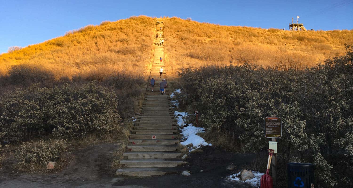
Incline at Castle Rock
The Incline at Castle Rock is a 0.6 mile loop that begins with a 200 step climb up the Challenge Hill to the top of a promontory. From the top, a trail winds down the side of the mesa for 1/2 a mile back to the bottom. It makes for a great workout in the outdoors, and is about 30 minutes south of the center of Denver. Explore the full Castle Rock Incline hike profile below for trail map, driving directions, and more tips and details to help you get active and enjoy the beauty of Colorado
Trail Snapshot: Incline at Castle Rock
| Hike Distance | 0.6 Mile |
|---|---|
| Difficulty | Moderate |
| Duration | Approx 30 min |
| Trail Type | Loop |
| Starting Elevation | Approx 6400′ |
| Elevation Gain | Approx +178′ |
| Seasons | Year Round |
| Dogs | Dogs Prohibited on Challenge Hill |
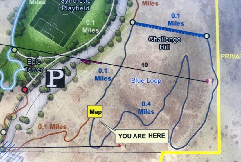
| Hike Trail Map | Click for a Map of Trails at Phillip S Miller Park |
| Denver Drive Time | 35 min |
| Driving Directions to Challenge Hill Parking Area | Click for Google Map |
| Town Nearest Hike | Castle Rock, Colorado |
| Beauty | Views of Pikes Peak to the South and Longs Peak and the Front Range to the North, Great Sunsets, Deer in Valley below. |
| Activities | Hiking and Trail Running, nearby playground and Zipline Tours. |
Parking & Trailhead Information for Incline at Castle Rock
Take interstate 25 south from Denver to the town of Castle Rock, exiting at Wilcox/Wolfensberger exit, taking a right onto Wolfensberger. At the roundabout, go around and take the left-hand exit (3rd option on the roundabout) onto West Plum Creek Parkway. Go 0.7 mile on West Plum Creek Parkway and the Phillip S. Miller Park entrance will be on the right. After entering the park, go left to the area behind the MAC facility and the parking area for the incline will be at the base of the incline.
The Hike: Incline at Castle Rock
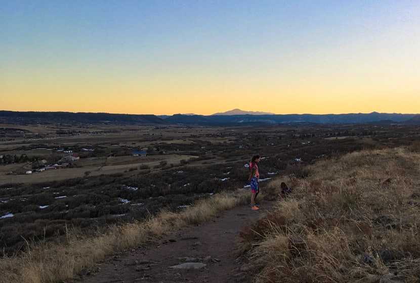
Officially, these 200 steps are called The Challenge Hill, but the locals call it "the incline," and rightly so, because it's inspired by the Manitou Incline near Colorado Springs. Because it's just 5 minutes down the road, we've turned this into a regular family workout. It's a perfect place to get in some exercise and take in amazing sunsets over the Colorado Front Range.
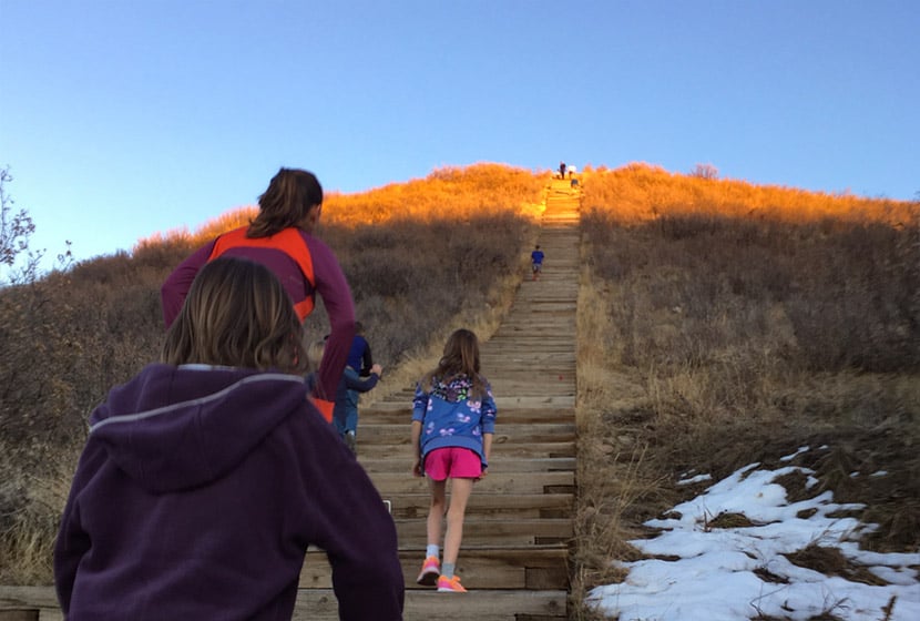
The first segment of the Castle Rock Incline is a 1/10th of a mile climb up 200 steps with close to 200' of elevation gain. This will kick your butt, especially if you take the steps back down. We prefer to run down the 1/2 mile loop trail, usually doing the loop a couple times. We've categorized this as a moderate trail because it has under 500' of total elevation gain and is only 0.6 miles, but many will find it difficult because of the grade of the ascent.
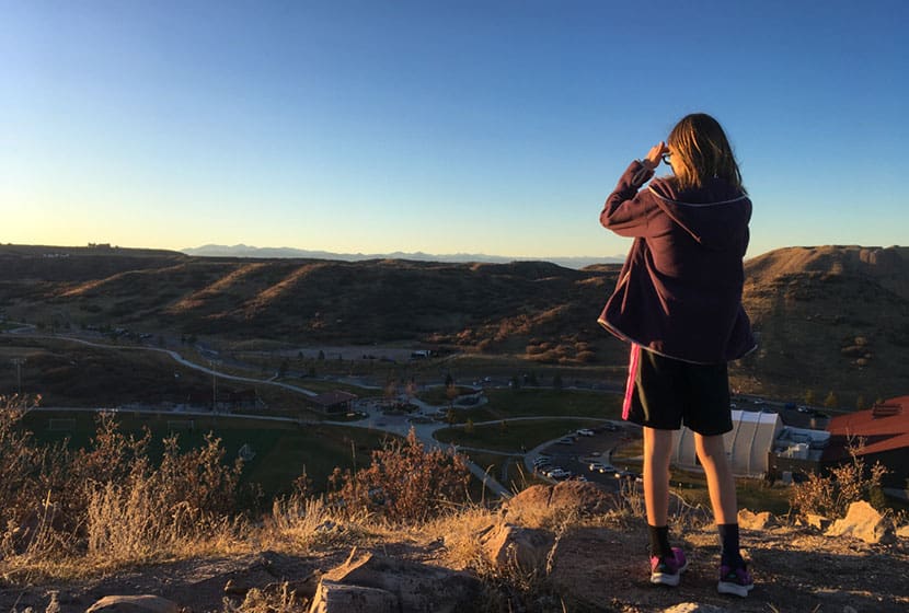
At the top of the Challenge Hill, you can take in views to the north and west of Longs Peak and Devil's Head. There's a wood bench if you want to rest or use it for stretching your legs after the climb. If you decide to descend via the steps be aware that the late afternoon sun can make it very difficult to see the steps.
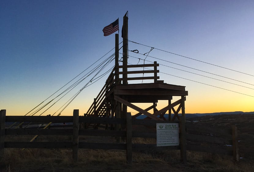
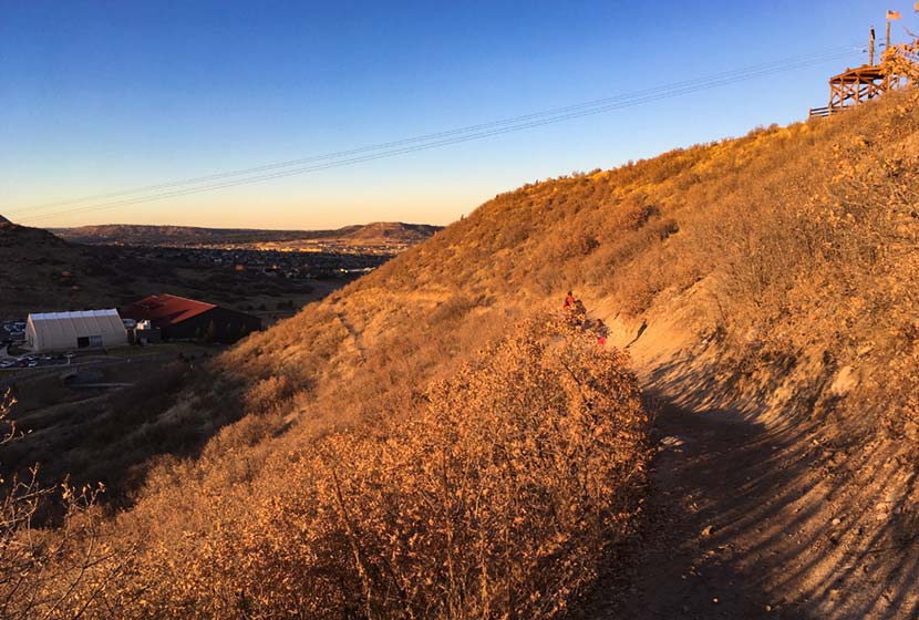
A Zipline platform stands at the peak of this promontory. It's fun to watch zipliners fly through the air across the park. The Zipline tours are operated by Castle Rock Zipline Tours. But don't keep your eyes on the sky because the trail down has a lot of loose gravel and the trail demands your attention.
The trail wraps around the mesa back to the West facing side. Snow and ice can take a while to melt free from the trail, especially in shaded spots. You can check on the trail conditions using the Castle Rock Trail Conditions Map online.
On the back side of the hill, you'll find panoramic views of Pikes Peak and the broad rolling country to the South of Castle Rock. This segment starts out rock then gives way to a gravel trail.
Trail Etiquette at the Castle Rock Incline
- The trail is popular with trail runners, so be aware of approaching runners and keep right to allow them to pass.
- Dogs are prohibited on the challenge hill, because--well, you can imagine why.
- Keep to the right on steps and in single file, especially when others are trying to pass or are coming the opposite direction.
- Let others know when you intend to pass them.
- Descent via the steps is not discourage by the park signage because it's easier to get injured.
- Hours are Dawn to Dusk
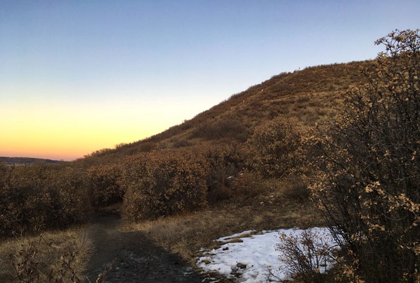
From the photo above, you can get a feel for the scale of the Challenge Hill. Much of the lower trail is in scrub oaks, and this next part may seem a bit overly cautious, but after reading a ton mountain lions, I always keep my kids close. As a local ranger told me, "On the Front Range, where there are deer, there are mountain lions." And a kid running fast through an area like this can incite the instincts of a lion. That I know of, we've not had any attacks in this area, but this is just a protocol our family follows on any hike or run--kids and adults always stay together.
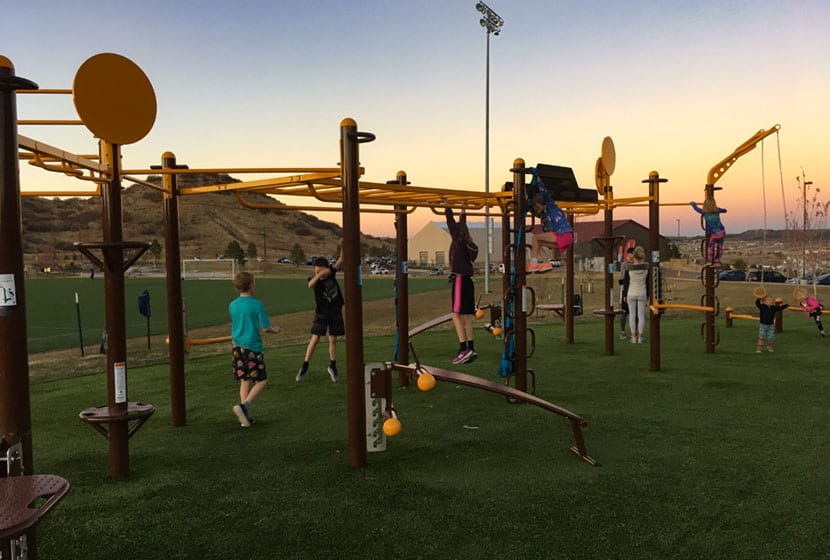
Speaking of the kids, the Phillip Miller park complex recently added (2019) a workout playground that looks like something out of Ninja Warrior competitions. After running the loop a couple times, we spend some time with the kids catching our breath and stretching at the playground.

Tips & Resources for Hiking the Incline at Castle Rock
- Check out Trail Conditions: Before going, check the trail conditions at the Challenge Hill at the Castle Rock Trail Conditions page.
- Pace Yourself: On the ascent, start with a sustainable pace. It gets way more steep and challenging at step 140.
- Trail Map: Incline at Castle Rock
- Packing List: Always pack the 10 Essentials. Download our Hiking Guide to get the list and dayhiking packing checklist.
- Colorado Road Conditions: Colorado Road Conditions
- After the Hike: Since I'm a local, I've got two absolute favorite spots for after the hike. The first is CRAVE Burgers. We love the Love Stinks Burger and the Not Yo Mamma's Burger (on the hidden menu) Crave Burgers in Castle Rock. The second is Manna, a a restaurant in the local hospital. But this is by no means hospital food! It's locally sourced food at great prices. Manna in Castle Rock
Weather
Map & Driving Directions
Click for Driving Directions
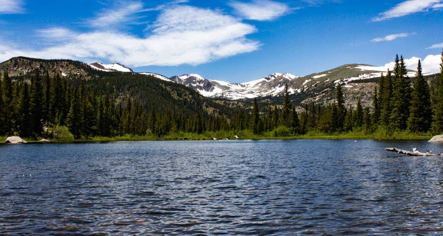
Lost Lake Hike Near Nederland
Lost Lake is an accessible 4-mile round-trip hike to a beautiful alpine lake surrounded by the mountains of Indian Peaks. Just over one hour northwest of Denver, the trail up to lost lake takes you along the course of Middle Boulder Creek, a slide waterfall, a set of tumbling cascades, and a variety of wildflowers that decorate the borders of the trail, the creeksides, and the small meadows that open up along the trail. In the winter months, the trail up to Lost Lake makes for a good snowshoeing route and cross-country trail. trail (though it's a bit steep on the way up
While we categorize Lost Lake as a family-friendly hike and a great trail to take in the changing colors of Fall, it's important to know that the hike is uphill and demanding up to its destination. Explore the full Lost Lake hike profile below for trail map, driving directions, and more tips and details to help you enjoy this adventure in Indian Peaks Wilderness.
Trail Snapshot: Lost Lake Trail near Nederland, Colorado
| Hike Distance | Approx. 4 miles Round Trip |
|---|---|
| Difficulty | Moderate |
| Duration | Approx 2-3 hrs |
| Trail Type | Out and Back |
| Starting Elevation | 8642′ |
| Elevation Gain | Approx +1144′ |
| Seasons | Year Round |
| Dogs | Allowed On Leash |
| Hike Trail Map | Click for a Map of Lost Lake in Indian Peaks Wilderness |
| Denver Drive Time | 1 hr 15min |
| Driving Directions to Hessie Trailhead | Click for Google Map |
| Driving Directions to Shuttle Parking in Nederland | Click for Google Map |
| Hessie Shuttle Details | @ Boulder County Hessie Page |
| Town Nearest Hike | Nederland, Colorado |
| Beauty | alpine lake, creek, waterfalls, wildflowers, columbine, Indian paintbrush, aspen groves, fall colors |
| Activities | Hiking, snowshoeing, cross-country skiing, camping, fishing, lunch |
Parking & Trailhead Information for Lost Lake Hike
Parking is very limited at the Hessie Trailhead, so be sure to take some time to review these details before departing for your hike. Because the Hessie trailhead is one of the most popular in the state, Boulder County offers a shuttle that runs from Nederland every 15-20 minutes on weekends during the Summer months and on some holidays. For full details on the Hessie Trailhead Shuttle, please see the Boulder County page for the shuttle service. This shuttle departs from the RTD Park-n-Ride in Nederland.
Directions to Hessie Trailhead
At the roundabout in Nederland, Colorado, drive south onto CO-119/South Bridge St. Take a right onto Eldora Road which will take you to Elodora Colorado. The road continues through Eldora, and changes to Eldorado Road. It proceeds out of town and changes its name to Hessie Road. About 3/4 of a mile outside of Eldora, the road will split, 4th of July Road goes to the right, and Hessie will turn to the left. The 2WD Hessie Trailhead Parking area is at this split. Do not park alongside the road, as you will likely be fined. If the parking area is full, then go back to Nederland for the shuttle (weekends and holidays). There is parking for 4WD vehicles further up the dirt road and closer to the beginning of the official trail. It's important to know that rains can quickly flood this segment of Hessie Road.
Trail Map for Lost Lake Hike
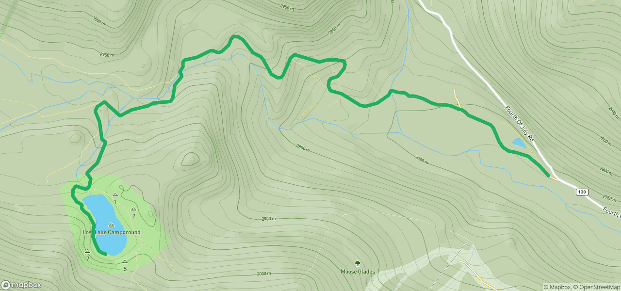
The Hike: Lost Lake Trail
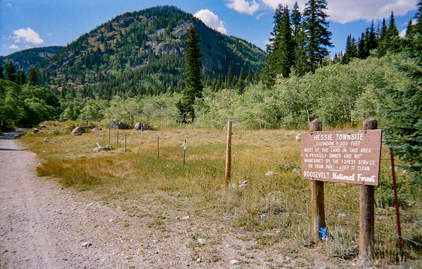
If taking the shuttle, it will drop you off at the 2WD parking area. From here, hikers will follow a trail for that runs along the north side of the 4WD dirt road. The trail runs past a small pond and will keep to the right-side of the 4WD Hessie Trailhead road until it arrives at the official trailhead. Keep your eyes peeled for Moose who frequent these waterlogged meadows along this lowland segment of the trail. At approximately 1/2 mile from the shuttle drop, a sign marks the site of the old mining town of Hessie, Colorado.
Soon, the trail will cross the North Fork of Middle Boulder Creek via a footbridge and a large sign will map and describe the several trails and destinations that can be accessed from this point. Hikers will continue on this old mining road as it leads uphill towards both Lost Lake and the intersection for the trails that lead to Devil's Thumb Lake, Jasper Lake, Woodland Lake, King Lake, and Bob and Betty Lakes. This trail profile will describe the route to Lost Lake only.
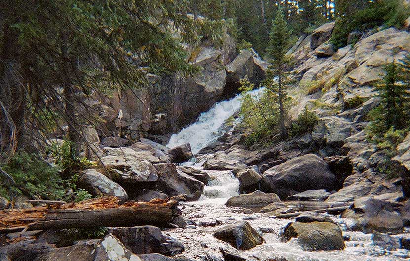
The next 1.2 miles climbs by way of switchbacks over rocky and steep terrain. Wildflowers pepper the trailsides and the riparian zone along Middle Boulder Creek. At the first trail intersection (Devils Thumb and Devils Thumb Bypass Trails), a sign will mark the way to Lost Lake and give distances and point the direction to the other destinations. Here the trail to Lost Lake will go left and cross another footbridge. Soon, a waterfall and set of cascades will come into view. The trail will make its way to a second intersection and sign. Here, the trail for Lost Lake departs, once again, to the left.
From this point, Lost Lake is just 1/2 mile away. It's a steep segment but worth the views when you arrive. At Lost Lake, hikers can explore the outside circuit of its shores (this will add both time and distance to the hike). Return via the same trails for a total of 4 miles.
Related Hikes
- Diamond Lake Hike in Indian Peaks
- Changing Aspens Hikes Near Denver
- Mt. St. Vrain Hike Near Allenspark, Colorado
Tips & Resources for Hiking the Lost Lake Trail
- TIP: Parking is very limited at the trailhead, so try to arrive before 7am. Review trailhead information above for seasonal weekend and holiday shuttle from Nederland.
- CAMPING: Camping is allowed by permit only and in designated spots. See the Indian Peaks Alliance page for details.
- USFS Indian Peaks: Camping is allowed by permit only and in designated spots. See the Indian Peaks USFS Page page for details.
- TIP: The trail is rocky so it would be a good idea to bring trekking poles.
- Trail Map for Lost Lake Trail: Trail Map Link
- Packing List: Always pack the 10 Essentials. Download our Hiking Guide to get the list and dayhiking packing checklist.
- Colorado Road Conditions: Colorado Road Conditions
- Photo: We would like to express our gratitude to Tim and Brad Fagan and Eric Frazier for sharing photographs of this hike on Lost Lake.
- After the Hike: Sundance Cafe, Nederland
Weather
Map & Driving Directions
Click for Driving Directions

Chief Mountain Hike
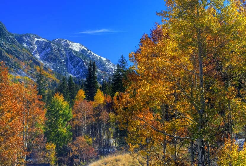
Chief Mountain is a 1.5-mile hike in the mountains just one hour outside of Denver, Colorado. The Chief Mountain trail travels through alpine forest, then breaks out into high-country tundra, eventually gaining panoramic views of surrounding mountains. Chief Mountain gives hikers an incredible vantage point to survey the changing colors of Fall spread out in 360 degrees below. Explore the full Chief Mountain hike profile below for trail map, driving directions, and more tips and details to help you enjoy this adventure near Denver.
Trail Snapshot: Chief Mountain Hike
| Hike Distance | 3 miles Round Trip |
|---|---|
| Difficulty | Moderate |
| Duration | Approx 3 hrs |
| Trail Type | Out and Back |
| Starting Elevation | 10800′ |
| Elevation Gain | Approx +1000′ |
| Seasons | Year Round (weather permitting) |
| Dogs | Allowed On Leash |
| Hike Trail Map - Winter | Click for a Map of Chief Mountain Trail |
| Hike Trail Map - Summer | Click for a Map of Chief Mountain Trail |
| Denver Drive Time | 1 hr |
| Driving Directions to Chief Mountain Trailhead | Click for Google Map |
| Town Nearest Hike | Idaho Springs, Colorado |
| Beauty | Panoramic views, Rock Formations, Summer Wildflowers, Fall Colors |
| Activities | Hiking, snowshoeing, skiing, camping, photography, |
Parking & Trailhead Information for Chief Mountain Hike
From Denver, take Interstate 70 west to exit 252. This exit will funnel you onto CO-74/Evergreen Parkway headed West/Southwest for about 2 miles, where you'll take a right onto Squaw Pass Road. Squaw Pass road is paved and climbs the mountain in a series of switchback for 10.4 miles. The trailhead is easy to miss. It's a pull-out on the right-hand/North side of the road. It's worth taking a look at the parking area using satellite view on Google maps before going. You'll notice that the trail begins just a bit East of the parking area on the South side of the road. We've dropped the pin in the driving directions above at the location of the trailhead. As with all roads at this altitude, be sure to check conditions and closures before setting out.
The Hike: Chief Mountain Trail
The Chief Mountain trail begins on the south side of Squaw Pass road. The trail starts out as a steep 1/4 mile segment that takes hikers through dense alpine forest to Old Squaw Pass Road. The trail is picked up again on the other side of the dirt road and marked by signage. The trail bends now along the base of Papoose Mountain and the dense forest gives way to scattered trees and eventually into high-country tundra. Colorado's tundra ecosystems are incredibly fragile. Here the alpine flowers and lichens grow close to the ground in order to survive in the harsh winds and cold. Stay on maintained trails as it can literally take centuries for this alpine environment to recover from the damage inflicted upon it by foot traffic.
The trail should be evident, but you'll also find that it is marked by blaze marks on some of the trees. The trail becomes more demanding and steep. With each switchback new panoramas reveal distant snow-capped landscapes. Jagged rock formations grow in size as the trail gains elevation and makes its way closer to the summit.
The views are incredible at the top (see photo below). Mount Evans can be seen to the West and Squaw Mountain to the East. This is a great vantage point for taking in the changing aspens along the Front Range of Colorado. For more Fall Hikes, see our 25+ Hikes for Viewing the Changing Aspens in Colorado.
Tips & Resources for Hiking the Chief Mountain Trail
- TIP: Because this hike is popular especially on summer weekends, get there early or do it during weekdays.
- Trail Map for Chief Mountain Trail - Winter: Trail Map Link
- Trail Map for Chief Mountain Trail - Summer: Trail Map Link
- Packing List: Always pack the 10 Essentials. Download our Hiking Guide to get the list and dayhiking packing checklist.
- Colorado Road Conditions: Colorado Road Conditions
- Photo: We would like to express our gratitude to Rick Pawela and CL Baker for sharing photo of this hike on Chief Mountain.
- After the Hike: Beau Jo's Pizza in Idaho Springs
Weather
Map & Driving Directions
Click for Driving Directions

Booth Creek Falls Hike Near Vail
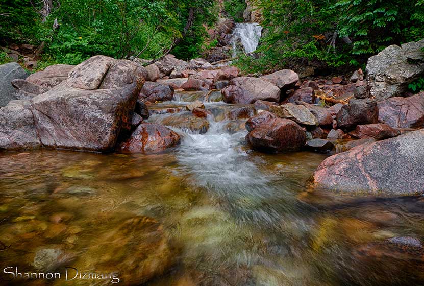
Booth Creek Falls is a 60-foot waterfall located in the Eagles Nest Wilderness near Vail, Colorado. The journey to the waterfall requires a strenuous, 2-mile hike along the banks of Booth Creek. Explore the full Booth Creek Falls hike profile below for trail map, driving directions, and tips and details to help you enjoy this adventure near Vail.
Trail Snapshot: Booth Creek Falls Near Vail
| Hike Distance | 4 miles Round Trip |
|---|---|
| Difficulty | Moderate |
| Duration | Approx 2-3 hrs |
| Trail Type | Out and Back |
| Starting Elevation | 8460′ |
| Elevation Gain | Approx +1290′ |
| Seasons | March to October |
| Dogs | Allowed On Leash |
| Hike Trail Map | Click for a Map of Booth Creek Falls |
| Denver Drive Time | 2 hr |
| Driving Directions to Booth Creek Falls Trailhead | Click for Google Map |
| Town Nearest Hike | Vail, Colorado |
| Beauty | Waterfall, Lake, Cascades, Creek, Aspen Trees, Wildflowers |
| Activities | Hiking, Photography, Birding |
Parking & Trailhead Information for Booth Creek Falls Hike
To get to the Booth Creek Falls Trailhead from Denver, follow interstate 70 West until you reach East Vail. Take exit 180. At the first intersection, make a right, then an almost immediate left onto the I-70 Frontage Road. After about 1 mile on Frontage road, turn right onto Booth Falls Road. Follow Booth Falls road for about 1/4 mile until it terminates at the trailhead parking area. Space is limited and the trailhead parking likely fills early in the day. The trailhead is near a residential area so please be courteous of those living in the vicinity.
The Hike: Booth Creek Falls Hike
From the trailhead, the trail starts at a steep incline as it follows the course of Booth Creek and passes through the aspen forests and glades of wildflowers that make this part of Colorado famous. In the fall, the changing leaves of the aspens make this hike a favorite. The trail continues on this steady ascent for the first mile, then becomes more gradual.
At around 1.8 miles be on the lookout for a trail sign indicating a side-trail for Booth Creek Falls. You may opt to view the falls from the overlook or proceed down the social trails for a closer experience of the falls. Exercise caution, however, because the area around the falls is steep and social trails are not maintained. As with all trails, conditions can change quickly after rains and weather.

Tips & Resources for Hiking Booth Falls Hike
- TIP: The trailhead may not be directly visible from the parking lot, so walk up the road and find it. It will be located just past the gate.
- TIP: Hike further up the trail to Booth Lake. This adds 2.4 miles (round trip).
- Trail Map: Booth Creek Falls Map
- Packing List: Always pack the 10 Essentials. Download our Hiking Guide to get the list and dayhiking packing checklist.
- Colorado Road Conditions: Colorado Road Conditions
- Photo: We would like to express our gratitude to Shannon Dizmang and Brandon Bombaci for sharing such an amazing photograph of this hike to Booth Falls.
- After the Hike: Loaded Joe’s
Weather
Map & Driving Directions
Click for Driving Directions
Butler Gulch Hike
The Butler Gulch Trail near Berthoud Falls is a moderately difficult out-and-back trail with a balance of shade on the first half and then above treeline with spectacular views of peaks and wildflowers all around. Activities here include stream crossings and steep climbs, and one can visit an old mine above the treeline. This is also a great snowshoeing hike during winter and is a well-known skiing destination. Explore the full Butler Gulch hike profile below for trail map, driving directions, and more tips and details to help you enjoy this adventure near Berthoud Falls.
Trail Snapshot: Butler Gulch Hike
| Hike Distance | Approx 5 Miles Round Trip |
|---|---|
| Difficulty | Moderate (difficult in Winter) |
| Duration | Approx 3.5 hrs |
| Trail Type | Out and Back |
| Starting Elevation | 10,400′ |
| Elevation Gain | Approx +1200+′ |
| Seasons | June to September; October to May for Winter Trail Conditions |
| Dogs | Allowed On Leash |
| Hike Trail Map | Click for a Map of Bulter Gulch Trail |
| Denver Drive Time | 1 hr |
| Driving Directions to Butler Gulch Trailhead | Click for Google Map |
| Town Nearest Hike | Empire, Colorado |
| Beauty | Summer Wildflowers, Lake, Cascades, Meadows, Stream, Aspen trees, Wildlife: Mountain Goats |
| Activities | Hiking, Photography, Snowshoeing, Cross-country Skiing |
| Nearby Hikes | Herman Gulch and Cascades Near Berthoud |
Parking & Trailhead: Butler Gulch Hike
The Trailhead for Butler Gulch is about 1 hour West of Denver via Interstate 70. Take the exit for Hwy 40/Winter Park (easy to miss) through Empire (be alert for reduced speed limit) up to where US 40 makes a sharp bend to begin climbing up the mountain toward Berthoud Pass. Just before this turn, there is a left-hand turn to take for the Henderson Mine Road. Follow Henderson Mine road for about a mile. It will pass the mining operation and the parking area is just past the mine on the left. The main parking area is the first one you will encounter and it's large. A smaller one is about .25 mile up the road (the road is 4WD after the first lot) is small and fills fast. We recommend parking in the first lot as it is maintained and this will prevent damage to the trailhead.
From the parking area, hike the 4WD road for about 1/4 mile to where the trail splits. There should be signage here at the fork indicating the Jones Pass Trail goes to the right, and the Butler Gulch Trail goes to the left. Soon, the trail begins to climb through mixed forest of spruce, fir, and aspens. After approximately one mile, a mountain stream nears the trail, forming a quaint meltwater waterfall (right side of trail). Soon, the trail emerges from the trees into a landscape of snow-capped mountains. This bowl will be replete with wildflowers in the early weeks of Summer. At this point, hikers are exposed to the elements, and during the Summer months, lightning storms can come up without warning in the afternoon. So, keep an eye on the sky. Winter travelers should be alert to avalanche conditions. Here in the bowl, the trail has come to about 2.5 miles and a hike back will make this a 5-mile round-trip adventure. Hikers can add a strenous hike up the nearby ridgeline to gain panoramic views on the Continental Divide. When I hiked this in April of 2016, tracks were evident that led past the remains of old mining equipment along the ridge. At the top, the views are absolutely beautiful. It's a great place to take in hundreds of miles of changing aspen trees in the Autumn. The trail map link for Butler Gulch in this post is not the best. Because of this we recommend The Latitude 40 Summit County Trails Map.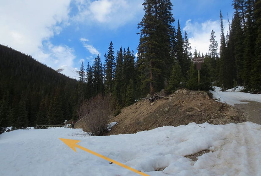
Tips & Resources for Hiking Butler Gulch Hike
Weather
Map & Driving Directions
Click for Driving Directions