Are you looking for the best hiking trails with wildflowers near Denver? The splashes of color which these hikes are known for are scattered throughout the landscape near Denver, Colorado. Because the Front Range is more dry than the more mountainous areas, most of these hikes will not be made up of flower-laden fields. So, if that’s what you are looking for, be sure to note hikes that are in Rocky Mountain National Park or deeper in the mountains. Explore the hiking trail profiles below to get driving directions to the trailheads, trail maps, and the important information you need for your Colorado hiking adventure.

Arthur’s Rock Trail in Lory State Park
The Arthurs Rock trail in Lory State Park near Fort Collins, Colorado ends with a beautiful panoramic views. You'll pass through meadows, forest, then end your hike with a scramble to the top of Arthur's Rock. Dogs are allowed on a leash, just be sure to bring plenty of water as there are not many places to access drinking water ...
Canyon View Nature Trail at Castlewood Canyon
Castlewood Canyon cuts a unique and green landscape into the plains near Denver. It's not the mountains, but it's worth the drive. Castlewood Canyon State Park has created this beautiful paved trail that follows the canyon rim. The Canyon Rim Trail also offers an audio tour and is a great way for children to learn more about the plains habitat ...
Canyon Loop Trail – Betasso Preserve, Boulder
This hike at Betasso Preserve near Boulder, Colorado makes for a perfect evening escape to watch the sunset over the town below. You'll cross through meadows dotted with wildflowers then under stands of Ponderosa pine that eventually open up to views to east. Explore the hiking trail profiles and map link below for details. Trail Snapshot: Canyon Loop Trail at ...
Chicago Lakes Hike Near Mt. Evans
Want to take in some of Colorado's breathtaking scenery and put some miles under your hiking boots? The Chicago Lakes hike begins at Echo Lake. You'll pass three more mountain lakes as you punch up into the high country of Colorado's Mt. Evan's Wilderness. Explore the full trail profile below for the Chicago Lakes which includes driving directions, map, and ...
Mt. Evans Summit Hike
Mount Evans is one of Colorado's Front Range Fourteeners, and like Pikes Peak, Mt. Evans has a road that takes you to a trail just a few hundred feet shy of the summit where you are likely to see both Bighorn Sheep and Mountain Goats. The key to exploring Mount Evans is knowing the stops along the way. View our ...
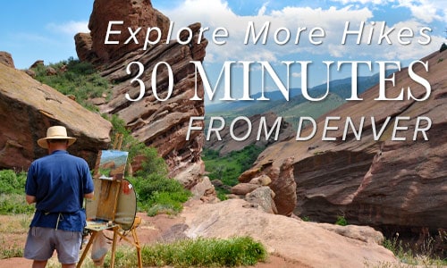
Meyer Ranch Open Space Hikes
Meyer Ranch is just 30 minutes outside of Denver, Colorado and offers three different hiking trail options, ranging from 2.4 to 4.8 mile, easy to moderate hikes. Check out the three different hiking trail options for this hike near Conifer, Colorado. Trail Snapshot: Meyer Ranch Open Space Hikes Hike Distance 2.4 to 4.8 miles Round Trip Difficulty Easy to Moderate ...
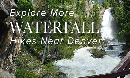
Bridal Veil Falls Hike at Rocky Mountain National Park
Atwenty foot waterfall hidden away in the northern reaches of Rocky Mountain National Park, Bridal Veil Falls makes for a great destination hike. Keep your eyes out for Elk in the meadows along this hiking trail in Colorado's favorite National Park. Get the hike information you need with our hiking snapshot for Bridal Veil Falls, and get more details by ...
Forsythe Canyon to Waterfall and Gross Reservoir
Looking for a trail that will provide some shade on a hot Colorado day? This hiking trail has shade, plus a waterfall, a stream, a canyon, and lake. It's hard to beat. Forsythe Canyon is just outside Boulder, Colorado (1hr 15min from Denver), and is an easy to moderate hike. Check out our full hiking trail profile for details and ...
First and Second Flatirons Hike in Boulder
Hiking the Flatirons near Boulder, Colorado is a must. The trail draws you across an green meadow, then up through a notch between the First and Second Flatiron. You'll find the best part of this hike in the Flatirons at the end of the trail: some breathtaking and unmatched views of Colorado's Rocky Mountains. There's even more though. Explore the ...
Blue Grouse Trail at Golden Gate Canyon Park
The Blue Grouse Trail is a short, 1.6-mile hike on the western edges of Golden Gate Canyon State Park. A pleasant trail with little gain in elevation and mellow terrain makes this a great escape from the city. The Blue Grouse Trail is a perfect hiking trail for spotting wildlife, from birds to deer, viewing fall colors and wildflowers, and ...
Ultimate Guide to Maroon Bells in Colorado
The Maroon Bells offer several hikes and some of the most beautiful scenery in Colorado. It's a Rocky Mountain landscape painted with cascades, lakes, golden aspens, and all against the backdrop of the peaks of the Maroon Bells. This guide to the Maroon Bells features 5 different hiking trail options, spanning from easy hikes to moderately demanding. Because traffic in ...
Timberline Falls in Rocky Mountain National Park
Timberline Falls is a demanding 8-mile round-trip waterfall hike in Rocky Mountain National Park. The trail takes you past Alberta Falls up into beautiful Loch Vale. Beyond Timberline Falls hikers will find Lake of Glass, additional falls, and breathtaking Sky Pond. Glacier Gorge is the home to some of the best hiking in Rocky Mountain National Park, and this waterfall ...
The Loch in Rocky Mountain National Park
If lakes are your favorite destination, then the hike to The Loch should be added to your trail list in Rocky Mountain National Park. It is a moderately difficult hike on the eastern side of the park where you can hike along the edge of the lake, fish for trout, or come early in the morning to photograph the iconic ...
Sky Pond in Rocky Mountain National Park
Situated above Timberline Falls in Rocky Mountain National Park are two spectacular lakes. The highest of the two is Sky Pond, and the lower is called The Lake of Glass. This demanding hike begins at the Glacier Gorge trailhead and takes you past at least three waterfalls and a beautiful set of cascades. Rewards await those who hike all the ...
Dream Lake in Rocky Mountain National Park
The hike to Dream Lake is one of the popular destination hikes in Rocky Mountain National Park--and for good reason. In the early morning hours, Dream Lake is a vision straight out of a fairy tale. This 2.2-mile, out-and-back hike begins at the Bear Lake trailhead and passes Nymph Lake along the way. Explore the full Dream Lake hike profile ...
Mills Lake Hike in Rocky Mountain National Park
The hike up to Mills Lake is a steady, uphill, 5.6 mile trek into the breathtaking Glacier Gorge trail system of Rocky Mountain National Park. You'll be entranced by spectacular views of mountain ridges, rugged peaks, and the color of wildflowers along the trail. Glacier Gorge provides surprises at almost every turn. Explore the full Mills Lake hike profile below ...
Jewel Lake Hike in Rocky Mountain National Park
Jewel Lake is a 6.4 mile round-trip hike into Glacier Gorge in Rocky Mountain National Park. This hike in RMNP takes you first past stunning Mills Lake. Less than half a mile beyond Mills you'll discover Jewel Lake under the shadow of the jagged eastern ridge known as Keyboard of the Winds. Explore the full Jewel Lake hiking trail profile ...
Black Lake in Rocky Mountain National Park
Black Lake is among the most spectacular lakes in Rocky Mountain National Park. The journey to Black Lake is a strenuous, 10 mile, round-trip hike with significant elevation gain--but both the destination of Black Lake and the several waterfalls along the way make it more than worth the effort. Explore the full Black Lake hiking trail profile for trail map, ...
Shelf Lake in Rocky Mountain National Park
This demanding hike in Rocky Mountain National Park takes you off the beaten path to two high-mountain lakes, and grants views of several waterfalls along the way. This trail profile provides helpful details for making the journey to Shelf Lake, Shelf Lake Falls, and Solitude Lake. Because the hike to Shelf Lake requires travel on unmaintained trails, it is best ...
Shelf Lake Falls in Rocky Mountain National Park
You won't find the cascades of Shelf Lake Falls on the map. This tiered, shelf waterfall is hidden away in the high country above Glacier Gorge in Rocky Mountain National Park. Shelf Lake Falls flows out of Solitude Lake then into a creek that spills over the rock shelves of the falls, cutting strange formations out of the snow and ...
Andrews Glacier and Tarn in Rocky Mountain National Park
Andrews Tarn and Andrews Glacier are high up in a more secluded area of Rocky Mountain National Park. It's a strenuous, almost 10 mile hike for those who are up for the challenge. Though it can be demanding, the Andrew's Creek area is one of our favorite trail sections in RMNP. Explore the full Andrew's Tarn and Andrew's Glacier hike ...
Solitude Lake Hike in Rocky Mountain National Park
Solitude Lake is an alpine lake situated in the heart of Rocky Mountain National Park. Solitude is aptly named, as it is hidden from the main trail system, situated high above Glacier Gorge in the shadow of Thatchtop and Arrowhead Peak. Because the hike to Solitude and its twin sister, Shelf Lake, require travel on unmaintained trails, it is best ...
The Pool in Rocky Mountain National Park
It's a 1.7 mile hike in to The Pool, a series of turbulent cascades and deep green-blue waters formed by the confluence of the Big Thompson River and Fern Creek. This is another popular and easy hike from the Fern Lake trailhead in Rocky Mountain National Park, and a great destination along the Fern Lake Trail. Explore the full hiking ...
Arch Rocks Hike in Rocky Mountain National Park
Along the way to The Pool or Fern Falls, you'll run into this towering waypoint of nature in Rocky Mountain National Park, the Arch Rocks. These are boulders as huge as cottages where the trail passes through. The trail is quite flat and hikers get to enjoy the sound of the running waters of the Big Thompson River. Explore the ...
Copeland Falls in Rocky Mountain National Park
Copeland Falls is just one of the many waterfalls hikers will encounter in the Wild Basin area of Rocky Mountain National Park. In fact, you can't miss Copeland Falls as it is the first waterfall along the main trail--just a short hike from the trailhead. Explore the full Copeland Falls hike profile below for trail map, driving directions, and more ...
Windy Gulch Cascades in Rocky Mountain National Park
The Windy Gulch Cascades is a hidden cascade waterfall less than half a mile into Fern Lake Trail system in Rocky Mountain National Park. Though a short hike, the final 1/10th of a mile segment is off the main trail and in steep terrain. For that reason, we've noted this as a moderate difficulty hike. Explore the full Windy Gulch ...
Fern Lake in Rocky Mountain National Park
A hike up to Fern Lake begins at the Fern Lake Trailhead on the east side of Rocky Mountain National Park. Along the Fern Lake Trail, hikers pass through Arch Rocks, over a bridge at The Pool, and by three cascade waterfalls. Near the, you'll gain spectacular views of The Gable, Knobtop Mountain, Notchtop Mountain, and Little Matterhorn from its ...
Marguerite Falls in Rocky Mountain National Park
Marguerite Falls is a set of casacades with upper and lower leaps, just below Fern Lake in Rocky Mountain National Park. After the 3.9 mile hike up to Fern Lake, a social trail leads into the woods along Fern Creek to the falls. Explore the full Marguerite Falls hike profile below for trail map, driving directions, and more of the ...
Spruce Lake in Rocky Mountain National Park
Spruce Lake is an ideal destination in Rocky Mountain National Park for those who are looking to hike through terrain with some variety. After the 3.9 mile hike to Fern Lake, the .9 mile spur trail to Spruce Lake is moderate, with a few steep and rocky segments. It's a great place to find some solitude as few hikers will ...
Lake Helene Hike in Rocky Mountain National Park
The hike to Lake Helene is a popular lake hike beginning at the Bear Lake Trailhead in Rocky Mountain National Park. Lake Helene is situated in a bowl beneath Flattop Mountain, Ptarmigan Point, and Notchtop Mountain. The trail weaves through aspen groves and pine forests with scenic mountain views at almost every turn. Explore the full Lake Helene hike profile ...
Grace Falls Hike in Rocky Mountain National Park
The hike to view Grace Falls, high in the rock cliffs and ledges of Odessa Gorge, is one of several waterfalls and scenic waypoints along the Fern Lake Trail. Grace Falls drops nearly a hundred feet from Notchtop Mountain, tumbling over a series of ledges, eventually making its way into Fern Creek. Explore the full Grace Falls hike profile below ...
Cub Lake Loop in Rocky Mountain National Park
The Cub Lake Loop Hike in Rocky Mountain National Park is a great alternative to the an out-and-back hike up to Cub Lake. Along the way, hikers will pass by Windy Gulch Cascades, travel alongside the Big Thompson River, cross over an area called The Pool, journey through wetlands, and will be surrounded by sights of a glacial-shaped landscape. Explore ...
Ouzel Falls in Rocky Mountain National Park
Ouzel Falls spills over a cliffside and enormous boulders, making it arguably one of the most beautiful waterfalls in Rocky Mountain National Park. Before reaching this 40-foot falls, the trail traces the course of several creeks and leads hikers past three other cascade waterfalls. Explore the full Ouzel Falls hike profile below for trail map, driving directions, and more tips ...
Calypso Cascades in Rocky Mountain National Park
Calypso Cascades is an easy 3.6 mile hike to one of several waterfall destinations along this section of trail. This waterfall in the Wild Basin of Rocky Mountain National Park is gets its name from the purple Calypso Orchids that bloom along the banks of Cony Creek. Explore the full Calypso Cascades hike profile below for trail map, driving directions, ...