Colorado has the perfect landscape for waterfall hikes: 100,000 miles of rivers and streams, many of them plunging through steep terrain. While most of the best waterfalls are buried deep in the mountains, there are still many to explore near Denver. Our goal is to discover them and give you the best information and directions so that you can get out and enjoy the beauty of our Colorado hiking trails. If you are wondering where to find waterfall hikes near Denver and throughout Colorado, you’ve come to the right place. We have more than 50 detailed trail profiles of the best waterfall hikes in the state!
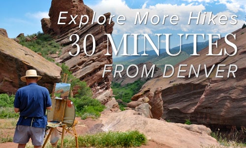
If you are specifically looking for waterfalls near Denver, see our 7 Waterfalls Near Denver post.

10 Colorado Waterfall Hikes One Mile or Less
Enjoy the Sights and Sounds of Waterfalls near Denver that Only a Short Distance to Hike To Short hikes with a big payoff! Ten Colorado waterfall hikes, one mile or less! Most waterfalls in Colorado require demanding hikes through difficult terrain. But not everyone has the time or ability to hike deep into the Colorado wilderness to discover these gems ...
Adams Falls in Rocky Mountain National Park
Adams Falls is a short .6-mile round-trip hike near Grand Lake, Colorado. The waterfall borders Rocky Mountain National Park and its trail begins at the same trailhead for the East Inlet Trail. Explore the full Adams Falls hike profile below for trail map, driving directions, and all the details you need for this short waterfall Hike in Rocky Mountain National ...
Agnes Vaille Falls Hike
Agnes Vaille falls is viewed on this 1 mile, easy, loop hike just south of Buena Vista, Colorado. Take in snow-capped Mt. Princeton and the white Chalk Cliffs of the canyon on what makes for a great family hike in the Arkansas River valley of Colorado. Trail Snapshot: Agnes Vaille Falls Hike Distance Approx. 1 mile Difficulty Easy to Moderate ...
Alberta Falls Hike at Rocky Mountain National Park
Colorado's Rocky Mountain National Park is full of waterfalls and this hike takes you to one of the most accessible waterfalls in the park. Alberta Falls is one of the most popular, short destination hikes in the park, and for good reason. If you only have time for one short hike on the East Side of RMNP, this is a ...
Black Lake Falls in Rocky Mountain National Park
Black Lake Falls cascades down the towering granite cliffs above Black Lake in Rocky Mountain National Park. This trail through Glacier Gorge takes hikers past multiple sub-alpine lakes and several waterfalls. It's a demanding, 10 mile, round-trip hike with significant elevation gain in the heart of RMNP. Note: Rocky Mountain National Park now requires timed entry permits from May 27th ...
Booth Creek Falls Hike Near Vail
Booth Creek Falls is a 60-foot waterfall located in the Eagles Nest Wilderness near Vail, Colorado. The journey to the waterfall requires a strenuous, 2-mile hike along the banks of Booth Creek. Explore the full Booth Creek Falls hike profile below for trail map, driving directions, and tips and details to help you enjoy this adventure near Vail. Trail Snapshot: ...
Boulder Falls
Boulder falls is a quick hike with big reward. This 100 yard hiking trail just outside Boulder, Colorado leads you into a cliff lined notch in Boulder Canyon where the creek gushes out to form one of the best waterfalls near Denver. Since it's not much of a hike, add one of the suggested hikes below to complete your hiking ...
Bridal Veil Falls Hike at Rocky Mountain National Park
Atwenty foot waterfall hidden away in the northern reaches of Rocky Mountain National Park, Bridal Veil Falls makes for a great destination hike. Keep your eyes out for Elk in the meadows along this hiking trail in Colorado's favorite National Park. Get the hike information you need with our hiking snapshot for Bridal Veil Falls, and get more details by ...
Bridal Veil Falls in Idaho Springs
Bridal Veil Falls is best viewed from Water Wheel Park, a short and easy walk from the downtown of Idaho Springs, Colorado. The legacy of steam locomotives and gold mining make this a historic hike in an historic Colorado town. Explore the full Bridal Veil Falls hike profile below for trail map, driving directions, and many of the details you ...
Buffalo Creek Falls at Wellington Lake
This waterfall isn't even on the map, and it's become my favorite waterfall hike near Denver. In fact, this is the only post that I'm tempted to keep to myself, because not only is there great hiking, but Wellington Lake may be the best camping spot within 90 minutes of Denver. There is a hitch though: it's a privately held ...
Calypso Cascades in Rocky Mountain National Park
Calypso Cascades is an easy 3.6 mile hike to one of several waterfall destinations along this section of trail. This waterfall in the Wild Basin of Rocky Mountain National Park is gets its name from the purple Calypso Orchids that bloom along the banks of Cony Creek. Explore the full Calypso Cascades hike profile below for trail map, driving directions, ...
Cascades Near Berthoud Falls
Looking for a place to stop and stretch your legs on your way to Winter Park? These cascades along US 40 will refresh your spirit and are immediately accessible right off the road.There are some unmaintained trails to explore, so check out the full profile below to discover more. Trail Snapshot: Cascades Near Berthoud Falls Hike Distance 0.1 mile Difficulty ...
Catamount Falls Hike Near Colorado Springs
The hike to Catamount Falls is a moderate 2.8-mile loop hike about 25 minutes outside of Colorado Springs. This waterfall hike takes hikers to three different waterfalls and over two different creeks that spill down from the heights of Pikes Peak. It makes for a great weekend adventure, coupled with a great opportunity for brunch at the Pantry in Green ...
Chaos Canyon Cascades in Rocky Mountain National Park
Chaos Canyon Cascades in Rocky Mountain National Park is formed as Chaos Creek tumbles through the forest below Lake Haiyaha. This 4.2 mile round trip hike is on the east side of RMNP to one of the lesser visited cascade waterfalls in the park. Explore the full Chaos Canyon Cascades hike profile below for trail map, driving directions, and some ...
Chasm Falls in Rocky Mountain National Park
Chasm Falls in Rocky Mountain National Park bursts through a chasm in Fall River where the rock funnels its waters into a narrow gorge. It's one of the more accessible waterfalls in RMNP, located about 100 yards off of Old Fall River Road. The only drawback is that parking fills fast. However, there are several parking and hike options that ...
Continental Falls Hike Near Breckenridge
Continental Falls crashes through cracks in the granite sides of the mountains near Breckenridge Colorado. It's a moderate 2.5 mile uphill hike to the base of the waterfall. The 1000+ feet of elevation gain require some bodily exertion, but it's worth the effort. Located on the eastern slopes of the Mosquito Range, waterfall finds its source in the high mountain ...
Copeland Falls in Rocky Mountain National Park
Copeland Falls is just one of the many waterfalls hikers will encounter in the Wild Basin area of Rocky Mountain National Park. In fact, you can't miss Copeland Falls as it is the first waterfall along the main trail--just a short hike from the trailhead. Explore the full Copeland Falls hike profile below for trail map, driving directions, and more ...
Cornet Falls Near Telluride Colorado
Cornet Falls in Telluride, Colorado, is an 80 foot waterfall and requires a short 1/4 mile hike to experience. The hike begins in town and affords views down into this beautiful Colorado mountain town. Explore the full Cornet Falls hike profile below for trail map, driving directions, and all the details you need to enjoy this hike in Telluride, CO ...
Crater Lake Hike in the Indian Peaks Wilderness
California may boast Yosemite, but Colorado offers the Indian Peaks Wilderness valley. And within this wilderness, one happens upon an arresting sight -- Mirror Lake and Crater Lake, dutifully monitored by the impressive Lone Eagle Peak. Long considered an iconic range, the Indian Peaks give hikers an endless stream of prime photography, wildflowers, and "Look at that!" moments. From the ...
Crystal Mill Hike: Iconic Colorado
You've likely seen the photo, but may not have known how to reach it: Crystal Mill. The legendary Old West structure, built in 1892 during the silver boom, stands tall - yet precariously as ever - in the gorgeous back county of the White River National Forest. The Crystal Mill remains one of the most photographed places in the state, ...
Devils Thumb Lake
Devils Thumb Lake is located in Indian Peaks Wilderness north of Boulder Colorado and can be accessed via a 6.5-mile (one-way) steep and challenging hike. Wildflowers, alpine meadows, small waterfalls, and cascades all beckon those who have the stamina to explore these heights in the Front Range near Denver. Explore the full Devils Thumb Lake hike profile below for trail ...
Diamond Lake Falls Hike
Diamond Lake Falls requires a 1.7 mile one-way hike into Indian Peaks Wilderness. Many hikers choose to hike the 1 mile further up to Diamond Lake. Wildflowers, cascades, and expansive mountain views are just a few of the features that make hiking to Diamond Lake Falls worthwhile. Explore the full trail profile below for trail map, driving directions, and more ...
Diamond Lake Hike
The Diamond Lake Trail leads hikers to a high alpine lake nestled in the forest below Jasper Peak in Indian Peaks Wilderness. This 3.5 mile, moderately demanding trail leads to good fishing at Diamond Lake, past a waterfall and multiple cascades, and opens up to the incredible views that make Colorado's high-country famous. Explore the full Diamond Lake hike profile ...
Elk Falls – New Waterfall Near Denver
Elk Falls in Colorado's new Staunton State Park opened to the public in 2013. This highest waterfall near Denver had been unknown to most, and inaccessible, except to a few. Now it's an adventure waiting for able hikers! If you are a fan of waterfall hikes and you live near Denver, you'll know that it's kind of slim pickings; most ...
Falcon Falls in Rocky Mountain National Park
Falcon Falls is one of two waterfalls that spill from the heights above Thunder Lake in this remote part of the Wild Basin. It's a difficult and demanding 16 mile round-trip hike that requires some land navigation and backcountry travel skills. Explore the full Falcon Falls hike profile below for trail map, driving directions, and more tips and details to ...
Fan Falls in Rocky Mountain National Park
Fan Falls is tucked away in the high reaches of the Wild Basin of Rocky Mountain National Park. This 15.5 mile, difficult trek, leads to a long set of segmented cascades spilling out of the heights and streaming down into Thunder Lake. This garden of water, wildflowers and rock is a perfect escape for those looking for a demanding hike ...
Fern Falls in Rocky Mountain National Park
Fern Falls tumbles down through the forest casting a fine mist across the trail. It's a perfect place to stop, cool off, and take in the sights and sounds of the falls before hiking on to Fern Lake. Explore the full Fern Falls hike profile below for trail map, driving directions, and more of the details and tips you need ...
Fish Creek Falls Near Steamboat Colorado
A 284 foot waterfall! Need we say more. Fish Creek Falls is a 1/4 mile hike located just outside Steamboat Springs, Colorado--about 3.5 hours from Denver. The Fish Creek Falls Overlook trail is handicap accessible, and a second trail takes hikers down to the base of the falls. Explore the full Fish Creek Falls hike profile below for trail map, ...
Forsythe Canyon to Waterfall and Gross Reservoir
Looking for a trail that will provide some shade on a hot Colorado day? This hiking trail has shade, plus a waterfall, a stream, a canyon, and lake. It's hard to beat. Forsythe Canyon is just outside Boulder, Colorado (1hr 15min from Denver), and is an easy to moderate hike. Check out our full hiking trail profile for details and ...
Four Lakes and Waterfall Loop in Rocky Mountain National Park
This loop hike in Rocky Mountain National Park takes you to four beautiful, subalpine lakes and Alberta Falls, one of the parks most visited and photographed waterfalls. It's a moderate, 6.4 mile hike that will give you a great taste for the breathtaking scenery found in this treasure of our National Parks system. Explore the full hiking trail profile below ...
Grace Falls Hike in Rocky Mountain National Park
The hike to view Grace Falls, high in the rock cliffs and ledges of Odessa Gorge, is one of several waterfalls and scenic waypoints along the Fern Lake Trail. Grace Falls drops nearly a hundred feet from Notchtop Mountain, tumbling over a series of ledges, eventually making its way into Fern Creek. Explore the full Grace Falls hike profile below ...
Granite Falls in Rocky Mountain National Park
Granite Falls takes a 5.1 mile journey from the Green Mountain Trailhead in Rocky Mountain National Park. At Granite Falls, the waters of Tonahutu Creek drop fifty feet through a course of smooth granite slabs. The hike offers a diverse landscape: from tranquil forests, to expansive meadows, and verdant creeksides--all alive with wildflowers and wildlife. Explore the full Granite Falls ...
Guide for Hiking Hanging Lake in Colorado
Hanging Lake is a short hike to two waterfalls and one of the most beautiful lakes in Colorado. On the same hike, you can explore Spouting Rock Falls, and even walk behind the waterfall. Reservations are required to hike Hanging Lake so don't leave home without booking (see info in trail snapshot below). It’s not a day hike near Denver, ...
Hayes Creek Falls Waterfall
Hayes Creek Falls is a 40' waterfall with multiple cascades located just off CO-133 along the Crystal River near Redstone, Colorado. Accessed via a roadside pull-off, Hays Creek Falls makes for a refreshing stop along the West Elk Scenic Loop, on of the most beautiful scenic drives in Colorado. Trail Snapshot: Hayes Creek Falls Hike Distance 0.1 miles Round Trip ...
Helen Hunt Falls in Colorado Springs
Helen Hunt Falls in Colorado Springs is a 35 foot waterfall requiring only a short walk from the parking area. For a longer and more demanding hike, visitors can take the 4 mile Columbine Trail from the bottom of Cheyenne Canyon to Helen Hunt Falls. This strenuous option affords and experience of the rich ecosystem of this canyon at the ...
Horseshoe Falls in Rocky Mountain National Park
Horseshoe Falls in Rocky Mountain National Park is a favorite family hike near Estes Park, Colorado. It's a short and easy hike from the Alluvial Fan Trailhead, but the falls can also be viewed from the roadside. It's an extensive cascade waterfall, named for the way it bends its course through the rocky hillside. Explore the full Horseshoe Falls hike ...
Horsethief Falls Hike Near Colorado Springs
Horsethief Falls is a small slab waterfall located 45 minutes from Colorado Springs on the West side of Pikes Peak. The Horsetheif Falls trail requires a 1.4-mile easy hike (one-way) to the falls. This hike, along with nearby Pancake Rocks make for great fall hiking and a scenic falls drive to see the golden aspens of the Colorado Front Range ...
Lake of Glass Waterfall in Rocky Mountain National Park
If you are up for a demanding hike in Rocky Mountain national Park, with 3 waterfalls in the space of less than 5 miles, then the hike up to Lake of Glass Falls is a great choice. A hidden waterfall that you won't find on the map! Lake of Glass falls is a segmented cascade spilling into the creek that ...
Lost Falls Hike in Rocky Mountain National Park
The hike to Lost Falls is a demanding 15.6 mile trek into into a lesser traveled, northern reaches of Rocky Mountain National Park. The trail follows the North Fork of the Big Thompson River through stands of lodgepole, the pinch of a rugged canyon, and past aspen laden meadows before reaching this hidden waterfall. Explore the full Lost Falls hike ...
Lyric Falls Hike in Rocky Mountain National Park
Lyric Falls is a beautiful stair-step waterfall that spills over the moss-covered granite slabs of Hunters Creek in Rocky Mountain National Park. A lesser-known waterfall, Lyric Falls requires a 3/4 mile segment on the unmaintained social trail that winds along Hunters Creek. Locating the falls may be a bit challenging and land navigation skills are needed for this hike in ...