Are you drawn to open green meadows? These meadow hikes near Denver have sceneries that look like they’re right out of the The Sound of Music. Explore the hiking trail profiles below to get driving directions to the trailheads, trail maps, and the important information you need for your Colorado hiking adventure.

Canyon Loop Trail – Betasso Preserve, Boulder
This hike at Betasso Preserve near Boulder, Colorado makes for a perfect evening escape to watch the sunset over the town below. You'll cross through meadows dotted with wildflowers then under stands of Ponderosa pine that eventually open up to views to east. Explore the hiking trail profiles and map link below for details. Trail Snapshot: Canyon Loop Trail at ...
Lakes Loop Trail at Rocky Mountain Arsenal
An arsenal turned into a Wildlife Refuge. What a great idea! The refuge boasts over 15,000 acres and over 300 species of wildlife. It also hosts three lakes and Denver lake hikes. The Lakes Loop Trail at the Rocky Mountain Arsenal Wildlife Refuge is a 1.7 mile loop that winds along the shores of two lakes in the park, Lake ...
Forgotten Valley Hike at Golden Gate State Park
Can you think of a more mysterious name for a hike? Colorado's Golden Gate State Park has many trails, and the Forgotten Valley is a great place to start discovering this gem that is tucked between Golden and Boulder, Colorado. Get all the details on hiking the Forgotten Valley by scrolling down to the hike snapshot and hiking tips below ...
Arthur’s Rock Trail in Lory State Park
The Arthurs Rock trail in Lory State Park near Fort Collins, Colorado ends with a beautiful panoramic views. You'll pass through meadows, forest, then end your hike with a scramble to the top of Arthur's Rock. Dogs are allowed on a leash, just be sure to bring plenty of water as there are not many places to access drinking water ...
Elk Meadow Park – South Loop
Elk Meadow Park is a great place to hike with your family, if you have little ones, or if you just want to talk with a friend as you hike and take in great views of Colorado. It is important to know that the adjacent off-leash dog park has been closed. Get all the info you need to hike Elk ...
Flatirons Vista Loop Trail
If you are yearning for wide open spaces, the Flatirons Vista trail near Boulder, Colorado makes for a perfect hike. The trail has two loop options and links up to other hiking trails along the Flatirons. Explore the trail profile of this classic Colorado hike for a trail map and all the details like driving directions, trail difficulty rating, and ...
Spruce Mountain Hikes Near Larkspur
These hikes along Spruce Mountain near Larkspur, Colorado offer both expansive vista of Colorado's rolling green hills and a unique view of Pikes Peak. Spruce Mountain is a tall butte just 45 minutes south of Denver. This hiking trail follows the outer edge of the mountain giving you a great 360 degree view of the area. Check out the entire ...
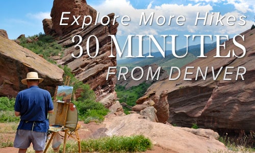
Red Rocks Trail at Red Rocks Park
The Red Rocks Trail at Red Rocks park gives you a chance to wander through the meadows just east of the imposing red monoliths that this Denver Mountain Park is named after. Close to Denver, the Red Rocks Trail is great for a sunrise hike, an inspiring trail run or a challenging bike ride. There's more: a cave carved into ...
White Ranch Sunset Loop Near Golden, Colorado
This loop hike in White Ranch Park is a great escape, a place to watch the glow of twilight on the city of Denver as the sun sets in the West. This Colorado trail is set at the very beginning of the foothills. You'll journey across a tranquil meadow punctuated with ponderosa pine and decorated with Spring and early Summer ...
Moraine Park Loop Hike in Rocky Mountain National Park
The Moraine Park Loop encircles the golden meadows of Moraine Park in Rocky Mountain National Park. The morning mists rising from the Big Thompson River, and herds of grazing elk make for an enchanted landscape. In the evening, the setting sun brings shadows and light play to the valley floor. All of this is against the backdrop of the distant ...
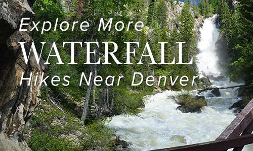
Granite Falls in Rocky Mountain National Park
Granite Falls takes a 5.1 mile journey from the Green Mountain Trailhead in Rocky Mountain National Park. At Granite Falls, the waters of Tonahutu Creek drop fifty feet through a course of smooth granite slabs. The hike offers a diverse landscape: from tranquil forests, to expansive meadows, and verdant creeksides--all alive with wildflowers and wildlife. Explore the full Granite Falls ...
MacGregor Falls in Rocky Mountain National Park
MacGregor Falls has become one of my favorite hidden waterfall hikes in Rocky Mountain National Park. The Black Canyon Trail meanders through old ranch land meadows, along the captivating Lumpy Ridge rock formations, and offers views of Longs Peak to the southwest. The falls are 3.1 miles (one way) from the Lumpy Ridge Trailhead. It's a lesser-known hike with a ...
Elk Valley Trail in Roxborough State Park
The Elk Valley Trail in Roxborough State Park climbs to a lesser visited valley in the park. Incredible views of the red rock formations of Roxborough make this a great moderate hike near Denver. The hike to Elk Valley is a 4.8 mile out-and-back journey, but can be turned into one of two more strenuous loop hikes. Explore all the ...
Windy Peak Hike in Golden Gate Canyon
Windy Peak is a summit hike in Golden Gate Canyon State Park. A moderate to difficult 6.4-mile loop hike that follows meltwater creeks, crosses green meadows replete with wildflowers, and offers great views at the summit of the snow-capped Rocky Mountains in the West. Explore the full Windy Peak Hike profile for trail map, driving directions, and many of the ...
Bear Canyon Loop Hike at NCAR
The Bear Canyon Loop Hike near Boulder, Colorado is a beautiful trail that spans wide open spaces and meadows near National Center for Atmospheric Research. The Bear Canyon Loop is a relatively easy 3.3-mile loop that features some of the best views of the Flatirons in Boulder. Explore the full NCAR Bear Canyon Loop hike profile below for trail map, ...
Shanahan Ridge Hike Near Boulder
The Shanahan Ridge Loop Hike is an easy, 4-mile lollipop-loop trail with stunning views of the Shanahan Ridge of the Flatirons in Boulder, Colorado. Explore the full Shanahan Ridge Loop hike profile below for trail map, driving directions, and more tips and details to help you enjoy this hike in Boulder. Trail Snapshot: Shanahan Ridge Loop Trail in Boulder, Colorado ...
Meyers Homestead Hike in Walker Ranch
The Meyers Homestead Hike located in Walker Ranch is an almost perfect family hike near Boulder, Colorado. This 5.2-mile out-and-back hike travels through Meyers Gulch, past the remnants of a historic homestead, to an overlook offering panoramic views of Boulder Canyon and the snowcapped mountains of Indian Peaks. It's a wide trail through meadows, stands of aspen, and punctuated by ...
Heil Valley Ranch Ponderosa Loop Hike
Heil Valley Ranch near Boulder offers this rewarding lollipop-loop hike which features views of distant snowcapped mountains and geological features unique to this section of Colorado. Nestled in the foothills between Boulder and Lyons this singletrack trail is a great destination for both hikers and mountain bikers. However, soil erosion has required occasional trail closures, so be sure to check ...
Santa Fe Regional Trail in Palmer Lake
The Santa Fe Regional Trail begins in Palmer Lake, Colorado, about 1 hour South of Denver. It's an easy trail with 17 miles from Palmer Lake to Colorado Springs along the old path of the Santa Fe Railroad. Explore the full Santa Fe Regional Trail hike profile below for trail map, driving directions, and more tips and details to help ...
Petrified Forest Hike at Florissant Fossil Beds
The Petrified Forest trail is an easy 1.5 mile loop hike just a 50 minute drive from Colorado Springs. This hike at the Florissant Fossil Beds National Monument takes you past the fossilized stumps of ancient sequoia trees, over rolling mountain meadows with views of snowcapped peaks, and is a great way to learn about the geology of Colorado while ...
Mesa Trail to Bear Canyon Creek
The Mesa Trail south of Boulder, Colorado, rambles across wild open country at the base of the iconic Flatirons. Hike a 4.1 mile loop or an 8.4 mile out-and-back option through pine woods, verdant creek draws, and flowering meadows. Explore the full Mesa Trail profile for this southern segment of one of our favorite dog-friendly hikes near Denver. Trail Snapshot: ...
Bergen Peak Hike Near Evergreen
The hike up Bergen Peak follows a challenging 4.6 mile trail in the Elk Meadows near Evergreen, Colorado. With both loop hike and out-and-back options, you'll take in views from Bergen's summit of the surrounding Colorado foothills, western mountains, and eastern plains. This makes a great adventure in the Fall to take in the changing colors of the aspen trees ...
Chautauqua Loop Trail in Boulder
The Chautauqua Trail is an easy 3.6 mile loop hike along Boulder's Flatirons. The trails pass several historical sites: a quarry, cabin, shelter, and ski area as it weaves through the meadows and ponderosa forest of Chautauqua Park. About 40 minutes from Denver, the Chautauqua Loop hike makes for a great hike for visitors who are looking for stunning landscapes ...
Square Top Lakes Trail on Guanella Pass
The Square Top Lakes Trail, one of several cresting Guanella Pass above Georgetown, CO, gives hikers a chance to behold sweeping valley vistas and the imposing profile of Mount Bierstadt. Simply driving to the trailhead along Guanella Pass can soothe a weary soul and take its breathe away at the same time! Once on the trail, the expansive pass greets ...
Silver Dollar and Murray Lakes Trail
Silver Dollar Lake Trail graces hikers with not just one, but three lakes! This easy to moderate hike, approximately 3-4 miles, treks up lake by lake. Each successive one along the Silver Dollar Lake Trail perches above the previous, creating multiple platforms from which to view the valley, breathe in the beauty, and take pictures. Situated along the stunning Guanella ...
Crater Lake Hike in the Indian Peaks Wilderness
California may boast Yosemite, but Colorado offers the Indian Peaks Wilderness valley. And within this wilderness, one happens upon an arresting sight -- Mirror Lake and Crater Lake, dutifully monitored by the impressive Lone Eagle Peak. Long considered an iconic range, the Indian Peaks give hikers an endless stream of prime photography, wildflowers, and "Look at that!" moments. From the ...
Eleven Mile State Park Interpretive Trail
Eleven Mile State Park feels like the proverbial "hidden in plain sight" gem. Situated off the commonly traveled Highway 24 between Colorado Springs and Buena Vista, this loop hike blesses visitors with uncommon beauty. Trekking around the 3.5+ mile trail serves up a superb buffet of Colorado's classic outdoors: aspen and evergreen forests, meadows, rocky crags, vistas of mountain ranges, ...
Mayflower Gulch Trail near Copper Mountain
Easy parking. Gentle elevation. Three miles round trip. And a ghost town? The Mayflower Gulch Trail gives you all this and a shockingly gorgeous basin to behold. On top of all this, the hike works well for families, especially if there exists any curiosity about the old west. The spacious gulch invites visitors to wander around and discover the fringes...a ...
Willow Creek Trail at Roxborough State Park
Entering Roxborough State Park is like walking into another world. The red rock and wildlife--and if you are lucky--the low lying cloud cover, conspire to make for a great escape just south of Denver. The Willow Creek trail makes for a short hike in Roxborough is a perfect way to begin exploring the park. Scroll down to get all the ...
Meyer Ranch Open Space Hikes
Meyer Ranch is just 30 minutes outside of Denver, Colorado and offers three different hiking trail options, ranging from 2.4 to 4.8 mile, easy to moderate hikes. Check out the three different hiking trail options for this hike near Conifer, Colorado. Trail Snapshot: Meyer Ranch Open Space Hikes Hike Distance 2.4 to 4.8 miles Round Trip Difficulty Easy to Moderate ...
Greenland Open Space Trail Near Larkspur, Colorado
Rolling meadows stretch to spectacular views of Pikes Peak on this easy Colorado hike near Larkspur. The Greenland Trail takes you across the stunning grasslands near Larkspur, Colorado, a Douglas County Open Space that spreads across 3,600 acres of sun-drenched fields.The Greenland Open Space trailhead can be easily accessed from I-25. Check out the full trail profile below for detailed ...
Elk Range Trail at Centennial Cone Park
For those who are looking for a nice hike that incorporates the highland meadows of Colorado and views to snowcapped mountains, then the Elk Range Trail at Centennial Cone Park is the perfect hike. The Elk Range Trail can be hiked as an out-and-back 6.6 mile adventure, starting from one of two different trailheads. We saw a lot of wildlife ...
Hiking Davis Ponds Hike at Staunton State Park
The Davis Ponds loop is a short and easy hike, perfect for young families. Davis Ponds is a great place to take your kids fishing near Denver. Explore the full trail profile below for all the details: hiking trails, trail map, and detailed directions to the trailhead. Staunton State Park is one of Colorado's newest gems and located just 45 ...
Adams Falls in Rocky Mountain National Park
Adams Falls is a short .6-mile round-trip hike near Grand Lake, Colorado. The waterfall borders Rocky Mountain National Park and its trail begins at the same trailhead for the East Inlet Trail. Explore the full Adams Falls hike profile below for trail map, driving directions, and all the details you need for this short waterfall Hike in Rocky Mountain National ...