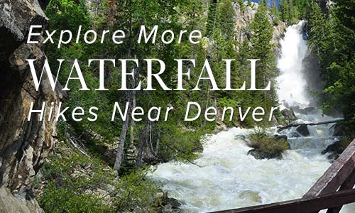
With thousands of miles of rivers and streams, Colorado has many miles of great hiking trails that follow and cross them. Often rivers mean shade, or take you into high canyons. Explore our set of trails near Denver that follow and crisscross the beautiful creeks, brooks, streams and rivers of Colorado.

Adams Falls in Rocky Mountain National Park
Adams Falls is a short .6-mile round-trip hike near Grand Lake, Colorado. The waterfall borders Rocky Mountain National Park and its trail begins at the same trailhead for the East Inlet Trail. Explore the full Adams Falls hike profile below for trail map, driving directions, and all the details you need for this short waterfall Hike in Rocky Mountain National ...
Arch Rocks Hike in Rocky Mountain National Park
Along the way to The Pool or Fern Falls, you'll run into this towering waypoint of nature in Rocky Mountain National Park, the Arch Rocks. These are boulders as huge as cottages where the trail passes through. The trail is quite flat and hikers get to enjoy the sound of the running waters of the Big Thompson River. Explore the ...
Bear Canyon Loop Hike at NCAR
The Bear Canyon Loop Hike near Boulder, Colorado is a beautiful trail that spans wide open spaces and meadows near National Center for Atmospheric Research. The Bear Canyon Loop is a relatively easy 3.3-mile loop that features some of the best views of the Flatirons in Boulder. Explore the full NCAR Bear Canyon Loop hike profile below for trail map, ...
Bear Creek Trail at Lair o’ the Bear Park
Lair o' the Bear is, in our family's opinion, the best family hike near Denver. First, the drive into the canyon on Bear Creek road is beautiful. Once at the park you'll find great hiking trail options, the cool water of bear creek, great parking, and some good picnic spots. There are open areas as well as shade. Our one ...
Black Lake in Rocky Mountain National Park
Black Lake is among the most spectacular lakes in Rocky Mountain National Park. The journey to Black Lake is a strenuous, 10 mile, round-trip hike with significant elevation gain--but both the destination of Black Lake and the several waterfalls along the way make it more than worth the effort. Explore the full Black Lake hiking trail profile for trail map, ...
Booth Creek Falls Hike Near Vail
Booth Creek Falls is a 60-foot waterfall located in the Eagles Nest Wilderness near Vail, Colorado. The journey to the waterfall requires a strenuous, 2-mile hike along the banks of Booth Creek. Explore the full Booth Creek Falls hike profile below for trail map, driving directions, and tips and details to help you enjoy this adventure near Vail. Trail Snapshot: ...
Bridal Veil Falls Hike at Rocky Mountain National Park
Atwenty foot waterfall hidden away in the northern reaches of Rocky Mountain National Park, Bridal Veil Falls makes for a great destination hike. Keep your eyes out for Elk in the meadows along this hiking trail in Colorado's favorite National Park. Get the hike information you need with our hiking snapshot for Bridal Veil Falls, and get more details by ...
Buffalo Creek Falls at Wellington Lake
This waterfall isn't even on the map, and it's become my favorite waterfall hike near Denver. In fact, this is the only post that I'm tempted to keep to myself, because not only is there great hiking, but Wellington Lake may be the best camping spot within 90 minutes of Denver. There is a hitch though: it's a privately held ...
Calypso Cascades in Rocky Mountain National Park
Calypso Cascades is an easy 3.6 mile hike to one of several waterfall destinations along this section of trail. This waterfall in the Wild Basin of Rocky Mountain National Park is gets its name from the purple Calypso Orchids that bloom along the banks of Cony Creek. Explore the full Calypso Cascades hike profile below for trail map, driving directions, ...
Castlewood Canyon State Park Trails
Because Castlewood Canyon State Park is hidden in the plains--and not the mountains--near Denver, it's often an overlooked State park of Colorado. But, whether you're hiking or rock climbing it's a beautiful and geologically unusual place to explore. It boasts a waterfall, homestead ruins, a stream, caves and clefts, and a lot of fairly easy hikes. Below you'll find more ...
Chaos Canyon Cascades in Rocky Mountain National Park
Chaos Canyon Cascades in Rocky Mountain National Park is formed as Chaos Creek tumbles through the forest below Lake Haiyaha. This 4.2 mile round trip hike is on the east side of RMNP to one of the lesser visited cascade waterfalls in the park. Explore the full Chaos Canyon Cascades hike profile below for trail map, driving directions, and some ...
Chasm Falls in Rocky Mountain National Park
Chasm Falls in Rocky Mountain National Park bursts through a chasm in Fall River where the rock funnels its waters into a narrow gorge. It's one of the more accessible waterfalls in RMNP, located about 100 yards off of Old Fall River Road. The only drawback is that parking fills fast. However, there are several parking and hike options that ...
Chicago Lakes Hike Near Mt. Evans
Want to take in some of Colorado's breathtaking scenery and put some miles under your hiking boots? The Chicago Lakes hike begins at Echo Lake. You'll pass three more mountain lakes as you punch up into the high country of Colorado's Mt. Evan's Wilderness. Explore the full trail profile below for the Chicago Lakes which includes driving directions, map, and ...
Clear Creek Trail in Downtown Golden
Want a hike to please everyone?The Clear Creek Trail in Golden, Colorado is it! It's got shade, the kids can bring their bikes, and you can finish your hike with a stroll around downtown. We might get some flack for calling this a hike, because it runs through the business district of Golden, CO.But you can wear the soles of ...
Continental Falls Hike Near Breckenridge
Continental Falls crashes through cracks in the granite sides of the mountains near Breckenridge Colorado. It's a moderate 2.5 mile uphill hike to the base of the waterfall. The 1000+ feet of elevation gain require some bodily exertion, but it's worth the effort. Located on the eastern slopes of the Mosquito Range, waterfall finds its source in the high mountain ...
Copeland Falls in Rocky Mountain National Park
Copeland Falls is just one of the many waterfalls hikers will encounter in the Wild Basin area of Rocky Mountain National Park. In fact, you can't miss Copeland Falls as it is the first waterfall along the main trail--just a short hike from the trailhead. Explore the full Copeland Falls hike profile below for trail map, driving directions, and more ...
Crater Lake Hike in the Indian Peaks Wilderness
California may boast Yosemite, but Colorado offers the Indian Peaks Wilderness valley. And within this wilderness, one happens upon an arresting sight -- Mirror Lake and Crater Lake, dutifully monitored by the impressive Lone Eagle Peak. Long considered an iconic range, the Indian Peaks give hikers an endless stream of prime photography, wildflowers, and "Look at that!" moments. From the ...
Crystal Mill Hike: Iconic Colorado
You've likely seen the photo, but may not have known how to reach it: Crystal Mill. The legendary Old West structure, built in 1892 during the silver boom, stands tall - yet precariously as ever - in the gorgeous back county of the White River National Forest. The Crystal Mill remains one of the most photographed places in the state, ...
Cub Lake Loop in Rocky Mountain National Park
The Cub Lake Loop Hike in Rocky Mountain National Park is a great alternative to the an out-and-back hike up to Cub Lake. Along the way, hikers will pass by Windy Gulch Cascades, travel alongside the Big Thompson River, cross over an area called The Pool, journey through wetlands, and will be surrounded by sights of a glacial-shaped landscape. Explore ...
Deer Creek Canyon Loop Hike
This loop hike in Deer Creek Canyon offers a quick getaway from the city of Denver and its surrounding suburbs. Because Deer Creek Canyon Park is tucked away in the entrance of the canyon, you can completely immerse yourself in the foothills and the valley that lies between Littleton and the park. Trail Snapshot: Deer Creek Canyon Loop Trail Hike ...
Devils Thumb Lake
Devils Thumb Lake is located in Indian Peaks Wilderness north of Boulder Colorado and can be accessed via a 6.5-mile (one-way) steep and challenging hike. Wildflowers, alpine meadows, small waterfalls, and cascades all beckon those who have the stamina to explore these heights in the Front Range near Denver. Explore the full Devils Thumb Lake hike profile below for trail ...
Dream Lake in Rocky Mountain National Park
The hike to Dream Lake is one of the popular destination hikes in Rocky Mountain National Park--and for good reason. In the early morning hours, Dream Lake is a vision straight out of a fairy tale. This 2.2-mile, out-and-back hike begins at the Bear Lake trailhead and passes Nymph Lake along the way. Explore the full Dream Lake hike profile ...
East Plum Creek Trail in Castle Rock
This paved trail meanders along Plum Creek in Castle Rock, Colorado. Though it winds through developed areas, the Plum Creek trail has some surprises: towering cottonwoods, pines, and the seasonal sounds of Plum Creek. Be sure to explore snapshot and full hiking profile below to get the details on parking, trail map, and hike options. Castle Rock is a growing ...
Eldorado Cascades at Walker Ranch
Eldorado Cascades is tucked back in Walker Ranch near Boulder, Colorado. It's an easy to moderate 1.25 mile hike from the Ethel Harrold Trailhead down to where South Boulder Creek winds through the park and crashes over the boulders blocking its path. Explore the full trail profile below for all the details: tips, trail map, and driving directions to the ...
Elk Falls – New Waterfall Near Denver
Elk Falls in Colorado's new Staunton State Park opened to the public in 2013. This highest waterfall near Denver had been unknown to most, and inaccessible, except to a few. Now it's an adventure waiting for able hikers! If you are a fan of waterfall hikes and you live near Denver, you'll know that it's kind of slim pickings; most ...
Emerald Lake Hike Rocky Mountain National Park
Emerald Lake is one of the most accessible hikes in Rocky Mountain National Park. If you are visiting RMNP, and have limited time to visit, the trail to Emerald Lake is an excellent option. You'll pass both Dream Lake and Nymph lake before you end your hike at Emerald Lake and it's stunning views of Hallet Peak. For more information ...
Fan Falls in Rocky Mountain National Park
Fan Falls is tucked away in the high reaches of the Wild Basin of Rocky Mountain National Park. This 15.5 mile, difficult trek, leads to a long set of segmented cascades spilling out of the heights and streaming down into Thunder Lake. This garden of water, wildflowers and rock is a perfect escape for those looking for a demanding hike ...
Fern Falls in Rocky Mountain National Park
Fern Falls tumbles down through the forest casting a fine mist across the trail. It's a perfect place to stop, cool off, and take in the sights and sounds of the falls before hiking on to Fern Lake. Explore the full Fern Falls hike profile below for trail map, driving directions, and more of the details and tips you need ...
Fern Lake in Rocky Mountain National Park
A hike up to Fern Lake begins at the Fern Lake Trailhead on the east side of Rocky Mountain National Park. Along the Fern Lake Trail, hikers pass through Arch Rocks, over a bridge at The Pool, and by three cascade waterfalls. Near the, you'll gain spectacular views of The Gable, Knobtop Mountain, Notchtop Mountain, and Little Matterhorn from its ...
Fish Creek Falls Near Steamboat Colorado
A 284 foot waterfall! Need we say more. Fish Creek Falls is a 1/4 mile hike located just outside Steamboat Springs, Colorado--about 3.5 hours from Denver. The Fish Creek Falls Overlook trail is handicap accessible, and a second trail takes hikers down to the base of the falls. Explore the full Fish Creek Falls hike profile below for trail map, ...
Forgotten Valley Hike at Golden Gate State Park
Can you think of a more mysterious name for a hike? Colorado's Golden Gate State Park has many trails, and the Forgotten Valley is a great place to start discovering this gem that is tucked between Golden and Boulder, Colorado. Get all the details on hiking the Forgotten Valley by scrolling down to the hike snapshot and hiking tips below ...
Forsythe Canyon to Waterfall and Gross Reservoir
Looking for a trail that will provide some shade on a hot Colorado day? This hiking trail has shade, plus a waterfall, a stream, a canyon, and lake. It's hard to beat. Forsythe Canyon is just outside Boulder, Colorado (1hr 15min from Denver), and is an easy to moderate hike. Check out our full hiking trail profile for details and ...
Georgetown Railroad Hike & Train Ride
After the hike, I asked our 7 year-old daughter what she thought of it. Her reply said it all, “Dad, it was awesome!” Here favorite parts were the fairy pond, a small, moss-rimmed pool probably created by miners long ago to hold drinking water, and the gleaming minerals in the rocks she picked up along the trail. I enjoyed the ...
Golden Gate Canyon State Park Hiking Trails
6 Hikes in Golden Gate Canyon State Park Located less than an hour from Denver and Boulder, Golden Gate Canyon State Park is a remarkable treasure. The park offers over 30 miles of hiking trails and some of the most accessible backcountry camping opportunities near Denver. Golden Gate is full of seasonal creeks and wildflowers, as well as promontories that ...
Guide for Hiking Hanging Lake in Colorado
Hanging Lake is a short hike to two waterfalls and one of the most beautiful lakes in Colorado. On the same hike, you can explore Spouting Rock Falls, and even walk behind the waterfall. Reservations are required to hike Hanging Lake so don't leave home without booking (see info in trail snapshot below). It’s not a day hike near Denver, ...
Helen Hunt Falls in Colorado Springs
Helen Hunt Falls in Colorado Springs is a 35 foot waterfall requiring only a short walk from the parking area. For a longer and more demanding hike, visitors can take the 4 mile Columbine Trail from the bottom of Cheyenne Canyon to Helen Hunt Falls. This strenuous option affords and experience of the rich ecosystem of this canyon at the ...
Herman Gulch to Herman Lake Hike
The Herman Gulch Trail is one of the best summer wildflower hikes near Denver. It's also a challenging winter snowshoe and is often used for cross-country skiing. The Herman Gulch Trail is a 2.5 mile (one-way), out-and-back adventure into snowcapped mountain country and provides access to many more trails in Arapaho National Forest. Explore the full Herman Gulch hike profile ...
High Line Canal Hike – County Line to Fly’n B Park
The High line Canal starts in the foothills and meanders over 60 miles through Denver, creating a treelined hiking and biking thoroughfare in the middle of the city. This stretch in Littleton, Colorado takes you past Fly'n B Park. Take the path south and you'll find yourself in Writer's Park. Scroll down for the trail snapshot, and for further details ...
Homestead Trail at Castlewood Canyon
This trail is great place to begin if you plan to explore the west side of Castlewood Canyon. It's a short hike, but the Homestead Trail can be used to link up to other hiking trails in this Colorado State Park. Scroll down to get all the hiking info you need in the trail snapshot, trail options descriptions and tips ...
Horsethief Falls Hike Near Colorado Springs
Horsethief Falls is a small slab waterfall located 45 minutes from Colorado Springs on the West side of Pikes Peak. The Horsetheif Falls trail requires a 1.4-mile easy hike (one-way) to the falls. This hike, along with nearby Pancake Rocks make for great fall hiking and a scenic falls drive to see the golden aspens of the Colorado Front Range ...