
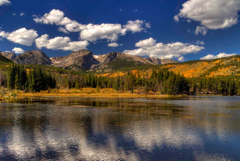
10 Best Hikes in Rocky Mountain National Park
If it's your first time visiting Rocky Mountain National Park and you're wanting to make the most of your visit, then this set of hikes is a great place to start. I've spent over six full months hiking the hundreds of miles of trails in RMNP, and we drive up with visiting family and friends to show them around. However, before we get into the hikes, here are a few scenarios on how you might want to spend your day.
NOTE: Rocky Mountain National Park requires that you have timed-entry permits Late-May through Late-October. More information at the RMNP Timed-Entry Permit Page.
Hiking Scenarios for Rocky Mountain National Park
Scenario #1: You have a full day and young kids.
Think of your day in two parts. Part 1 is hiking and Part 2 is the scenic drive up Trail Ridge Road (if it's open) to the Alpine Visitor Center. Hike first, early in the day, before the storms roll in during the afternoon. Some great family hikes are: Horseshoe Falls, Sprague Lake, the short hike around Bear Lake, and Alberta Falls, or Emerald Lake. Between driving, parking, and hiking, you'll likely have time for just one of these before your drive up Trail Ridge Road.
Scenario #2: You have a full day and no kids with you
You've got some options. Option A is to do one of the longer hikes in this post: Sky Pond, Timberline Falls, Ouzel Falls, or Fern Lake.
Scenario #3: You only have a few hours.
This one is the toughest scenarios because there are so many great places to see, and many of them require a drive. If you only have a few hours, I'd recommend the short hike around Sprague Lake, and if you have a bit more time, to drive up to Bear Lake. Bear Lake will give you an up-close feel of the mountains, and Sprague Lake will provide you with a larger-than-life panorama of the continental divide.
Top 10 Hikes at Rocky Mountain National Park
I've organized these from easiest to most demanding (which are also the longest).
-
Sprage Lake Loop Hike
-
Bear Lake
-
Horseshoe Falls
-
Alberta Falls
-
Four Lakes and Waterfall Loop
-
Fern Falls
-
Fern Lake
-
Ouzel Falls
-
Timberline Falls
-
Sky Pond
Distance: 0.5 Mile | Difficulty: Easy
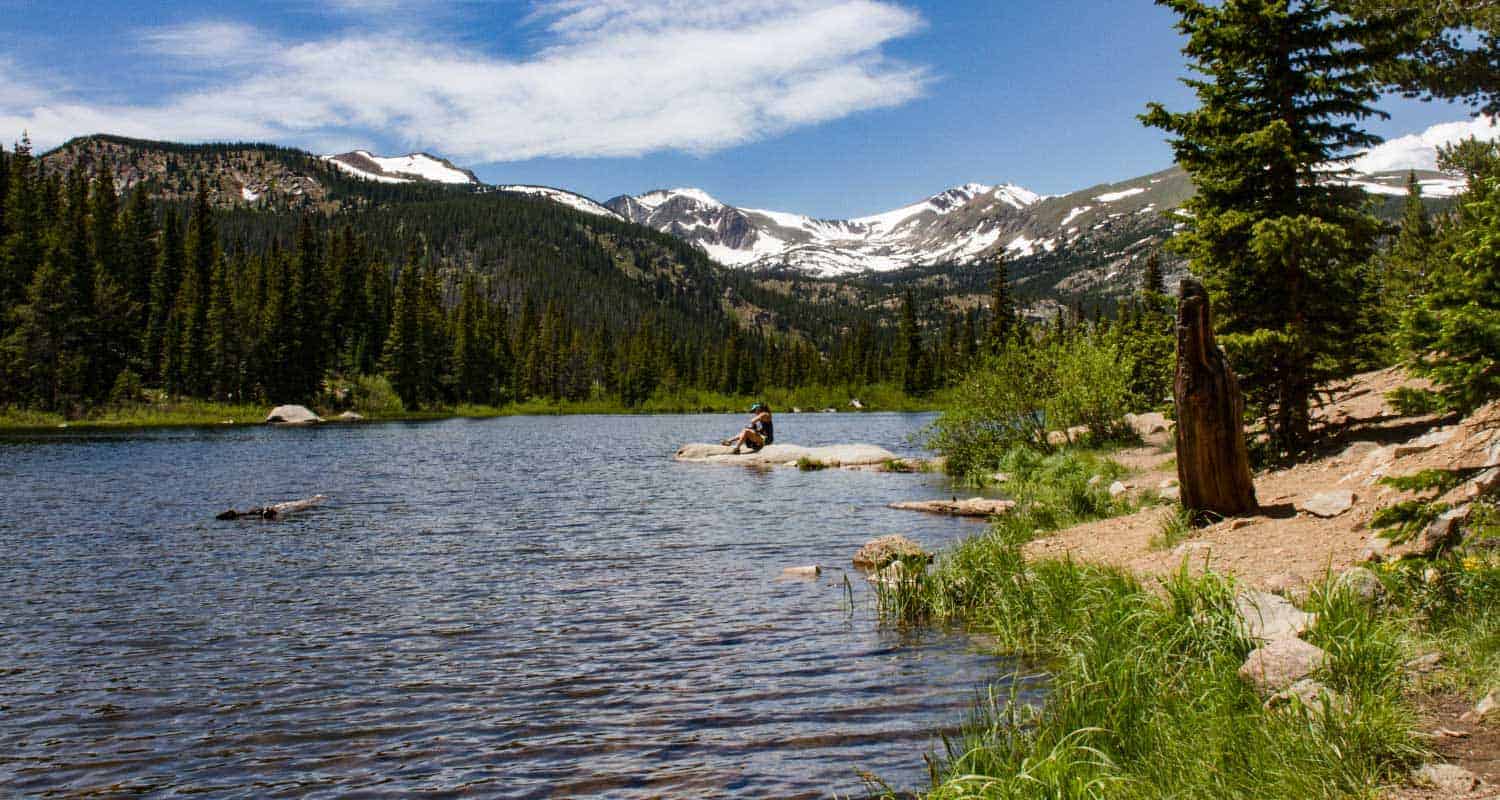
If you don't have a lot of time and are lookign for an easy introduction to Rocky Mountain National Park, Sprague Lake is the place to start. On the way, be sure to stop and look for elk in Moraine Park. This small lake was actually built by an early settler of the area, Albert Sprague, who built a resort along its waters. This is a great place to bring a picnic lunch or watch the sun set over the Rockies.
![]()
Distance: 0.6 Miles | Difficulty: Easy | Elevation Gain: Nominal
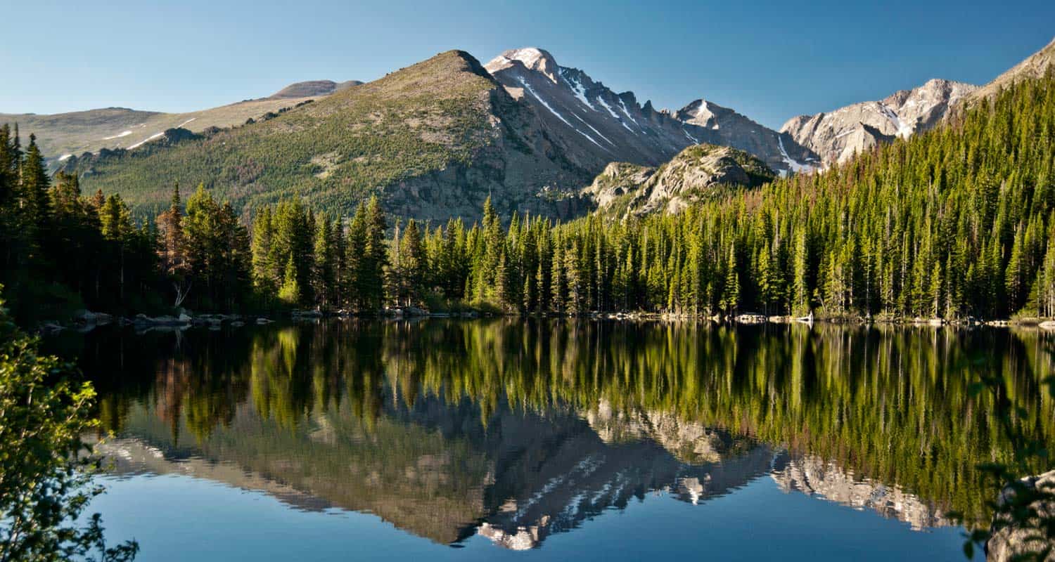
Think of Bear Lake as the epicenter of Rocky Mountain National Park. From the Bear Lake Trailhead, you can venture to destinations inside Glacier Gorge, Andrews Creek, or even up to the top of Hallett Peak. Though the parking lot is huge, it fills quickly, and you may need to take the shuttle from down in Glacier Basin. The hike at Bear Lake is an easy half-mile around the lake. If you've traveled all this way, I'd recommend checking out Alberta Falls and the hike to Emerald Lake.
![]()
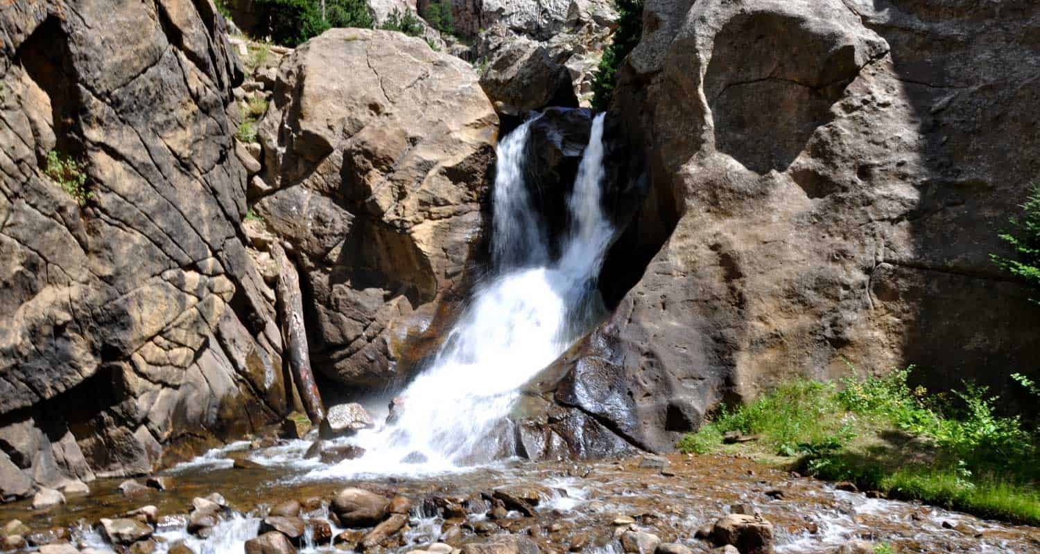
Distance: 0.4 Miles | Difficulty: Easy | Elevation Gain: Nominal
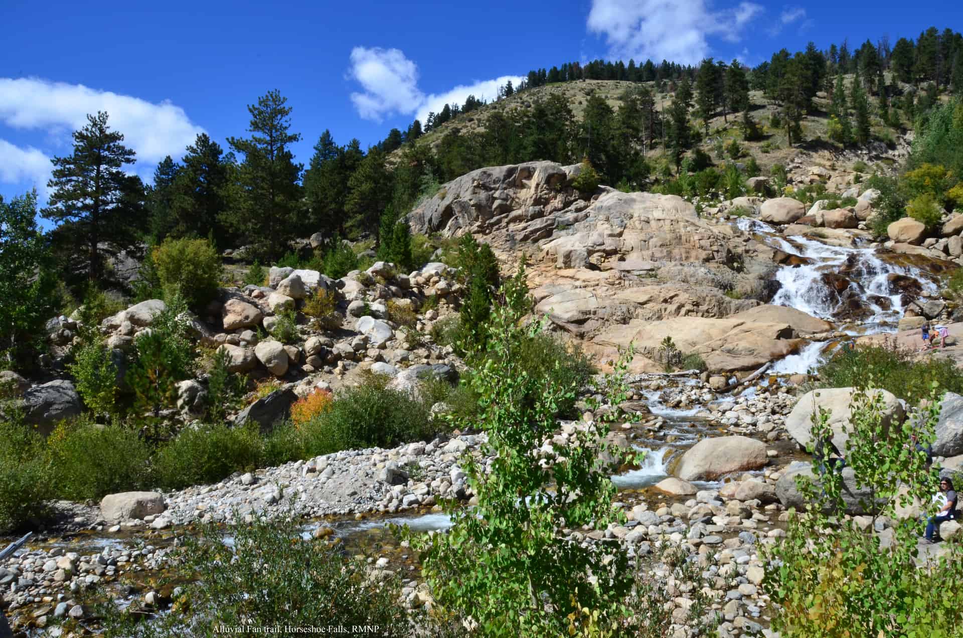
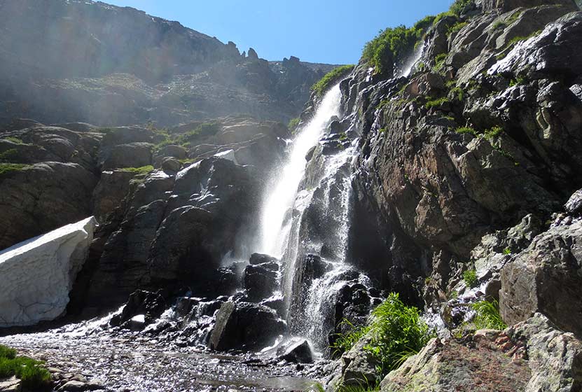
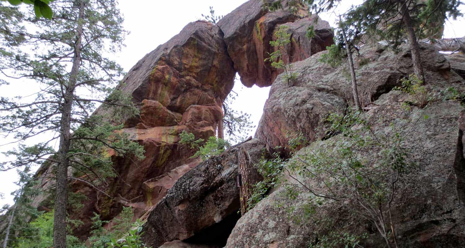
Horseshoe Falls is a beautiful and easily accessed off Old Fall River Road. When our kids were younger, they loved this hike because you can scramble along small boulders and explore the many courses of the waterfall. Do be careful though as rocks can shift, and the granite can be sharp. If you're up for a longer adventure, you can drive up Old Fall River Road (when it's open) and take Trail Ridge Road back down.
![]()
Distance: 1.6 Miles | Difficulty: Easy | Elevation Gain: 200'
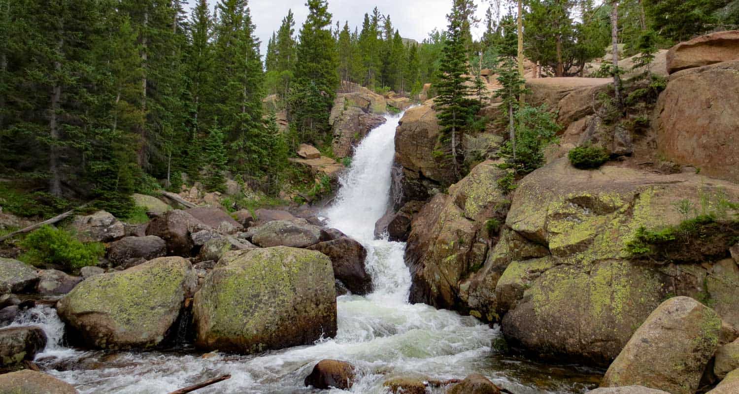
Glacier Creek plummets thirty feet to creat the impressive spray of Alberta Falls. The falls are known for their impressive flow, especially during the spring and early summer months when the snowmelt increases the water volume. The hike up to Albrta Falls is short and easy, making it perhaps the busiest trail in the entire park. However, we recently hiked it in the late afternoon and were the only people on the trail for most of our hike.
![]()
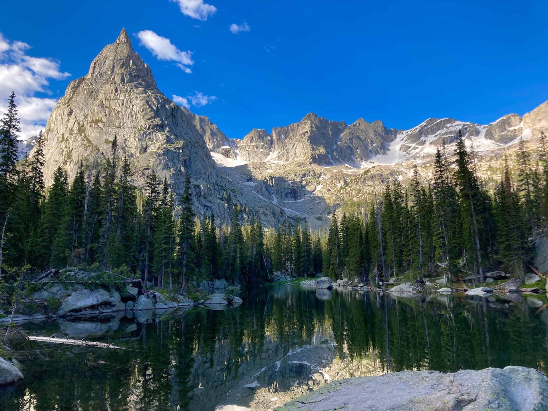
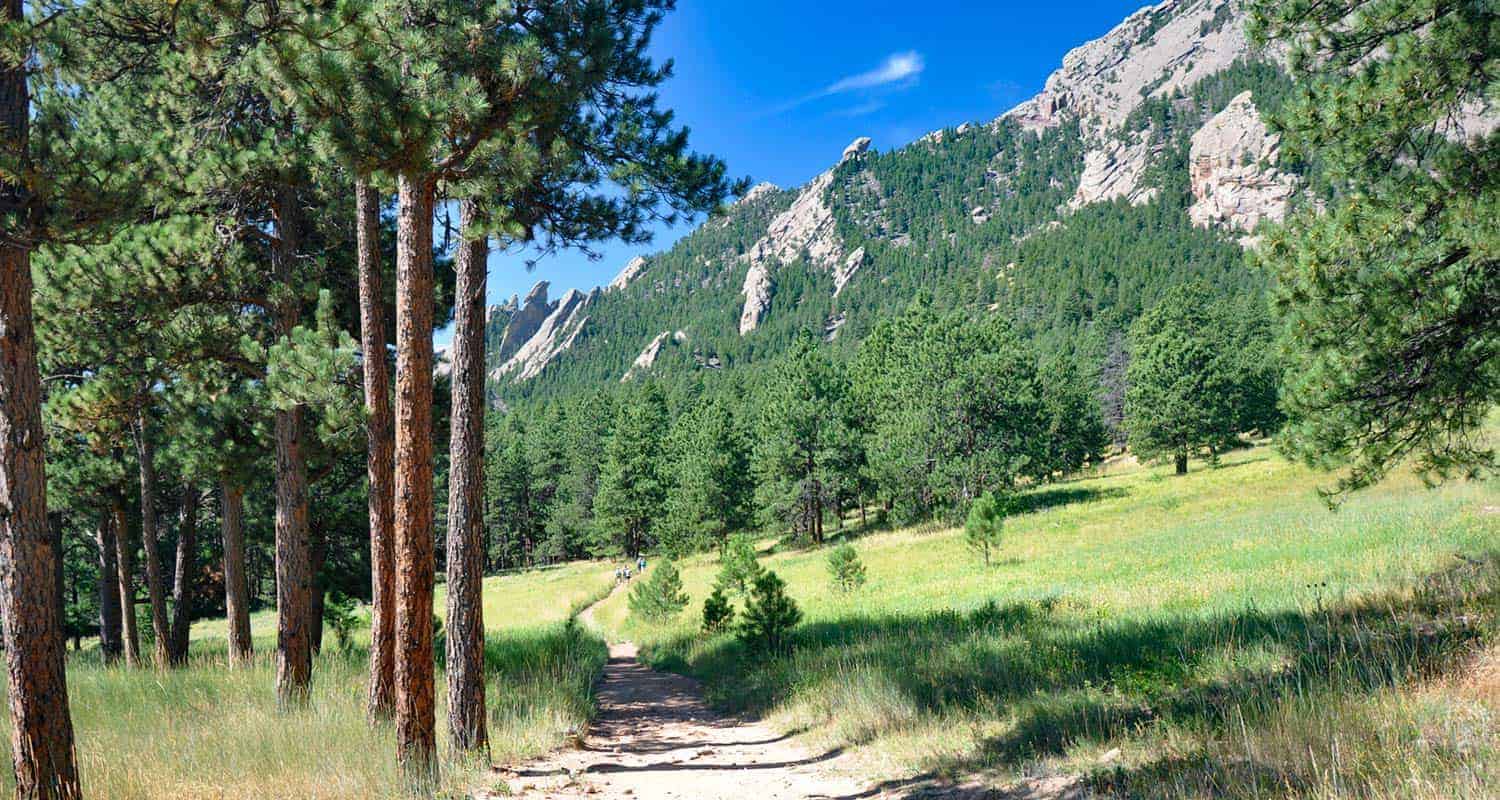
Distance: 6.4 Miles | Difficulty: Moderate | Elevation Gain: 800'
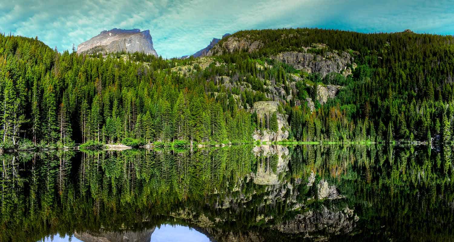
This is one of my favorite hikes to take friends on in RMNP. You'll travel past Alberta Falls on your way up to Lake Haiyaha. I love lake Haiyaha because it's right up against the mountainside, had really cool big granite boulders, and a beautiful old pine tree along its shore. After that, you'll hike to Dream Lake. From there, you'll hike to Dream Lake and Nymph Lake, with the option of adding an out-and-back segment to Emerald Lake to your adventure. From Nymph Lake, take the trail back to Bear Lake.
![]()
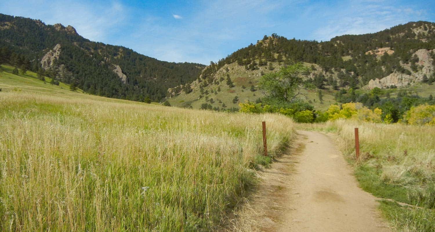
Distance: 5.4 to 8 Miles | Difficulty: Moderate | Elevation Gain: 650'
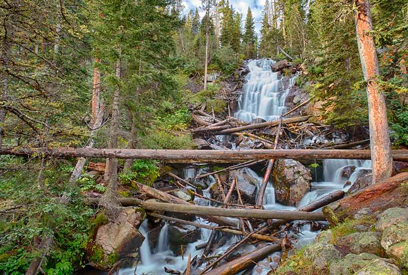
The hikes up to Fern Falls and Fern Lake begin at the Fern Lake Trailhead. It's a small trailhead with limited parking, so go early, or plan to add 0.8 (one-way) to your hike from the shuttle stop. I love Fern Falls because it crashes through the forest over granite boulders and deadfall. It's loud and picturesque. Along the way you'll pass through Arch Rocks, pass by The Pool, and hear the rushing waters of the Big Thompson River as it courses its way out of the high country.
![]()
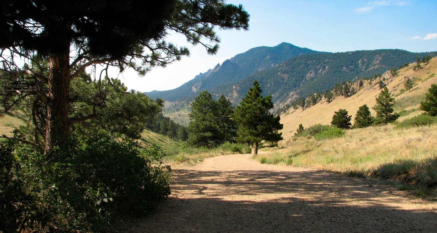
Distance: 7.8 to 9.4 Miles | Difficulty: Moderate | Elevation Gain: 1400'
Fern Lake is a beautiful alpine lake, and worth taking this more demanding hike. Be aware that there can be snow covering the upper reaches of the trail into early Summer. The fishing at the lake is great, and the lake is a perfect place to hike to for an afternoon picnic. If you start early, you can add Odessa Lake to your trip.
![]()
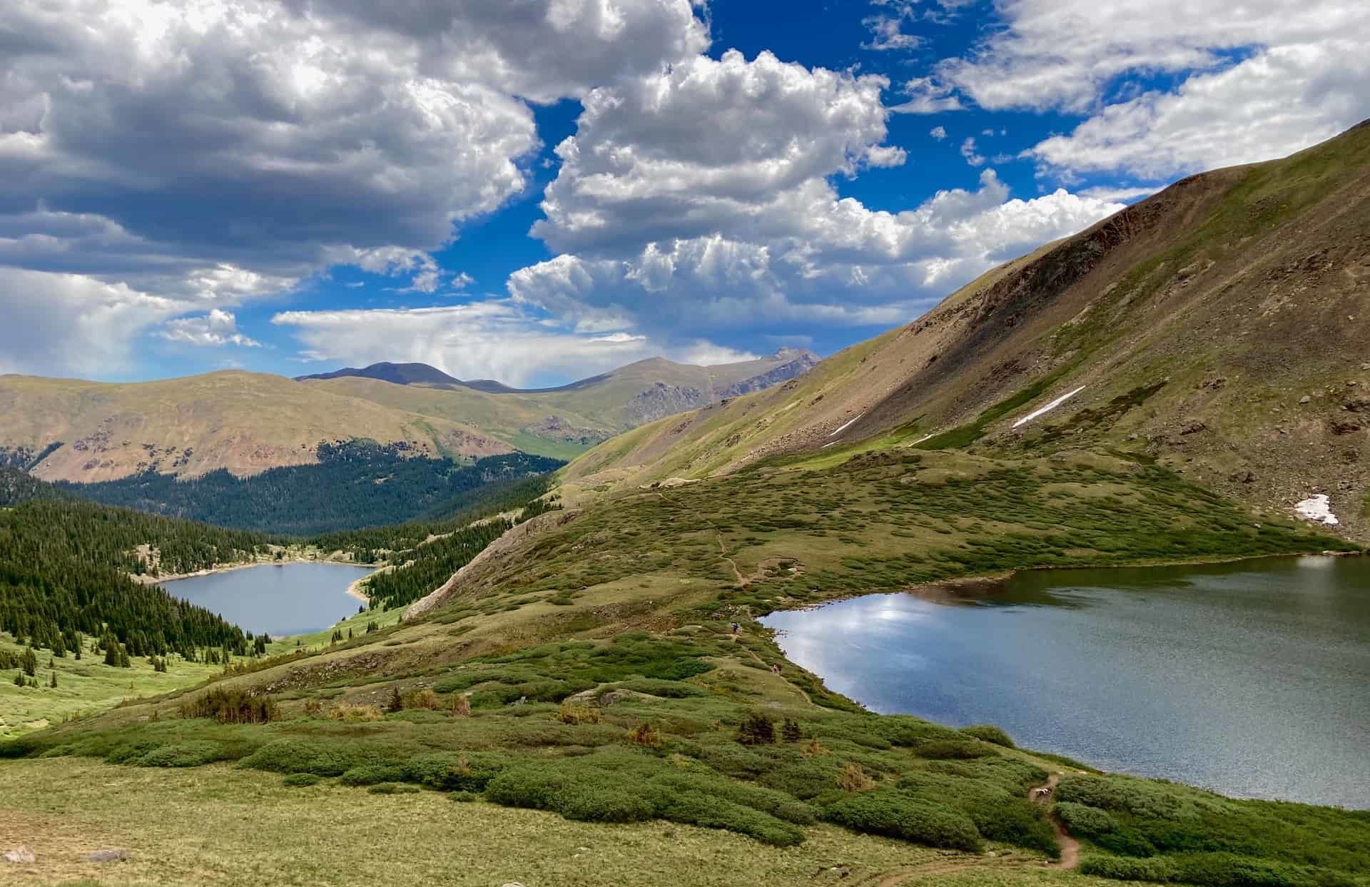
Distance: 5.4 Miles | Difficulty: Moderate | Elevation Gain: 1000'
The hike up to Ouzel will take you into the Wild Basin area of Rocky Mountain National Park and past two other smaller but beautiful waterfalls. Less than a half-mile into your hike you'll pass Copeland Falls, and at approximately one mile into the trail, you'll see Calypso Cascades. The trail climbs, becoming more demanding and providing some great views into the Wild Basin. A bridge crosses Ouzel Creek and offers the first breathtaking views of the falls. It might be my favorite waterfall in the park because of how it shoots off the cliff above.
![]()
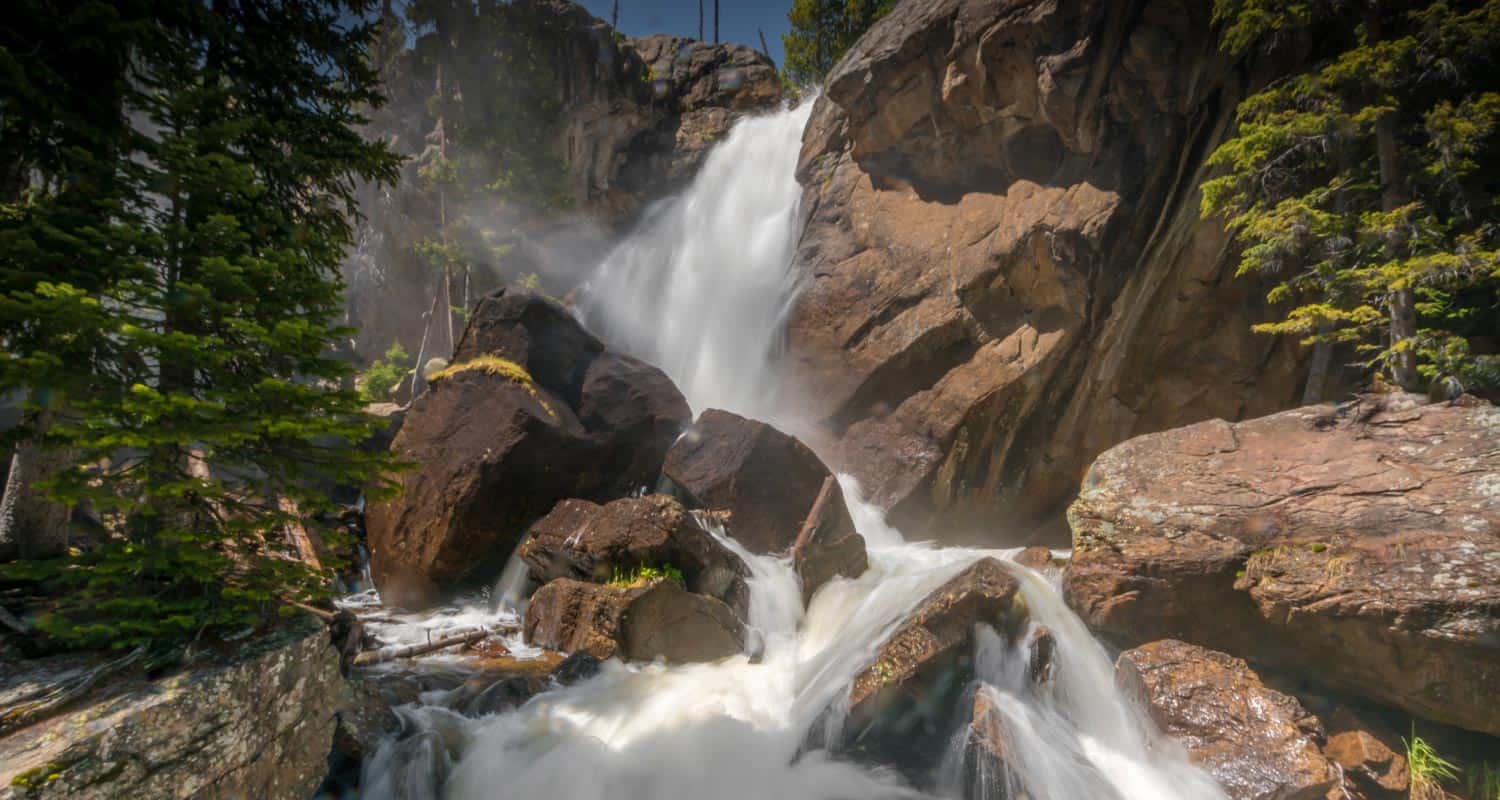
Distance: 8 Miles | Difficulty: Difficult | Elevation Gain: 1500'
If you're looking for a challenging hike in Rocky Mountain National Park that offers a ton of scenery, the hike up to Timberline Falls is perfect. You'll venture into Loch Vale and experience the vaulting grey-granite spires of the surrounding mountains. During snowmelt, the waterfall covers a long ridge as well has has a central spout that leaps from the cliffside. If you've hiked this far, think about pushing further to Sky Pond.
![]()
Distance: 9+ Miles | Difficulty: Difficult | Elevation Gain: 1650'
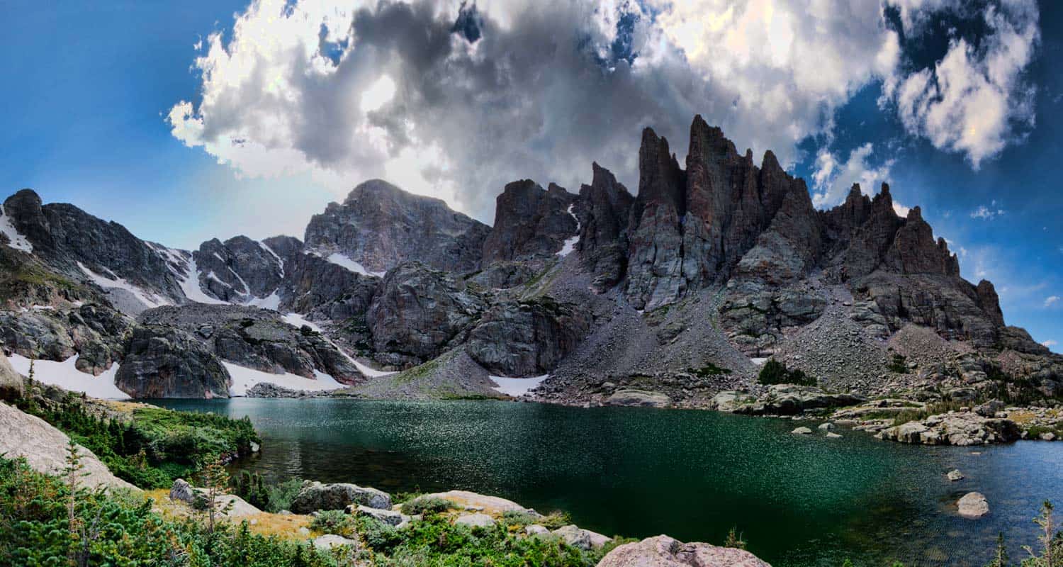
There are so many sights to take in on the way to Sky Pond, you should plan to take your time and plan on it taking your entire day. The peaks surrounding Sky Pond look like jagged sharks teeth, and the wildflowers on it's western flanks are resplendant in the mid-summer. Along the way, you'll pass Alberta Falls, The Loch, Timberline Falls, and Lake of Glass.
![]()
Download Our Hiking App
Explore More of Colorado with our New Dayhikes Near Denver Hiking App
Dayhikes Near Denver has partnered with TOTAGO to create a whole new way to find your hike and get on the trail.
- Explore hundreds of hiking trail profiles within 90-minutes of Denver.
- Download and save trail profiles for use when you are out of cell range.
- Search by map to find hikes nearest your location
- Filter hikes by distance, difficulty, dog-friendly, and more.
- Available on both iOS for iPhones and Android Devices
When you Download the Dayhikes Near Denver App, you can save a trail guide offline for FREE.
With a subscription, you can download and save an unlimited number of trails for just $2.99 a month (perfect if you’re just visiting) or $14.99 $9.99 a year. That’s a third of the price of other trail apps!
We’ll be updating the app by adding more trails, maps, and more search options.
Silver Dollar and Murray Lakes Trail
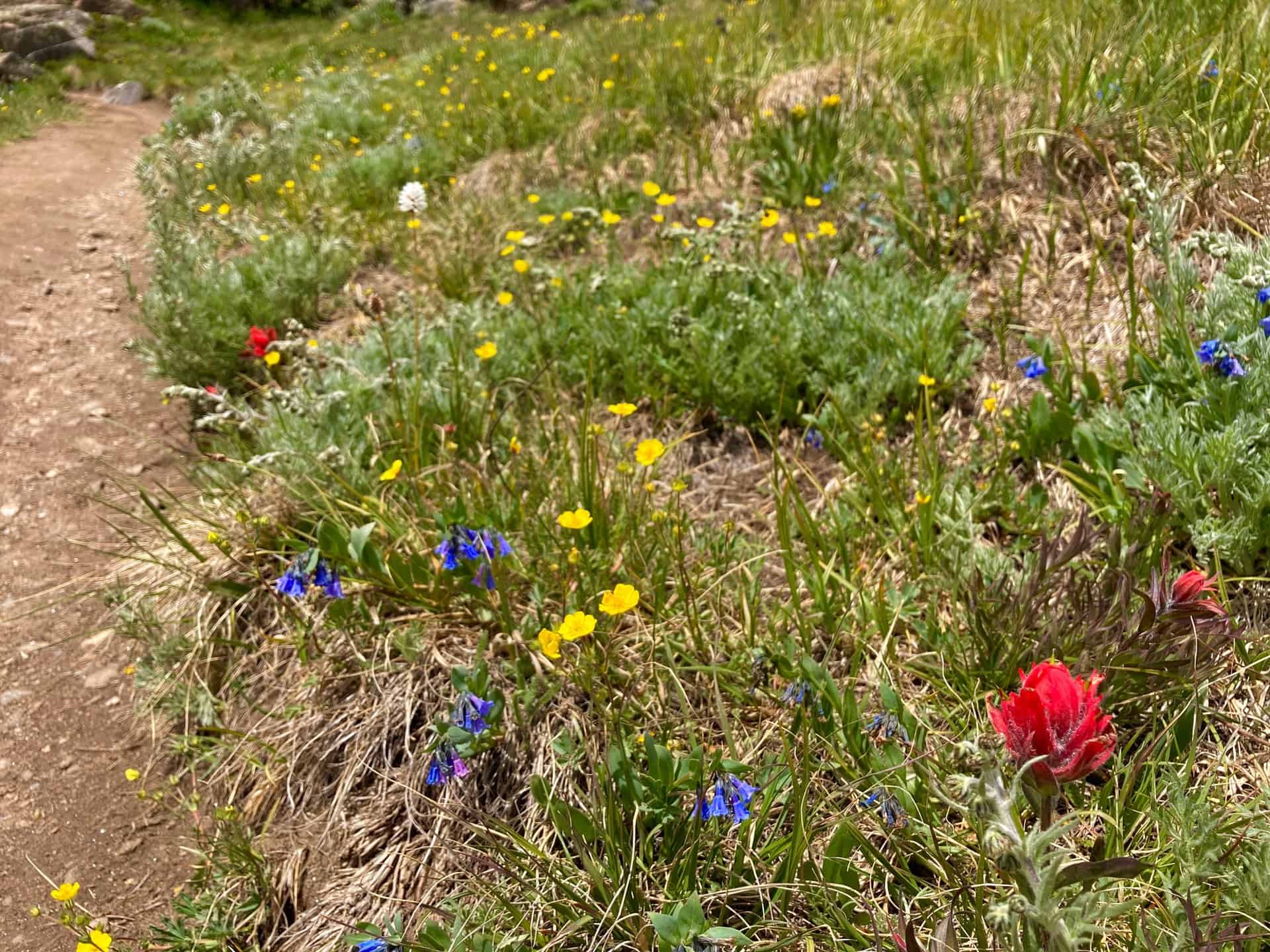
Silver Dollar Lake Trail graces hikers with not just one, but three lakes! This easy to moderate hike, approximately 3-4 miles, treks up lake by lake. Each successive one along the Silver Dollar Lake Trail perches above the previous, creating multiple platforms from which to view the valley, breathe in the beauty, and take pictures. Situated along the stunning Guanella Pass, the hike first skirts the edge of Naylor Lake, then proceeds onto the shore of Silver Dollar Lake, and finally to uppermost Murray Lake. Wildflowers punctuate the landscape all along the way as the trail exits the forest and walks the slope of the ridge through the basin.
Explore the full Silver Dollar and Murray Lakes Hike profile below for trail map, driving directions, and more tips and details to help you enjoy this adventure on Guanella Pass near Denver.
Trail Snapshot: Silver Dollar and Murray Lakes Trail
| Hike Distance | 3-4 miles Round Trip |
|---|---|
| Difficulty | Moderate |
| Duration | Approx 2-3hr |
| Trail Type | Out-and-Back |
| Starting Elevation | 11,200′ |
| Elevation Gain | Approx +1,000′ |
| Seasons | All Year |
| Dogs | Allowed On Leash |
| Hike Trail Map | Click for Trail Map of Silver Dollar and Murray Lakes Hike |
| Denver Drive Time | 1.5 hours |
| Driving Directions to Silver Dollar and Murray Lakes | Click for Google Map |
| Town Nearest Hike | Georgetown, Colorado |
| Beauty | Wildflowers, Guanella Pass, Evergreens, Lakes |
| Activities | Hiking, Fishing, Photography |
Parking & Trailhead Information for Silver Dollar and Murray Lakes Hike
From Denver, heading west on I-70, exit 228 for Georgetown, CO. Going left under the bridge, Georgetown's Visitor's Center appears immediately on the right. This is an excellent place to rest before or after a hike. Going straight through the traffic circle and turning right onto Rose Street, Guanella Pass begins at the end of the street, curving up and up! Approximately 8.5 miles up the route sits the Guanella Pass Campground on the west. Just past this the parking for Silver Dollar Lake Trail appears on the right-hand side. Parking lots on both sides of the pass accommodate the crowds; passengers vehicles should park here. Skilled drivers in high-clearance and 4WD vehicles may carefully navigate an additional 0.7 mile stretch up Naylor Lake Road to the official trailhead.
Available parking fills fast. If no spots remain, eager hikers can consider driving three miles further up the pass to the Square Top Lakes Trail, where a larger parking area may still have openings. Square Top Lakes Trail also has a restroom, whereas Silver Dollar Lake Trail does not.
Silver Dollar Lake Trail is quite popular in the summer, but remains open all year for an accessible but challenging (when the snowshoeing adventure) in the winter.
The Hike: Silver Dollar and Murray Lakes Trail
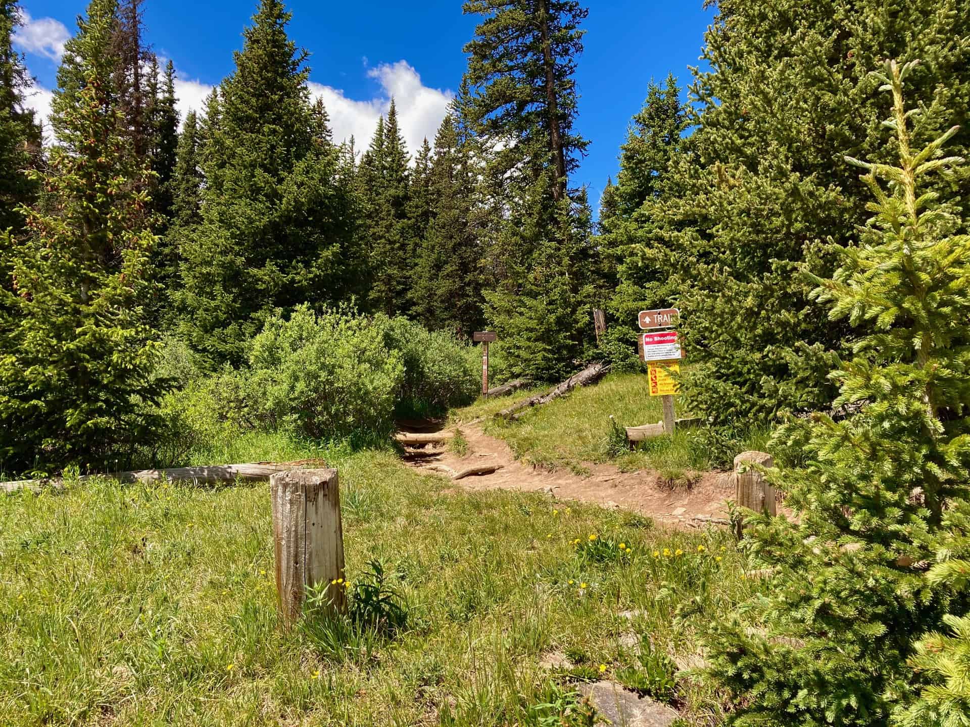
Beginning at the official trailhead, the hike moves in and out of the shade of thick forest. After a steady, strolling ascent, at the 1/2-mile mark, the trail swings left. A "TRAIL" sign directs hikers toward the ridge used to climb up the valley to Silver Dollar Lake. Near this spot, tracked on the GPS map, a short diversion provides a glimpse of Naylor Lake. Please note that private property surrounds the eastern rim of the lake at the end of Naylor Lake Road.
The trail climbs the basin ridge up and out of the forest, offering the first clear view of Naylor Lake down and to the right. Silver Dollar Lake is seated approximately one mile further up the trail, which rides the slope of the basin. Approaching the lake and then curving right, the trail crosses over the mouth of Silver Dollar Lake. Depending on water levels, this crossing can be up 10-15 feet wide. While the water is not deep, wise hikers look for dry, flat, small boulders to navigate across and avoid soggy socks! The trail ascends with moderate steepness up to Murray Lake, less than 1/2-mile away. After meandering about the top of the basin around Murray Lake, the return trail simply follows the route in reverse. As it descends, you will notice even more novel views on each lake, and benefit from the shade of the forest as it brings you back to the trailhead.
Tips & Resources for Hiking Silver Dollar and Murray Lakes Trail
- TIP: The parking situation at Silver Dollar Lake Trail often ebbs and flows since the trail does not require as much time as many others. If you get skunked on parking, consider returning in a couple hours when a wave of hikers has come and gone. Georgetown, CO, has a wonderful trail circumnavigating the local lake, as well as a Wildlife Viewing Station for sighting big horns sheep.
- Trail Map: Silver Dollar and Murray Lakes Hike
- Packing List: Always pack the 10 Essentials. Download our Hiking Guide to get the list and dayhiking packing checklist.
- Colorado Road Conditions: Colorado Road Conditions
- After the Hike: Grab some post-hike nourishment at Cabin Creek Brewing.
Weather
Map & Driving Directions
Click for Driving Directions
Square Top Lakes Trail on Guanella Pass
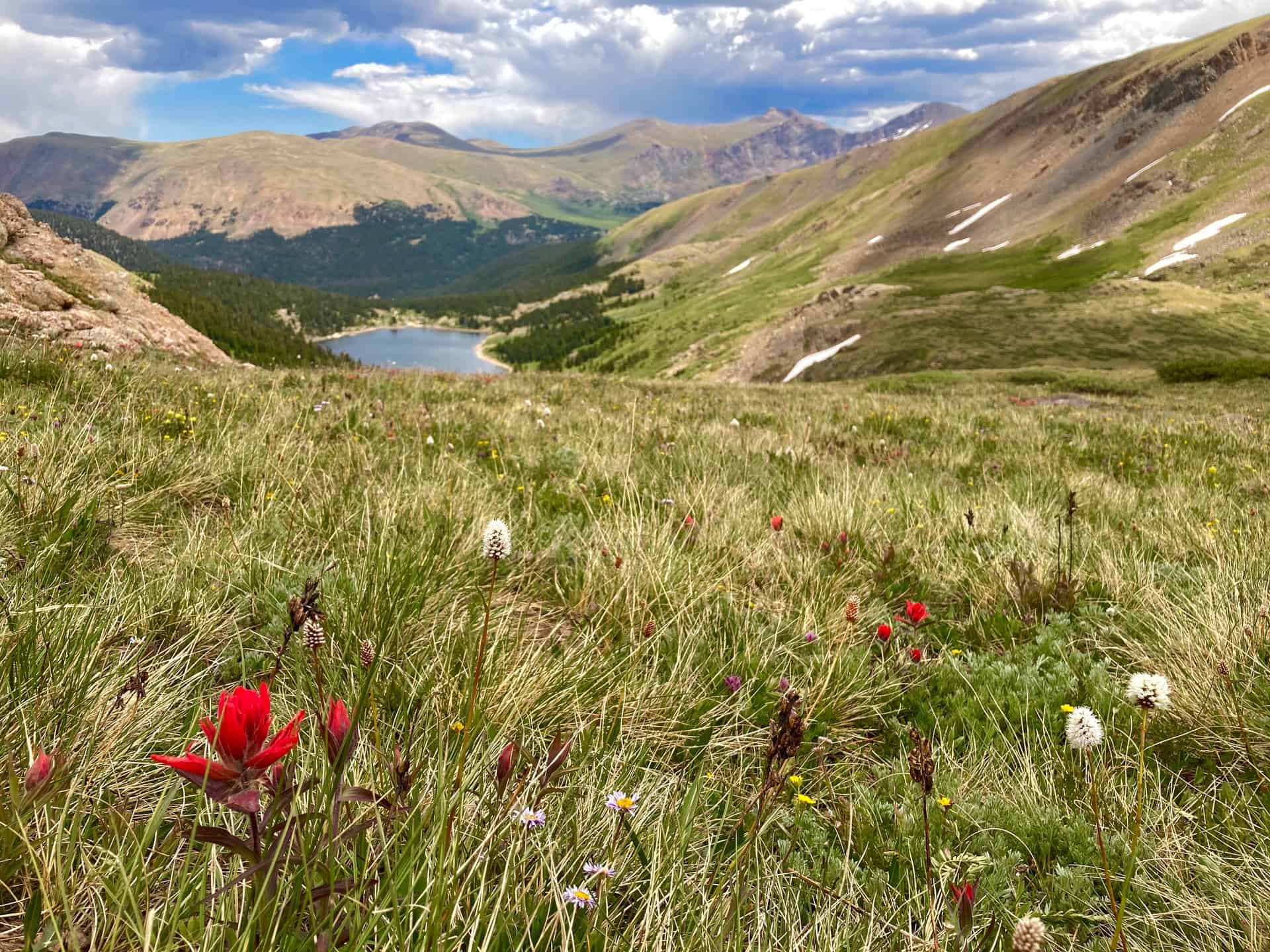
The Square Top Lakes Trail, one of several cresting Guanella Pass above Georgetown, CO, gives hikers a chance to behold sweeping valley vistas and the imposing profile of Mount Bierstadt. Simply driving to the trailhead along Guanella Pass can soothe a weary soul and take its breathe away at the same time! Once on the trail, the expansive pass greets hikers young and old of all skill levels.
Explore the full Square Top Lakes Hike profile below for trail map, driving directions, and more tips and details to help you enjoy this adventure on Guanella Pass near Denver.
Trail Snapshot: Square Top Lakes Trail
| Hike Distance | 4.5 miles Round Trip |
|---|---|
| Difficulty | Easy to Moderate |
| Duration | Approx 2-3hr |
| Trail Type | Out-and-Back |
| Starting Elevation | 11,600′ |
| Elevation Gain | Approx +700′ |
| Seasons | Summer |
| Dogs | Allowed On Leash |
| Hike Trail Map | Click for Trail Map of Square Top Lakes Hike |
| Denver Drive Time | 1.5 hours |
| Driving Directions to Square Top Lakes | Click for Google Map |
| Town Nearest Hike | Georgetown, Colorado |
| Beauty | Wildflowers, 14er, Lakes, Valleys, Guanella Pass, Aspens |
| Activities | Hiking, Fishing |
Parking & Trailhead Information for Square Top Lakes Hike
From Denver, heading west on I-70, exit 228 for Georgetown, CO. Going left under the bridge, Georgetown's Visitor's Center appears immediately on the right. This is an excellent place to rest before or after a hike. Going straight through the traffic circle and turning right onto Rose Street, Guanella Pass begins at the end of the street, curving up and up! Square Top Lakes Trail, easily accessed directly from the pass in the summer (when the pass opens) means that crowds often swell on weekends. Parking is free, but can present a challenge by mid-morning, especially near the Mount Bierstadt trailhead. The Square Top Lakes parking sits on the west side of the pass. Restrooms are available at the trailhead at the far end of the parking lot.
The Hike: Square Top Lakes Trail
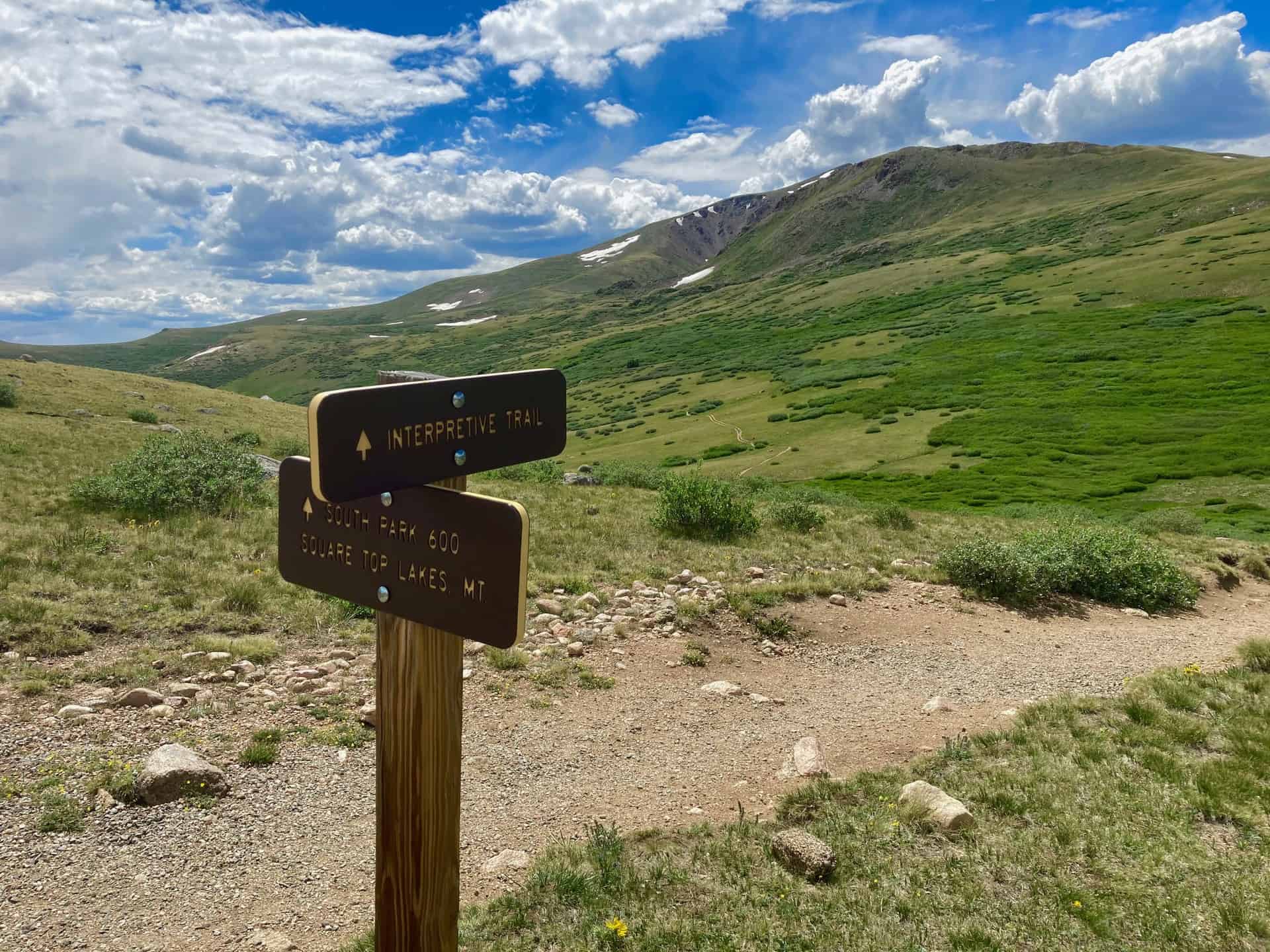
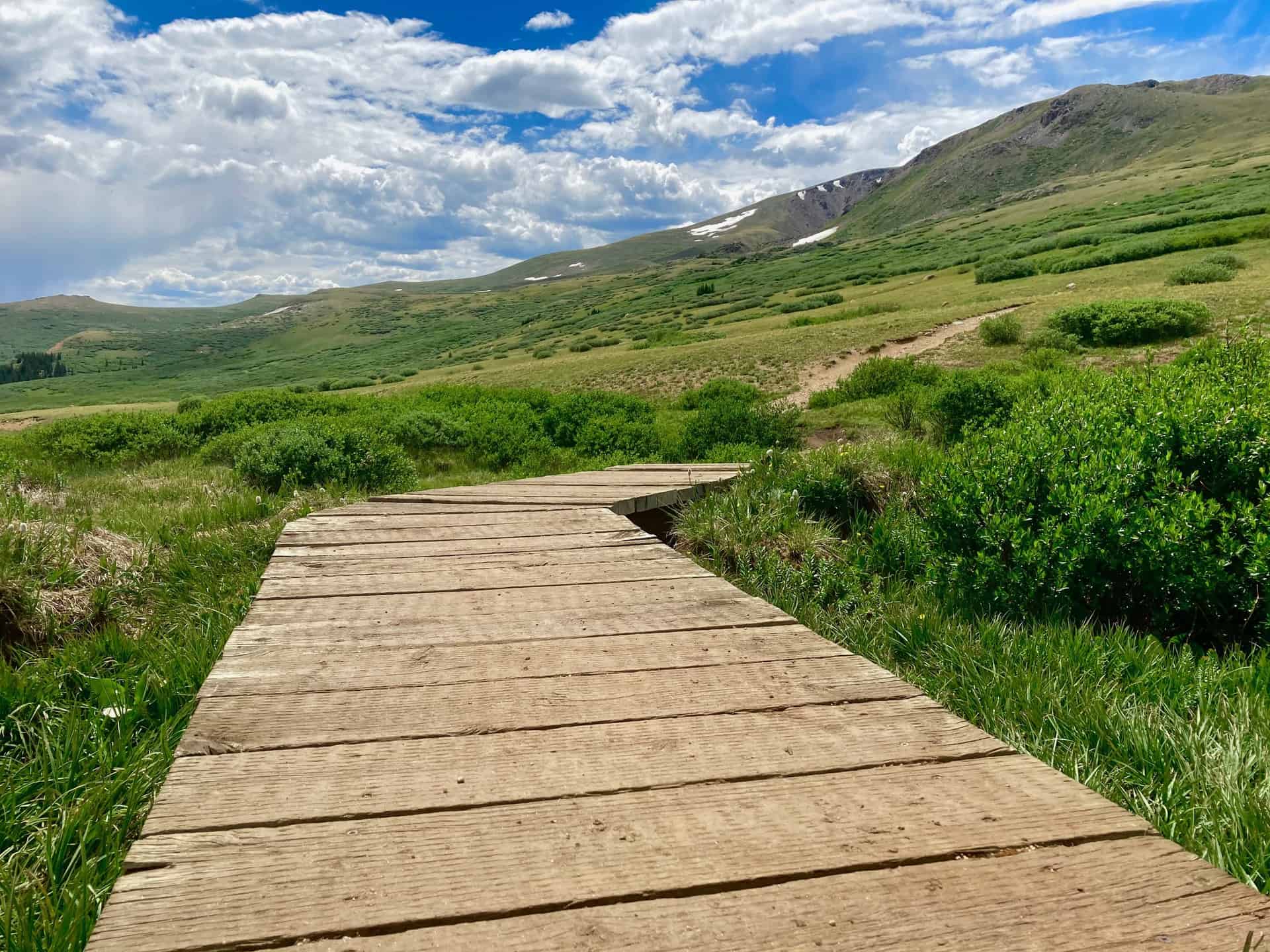
Beginning near the restrooms, the trail immediately jaunts left to reach a junction between the Interpretive Trial and the hiking trail. Turning right and heading down the steps into the valley, hikers encounter the signature Guanella Pass landscape...willows and mud. Thankfully, several years ago, boardwalks were installed to assist in traversing the low-lying areas. While more willows await hikers ahead on the Square Top Lakes trail, a clear pathway enables simple navigation. Still, some may prefer long pants to protect legs from scrapes.
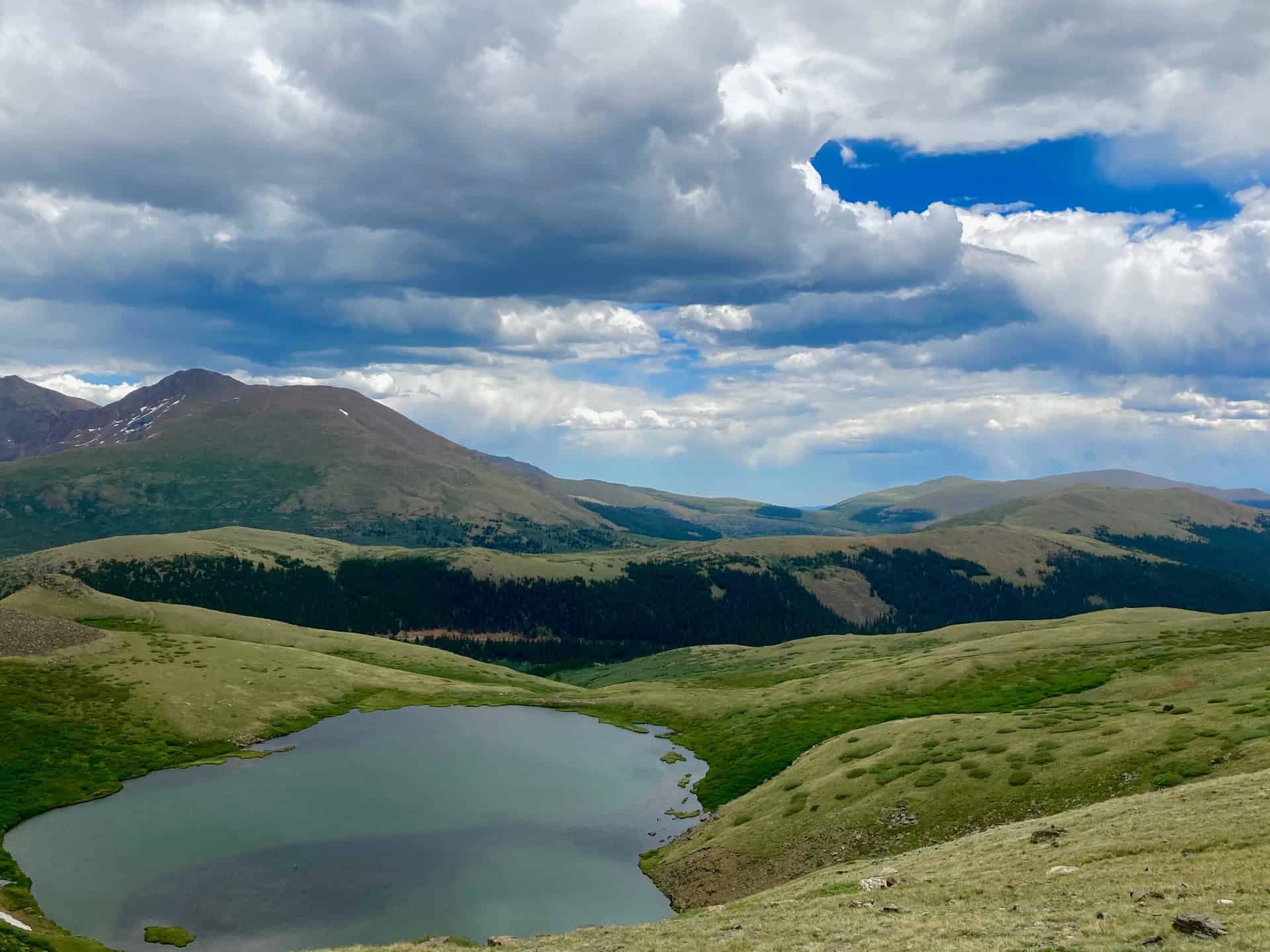
Soon after, as the trail commences a steady ascent, the sloping ridge provides a view onto Duck Lake to the south. It disappears as quickly as it appears. At approximately 1.5 miles the trail rises over a small ridge. The wind often flows from the valley up through this small dip, and weather can change quickly atop the pass in general, so wise hikers keep an eye on the sky. Barely 1/4-mile later the trail meets, but skirts to the left of, the lower lake. A few paces beyond the lower lake the trail intersects with South Park Trail 600.
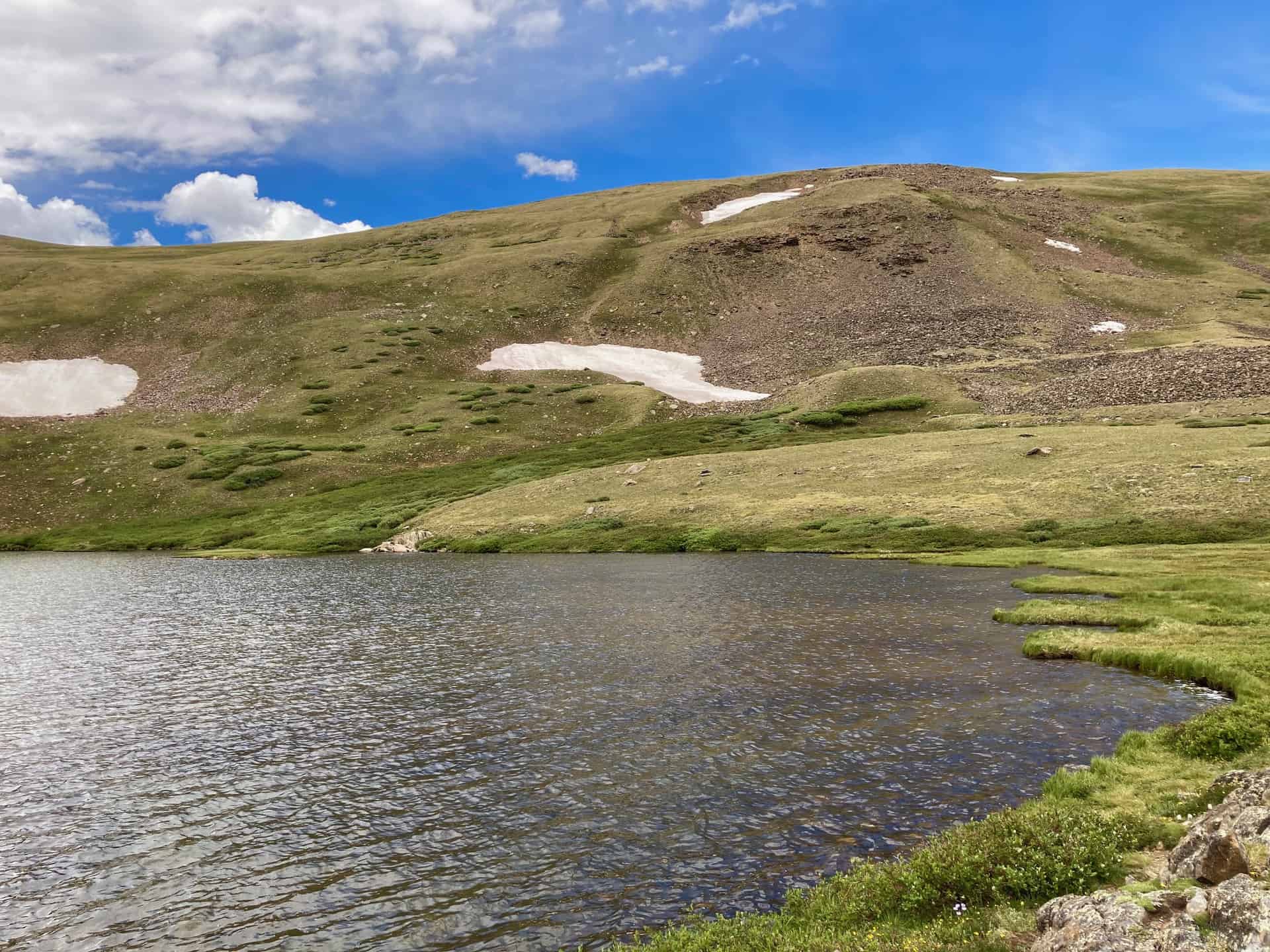
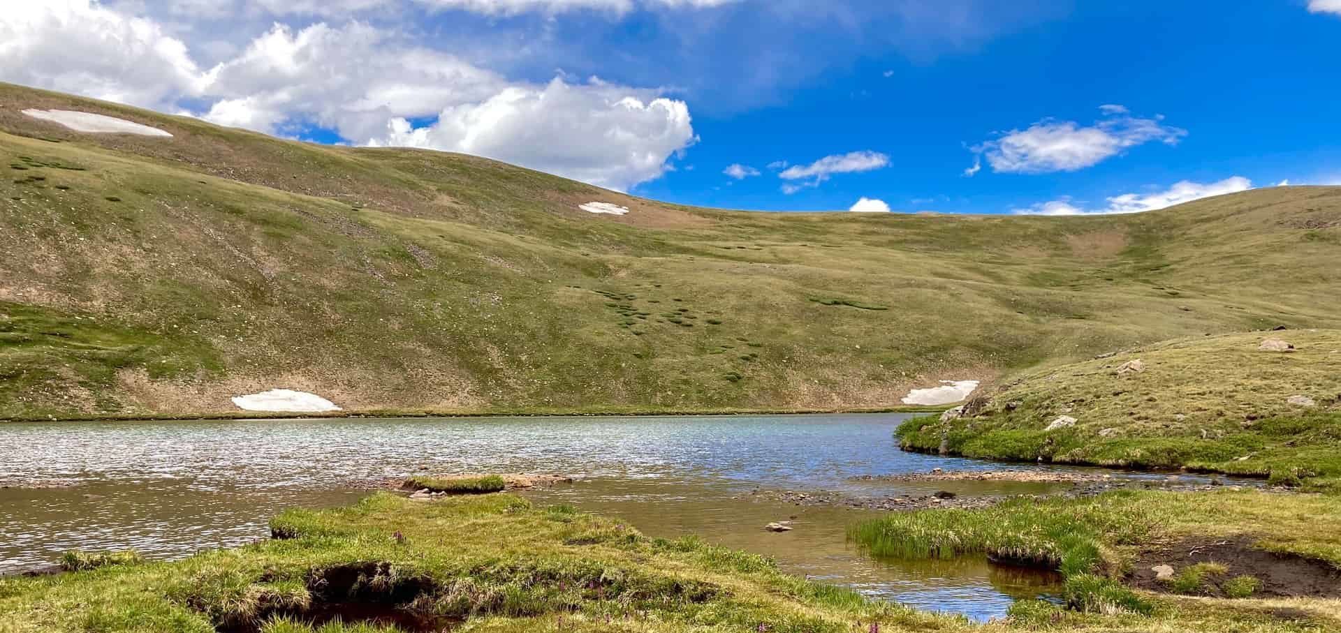
Staying right, the trail presents presents the upper Square Top Lake via a half-mile ascent. Informal trails spread out around the lake. The eastern ridge of the lake puts hikers on seemingly eye-level with Mount Bierstadt, a local favorite 14er. The return hike simply reverses the route, following the trail back down and out of the valley.
Tips & Resources for Hiking Square Top Lakes Trail
- TIP: The Square Top Lakes Trail completely lacks shade. Consider hiking early to mid-morning. If hiking later in the day, pay attention to the weather forecast--it changes quickly on Guanella Pass.
- Trail Map: Square Top Lakes Hike
- Packing List: Always pack the 10 Essentials. Download our Hiking Guide to get the list and dayhiking packing checklist.
- Colorado Road Conditions: Colorado Road Conditions
- After the Hike: While time may require a direct return trip to Denver, if time permits, many enjoy continuing on over Guanella Pass, following it down to Grant, CO. Turning left onto Highway 285 toward Denver, a late breakfast or early lunch awaits hungry hikers at The Shaggy Sheep. Further up the road, looking to the left, a 55-ft tall statue of Jesus watches over the historic town of Santa Maria, CO.
Weather
Map & Driving Directions
Click for Driving Directions

Open and Closed Hiking Trails
Here you'll find a list of the nearly 200 hikes on Dayhikes Near Denver with information on what trails and parks are closed and how to get updated information about when they will open. Those without closure information were considered open as of Saturday, May 23rd 2020. However, any of these parks and trails can be closed at any moment by parks departments and local governments. Because of this, verify the trail’s status with the individual park or forest service ranger district before traveling to the trailhead. Additionally, note and follow directions at the trailhead regarding parking, hiking, and distancing.
Currently, Colorado is under a Safer at Home Order until further notice. "Local and personal outdoor recreation" is recognized as a "necessary activity" in the order. See section H in the linked document for the current State recreation protocols, giving attention to the 10-mile rule for outdoor recreation. In short, hike local until guidelines are revisited on May 27th. The Executive Order from the State of Colorado is tentatively set to expire on May 27th. It can be amended or extended at any time, so check for updates at the Colorado Executive Orders site.
It's important to note that while many trailheads are open, some restrooms and most visitor centers are closed. The list below is not exhaustive. It's limited to the 190+ hiking trail profiles posted on Dayhikes Near Denver.

COVID-19 Denver Area Trail Closures
Because our Colorado trails are served by a variety of agencies, Dayhikes Near Denver is not able to update closure information for every trail. The best way to check these closures is directly on the websites of those agencies (listed below). Please adhere to social distancing requirements, local quarantine requirements, and the limitations put in place by the specific agencies listed below. Our collective goal is to protect the most vulnerable and pursue the common good of our communities.
- Denver Mountain Parks: https://www.denvergov.org/content/denvergov/en/denver-parks-and-recreation/parks/mountain-parks.html
- Waterton Canyon (managed by Denver Water): https://www.denverwater.org/news/waterton-canyon-access-closed-starting-march-18
- City of Denver Parks and Trails: https://www.denvergov.org/content/denvergov/en/denver-parks-and-recreation/recreation-centers-pools/recreation-centers.html
- Boulder Parks Closures site: https://bouldercolorado.gov/osmp/temporary-closures
- Jefferson County Parks: https://www.jeffco.us/964/Parks
- Colorado State Parks: https://cpw.state.co.us/aboutus/Pages/COVID-19-Response.aspx?utm_source=CPW-Web&utm_medium=Slider1&utm_campaign=2020_COVID-19_Coronavirus_Info
- Hanging Lake in Glenwood Springs Area: https://visitglenwood.com/hanginglake/
- National Parks in Colorado (RMNP): https://www.nps.gov/state/co/index.htm
- US Forest Service Trailheads and Campgrounds: https://www.fs.usda.gov/detail/arp/alerts-notices/?cid=FSEPRD719034
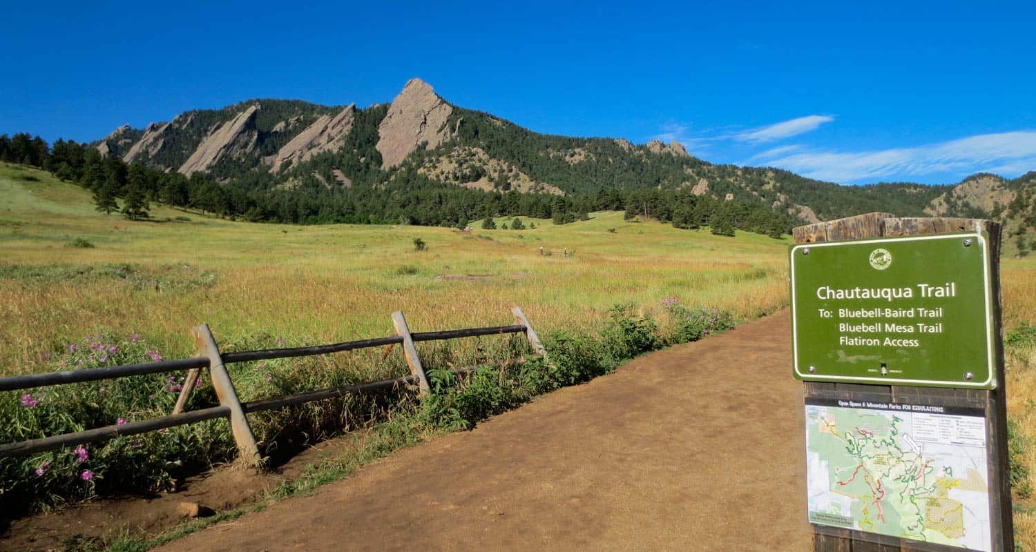
10 Best Hikes Near Boulder Colorado
Where are the best hiking trails close to Boulder? We've been hiking in and around Boulder, Colorado for years, profiling over 30 different trails. So, we decided to share here our favorite hikes near Boulder. These ten hikes will give you a variety of landscapes and experiences. You'll find dog friendly hikes, hikes to summits, and waterfalls. And we'll update it when a new hike strikes our fancy and pushes one of the others off the list. Explore this page for an overview. But there is more, as each hike has a detailed page with trail maps, driving directions, and photos.
-
First and Second Flatirons Hike
-
Bear Peak Summit Hike
-
Eldorado Canyon State Park Trails
-
Boulder Falls
-
Mesa Trail: South Segment Hike
-
Green Mountain Summit Hike
-
Mt. Sanitas Hike
-
Royal Arch Hike in Chautauqua Park
-
Lost Lake Hike in Indian Peaks Wilderness
-
South Boulder Peak Summit Hike
Distance: 2.6 Miles
Difficulty: Moderate
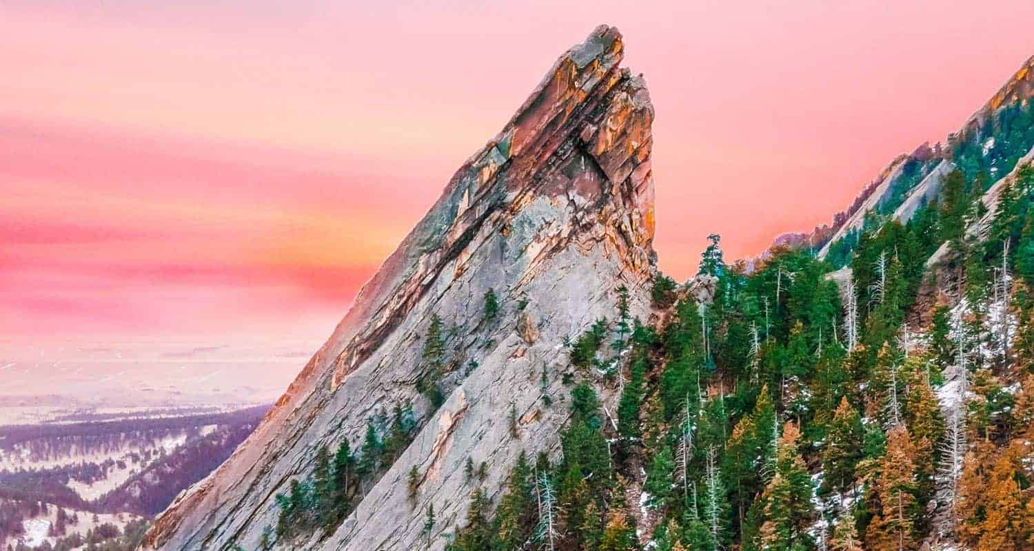
Let's start with my favorite and probably the most classic hike in Boulder, the trail that leads between the 1st and 2nd Flatiorns in Chatauqua Park. The trail takes you across the open meadows of the park, then ascends up the long ridge of the Second Flatiron before passing through the gateway between the two stunning rock spires. The trail curves around to the back side of the First Flatiron where you can scramble up to a natural alcove and take in views of the snowcapped Rocky Mountains in the west. The photo at the top of this page with the pink sky is of the 2nd Flatiron. Explore our full trail profile for trail map, driving directions and more photos of the hike.
![]()
Distance: 7.4 Miles Round Trip or 8.4 Mile Loop
Difficulty: Difficult
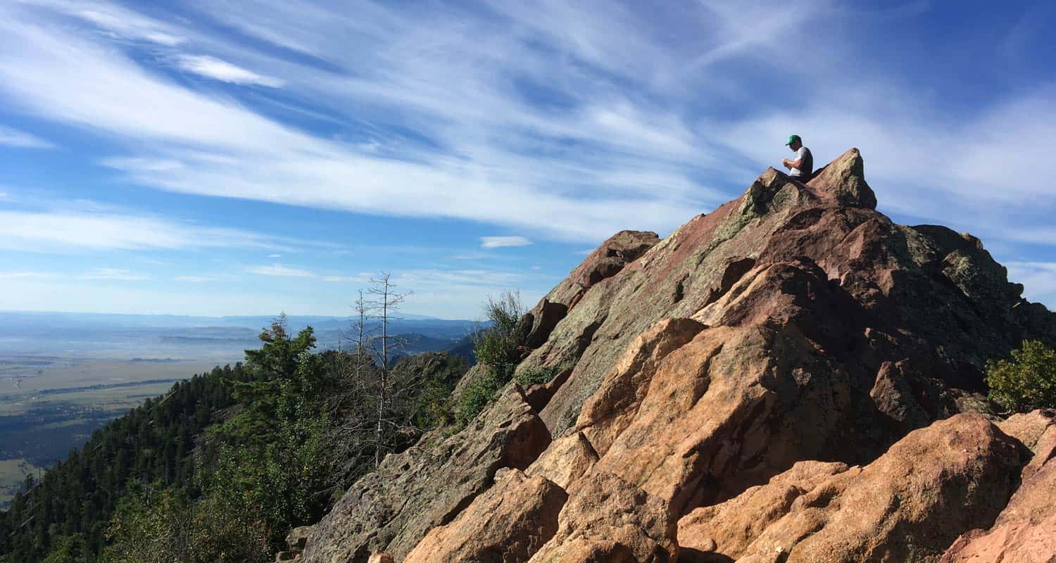
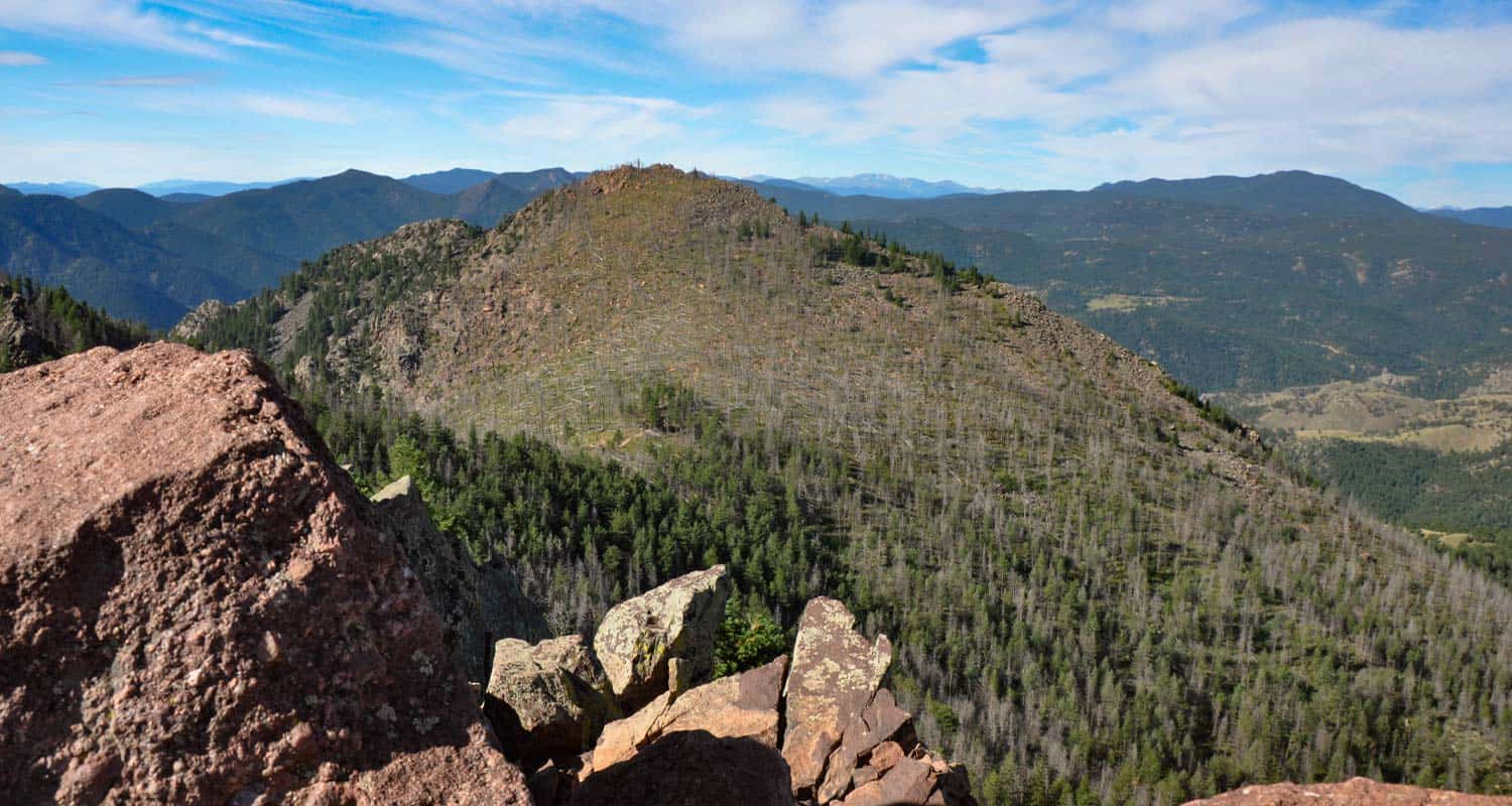
Bear Peak is located along the Flatirons range just south of Boulder, Colorado. The South Mesa Trailhead is one of our favorites because of the number and variety of hikes that start here. The hike up to Bear Peak starts out on a gradual ascent up the mesa, then follows the route of Fern Canyon until it breaks out into an open saddle between South Boulder and Bear Peaks. The last bit to the summit is a scramble along a real knife edge to its pointed peak.
![]()
Distance: 0.5 to 7 Miles
Difficulty: Easy to Moderate
Eldorado Canyon is like entering another world. The high and narrow canyon walls shut out the distant sounds of the city and South Boulder Creek tumbles over cascades through the middle of the park. It's a rock climbing mecca and quite popular, so you'll need to go early and either pay the daypass fee or have a Colorado State Parks Pass to enter. Hikes in Eldorado Canyon State Park range from easy short jaunts along the creek or more demanding hikes up to the top.
![]()
Distance: 100 Yards
Difficulty: Easy
Just a short drive out of Boulder, you'll find one of the best waterfalls along the Front Range of Colorado. Boulder Falls requires a walk, not a hike, to take in its 70 foot plunge over a cliff face in Boulder Creek Canyon. Parking is roadside on a curving road, so be alert along the road. Climbing is prohibited inthe area around Boulder falls, so stay the trail and take in the beauty of this waterfall.
![]()
Distance: 8.4
Difficulty: Easy to Moderate
The southern segment of the Mesa Trail is my favorite easy hike near Boulder. The trail starts by crossing South Boulder creek then making its way through meadow grasses onto the expansive mesa, giving you views of the entire Flatirons and down into Eldorado Canyon. The ecosystem here where the foothills meet the prairie is unique, and you'll take this in as the land makes a gentle roller-coaster, dipping into canyon draws and back into wooded areas of ponderosa pine.
![]()
Distance: 5.5
Difficulty: Difficult
Like the 1st and 2nd Flatirons, Green Mountain is situated on the north end of Chautauqua Park, right in the heart of Boulder. If you are looking for a challenging hike that takes you to a summit with 360 degree views, then Green Mountain is a great workout to great panoramas.
![]()
Distance: 2 and 3.1 Mile Loop Options
Difficulty: Easy to Moderate
Liesurely. That's the word that comes to mind when I think about hiking Mt. Sanitas. Well, that's true of the trail near the bottom of the mountain. The climb up is more challenging. Situated right in the heart of Boulder, the trails at the base of Mt. Sanitas may be the best place to walk your dog in town because of the broad trails, great views, and places for your pup to get a sip of water. Take the broad ridge trail up to the summit if you want to shift into workout mode and take in views of the city.
![]()
Distance: 3.5 Mile
Difficulty: Moderate
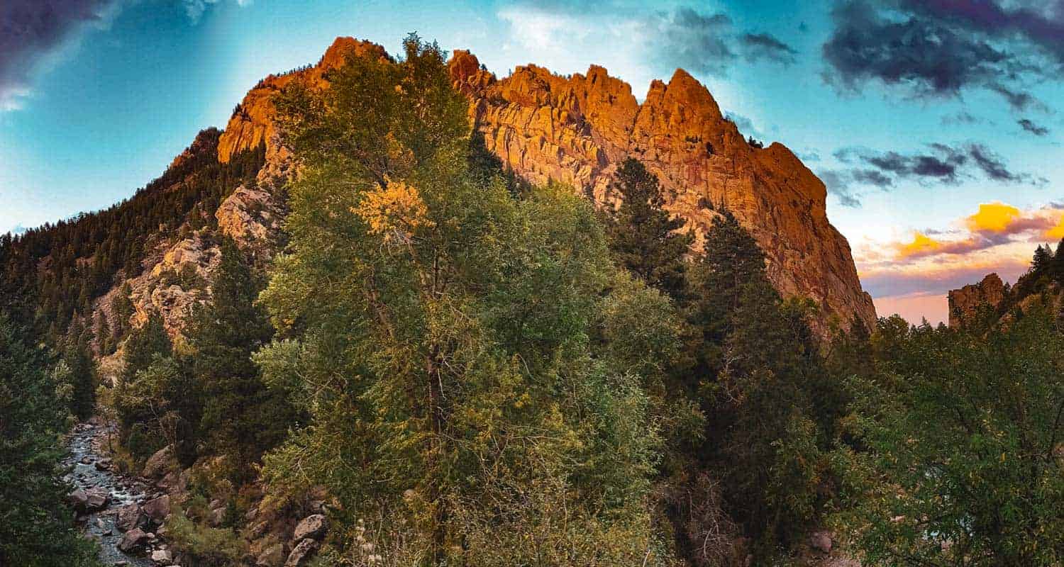
The Royal Arch is a pink granite formation tucked back into the heart of the Flatirons range. This 3.5 mile, out-and-back hike. The hike climbs over 1000 feet in a short distance, as the trail makes its way up through narrow Bluebell canyon. Because of the many steps and because it's a popular hike, we recommend not hiking to Royal Arch with your pup. But because of the uphill and many steps, this adventure makes for a great leg workout.
![]()
Distance: 4 Mile
Difficulty: Moderate
Indian Peaks is so breathtaking, that we had to include at least one hike on the list from the closest wilderness area to Boulder. The Lost Lake hike is a moderate, out-and-back trek from the Hessie Trailhead, located about 45 minutes west of Boulder. Because the trailhead has limited parking and is a popular hiking and backpacking starting point, there is a shuttle that runs during the Summer months that you can pick up in the mountain town of Nederland. We love this hike because it gets you back in the heart of the mountains and offers landscapes similar to those in Rocky Mountain National Park. Check out the full trail profile for more details on the hike and the seasonal shuttle service.
![]()
Distance: 7.4 Mile Out-and-Back or 8.7 Mile Loop Hikes
Difficulty: Difficult
We'll finish up this list of best hikes near Boulder with a classic, South Boulder Peak. Like the Bear Peak an Mesa Trail hikes, the 3.7 mile ascent up to the summit begins at the South Mesa Trailhead (see trail profile for parking fee details). Enjoy late-summer raspberries along the trail, and take in 360 degree views of the surrounding Colorado countryside.
![]()
Dayhikes Near Denver has been serving the outdoor community of the Colorado Front Range since 2010. In 2020, we have launched a line of apparel designed by Colorado-based artists featuring Colorado peaks and landscapes. Check out our store for new designs and to wear clothing that shows off your love for our beautiful state.

10 Tips for Hiking Muddy Trails
During the Spring and Winter months the trails near Denver get pretty muddy. How do you hike when the trails are muddy? We've put together a list of ten tips to help you take care of both the trails and your boots during this messy season.
1. Prioritize Damage Control:
Hiking muddy trails requires the mental shift from "I don't want to get muddy" to "I want to to preserve this trail." Most of the damage to trails and the surrounding environment happens when the trails are wet and muddy. This mental shift is our most important tip. For example, Matthew-Winters Park near Red Rocks experiences seasonal closurs because of the trail damage caused during these muddy days. So, if it's a high traffic trail with a lot of mud, consider choosing a different trail where you won't contribute to the damage. More on finding those trails below.
2. Stay the Trail:
This means choosing to get muddy. Hike right through the middle of those muddy segments. We all want to take those inviting sidetrails, but in doing that we create some serious erosion, that can lead to severe damage. You know those trails that cut across switchbacks? Those are the worst because they go through steep areas and can contribute to some serious trail damage.
3. Hit the Trail Early:
Because temperatures are colder in the morning, hiking trails are more firm and less muddy. It's a great way to reduce both damage to the trail and mud on your boots and pants.
4. Hike on Snow:
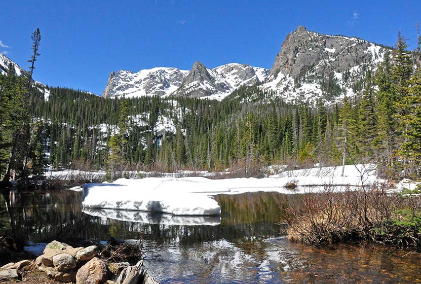
During muddy seasons, go snowshoeing or cross-country skiing up in the mountains. I love hiking the east side of Rocky Mountain National Park during the winter and spring when the snow covers the trail. A few recommended hikes: Emerald Lake - Fern Falls (for the more adventurous) - Calyspo Cascades in the Wild Basin - Alberta Falls - 4 Lakes and Waterfall Loop (for the more adventurous).
5. Hike on Paved Trails:
There are not a ton of these, but there are some. The main trail of Garden of the God's is paved, and many of our local Denver Bike paths. Clear Creek Trail in Downtown Golden is a family favorite, as well as the boardwalk along Evergreen Lake (short, but beautiful). The initial segment of the Fountain Valley Trail in Roxborough State Park is breathtaking.
6. Hike South-Facing Trails:
The sun shines on these segments and dries the trail faster. It takes some thinking and reviewing the trail maps. We provide links to trail maps on almost all of the hikes on Dayhikes Near Denver.
7. Trekking Poles:
Trekking Poles are probably my favorite piece of gear because they take so much impact and weight off of my knees. They also will help you to hike over the muddy puddles along the trail and you can use them to probe the depth of water-logged segements.
8. Wear Gaiters:
Gaiters are a great way to preserve your hiking pants and to keep mud away from the upper laces of your boots. I usually only wear gaiters if I'm on a multi-day backpacking trip. Check out REI's options for Gaiters.
9. Bring Grocery Bags for Your Muddy Boots:
When you get back to the car, you don't want to get the mud all over the upholstery. Pop your boots into those plastic bags, cinch them up, and you'll be able to clean them when you get home without also having to clean your car
10. Cleaning Your Boots:
Here's a simple step-by-step process for cleaning muddy hiking boots
- Rinse with water (don't scrub yet) to get the most of the mud you can. Don't immerse.
- Lightly scrub with a nylon brush or old toothbrush. Take out the laces and clean them seperately. This will allow you to get to the rest of the boot under the laces.
- If the boots are wet inside, then stuff them with an old t-shirt, paper towels, or newspaper.
- Let them dry. Don't accelerate this by putting them by a heat source. For instance, I dried out a pair of boots by the fire on an early backpacking trip and they shrunk by 1/2 and inch. Leather gets damaged near heat, too, so let them slow dry.
- Waterfproof. If your boots are Gore-Tex, don't waterproof them or you'll clog the breathable aspect of the boots. If they are old and the membrane is worn out, then you can waterproof them like any other boot. Check out REI's boot care options for waterproofing products.
Thanks goes out to Kevin Doncaster for the awesome muddy boot photo.

Holly Mandarich Colorado Adventure Photographer
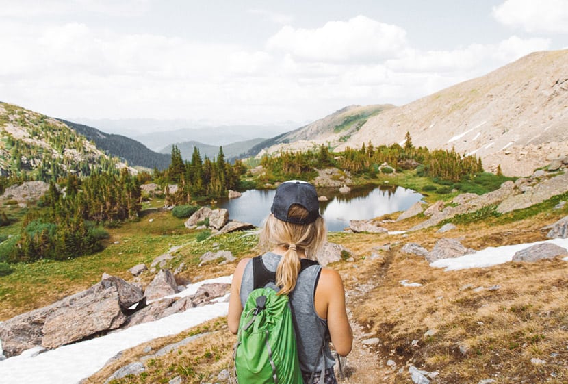
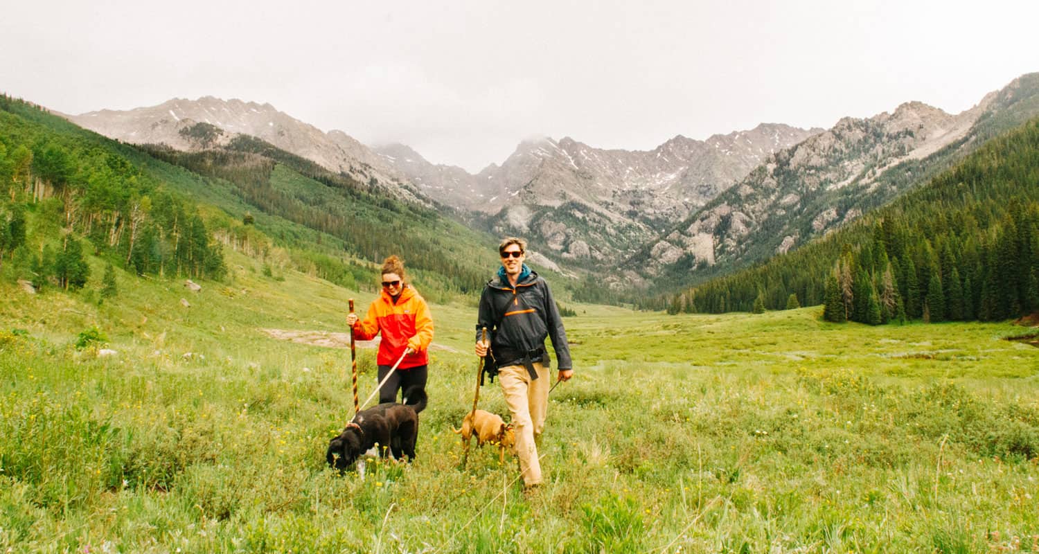
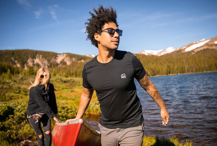
Holly Mandarich grew up along the shores of Lake Michigan exploring wild places like the Sleeping Bear Sand Dunes. Those places inspired a love of storytelling. Early on, Holly began documenting her trips, finding new perspectives on life through the lens of her camera. In college, she honed her skills of photo journalism. When she moved to Colorado, Holly has brought together her love for storytelling and the outdoors, capturing the beauty of our State and the lives of active people enjoying its landscapes.
During our recent redesign of Dayhikes Near Denver, we found Holly’s work and decided it was the perfect imagery to communicate what we want for our visitors. Her photographs inspire us to break free from the routine and to get outside and enjoy the outdoors. What follows is an interview with Holly so you can get to know of the storyteller behind her work and the images that may have already beckoned you back out and onto the trail.
What have you discovered by looking at life through the lens of a camera?
Holly: I have discovered that everything can have emotion, even inanimate objects, light helps determine these factors. By looking through the lens and challenging myself to see with different perspectives, it gives me the power to communicate what I feel in a situation, rather than simply what is just in front of me. This allows me to tell a story in a whole new way.
When people are viewing your photography, how do you want your work to make them feel?
Holly: I want people to see my photography, and see themselves in the experience, so much outdoor and lifestyle photography to me feels unattainable, with perfect models, and perfect scenes, I want people to feel like the outdoors is accessible to them, and that those picture perfect moments – are for everyone. When I shoot it’s my intention to have my photographs feel authentic.
"...those picture perfect moments - are for everyone."
What do your favorite clients have in common?
Holly: Everyone I work with has a similar sentiment when it comes to how they approach their business and their life, they are passionate, act with purpose, and are focused on enjoying the great outdoors with good people!
Let's talk Colorado: What story do you want to tell about our beautiful State?
Holly: For Colorado specifically, I want to tell the story of its beauty and community. Colorado is a place for people to reconnect with themselves and reconnect with the people they love most. By experiencing the great outdoors alongside your best friend, you’re sure to have an impactful experience that goes beyond anything else, considering you’re in the land of giant mountains, and endless sunshine!
"I want people to see my photography and see themselves in the experience...to feel like the outdoors is accessible to them..."
Where's your favorite place to hike in Colorado?
Holly: The Holy Cross Wilderness! It holds a type of magic and silence that I have never been able to find anywhere else. Being above tree-line in that wilderness area will touch your soul, especially in late July when the wildflowers are in full bloom.
If someone from out-of-State, asked you, "What do you love about living in Colorado?"...
Holly: The sunshine, the mountains, and the remote silence you can find! There is magic here. Colorado can be filled with humans, but if you know where to go, you can find those magical moments we all seek!
Holly is an adventure lifestyle photographer who works closely with outdoor brands, active brands, and tourism destinations to capture authentic adventure! She also offers adventure elopement photography packages!
You can see more of Holly’s work and get in contact with her here:
Her Website: http://hollymandarich.com
On Instagram: https://www.instagram.com/holly.mandarich

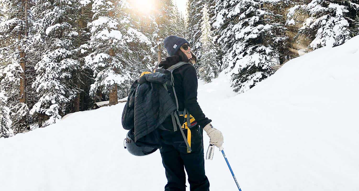
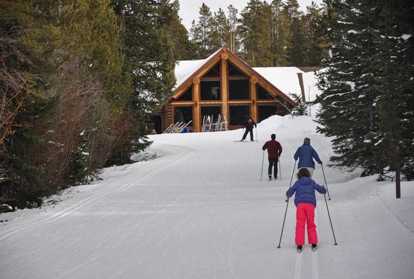
Learning to Cross Country Ski
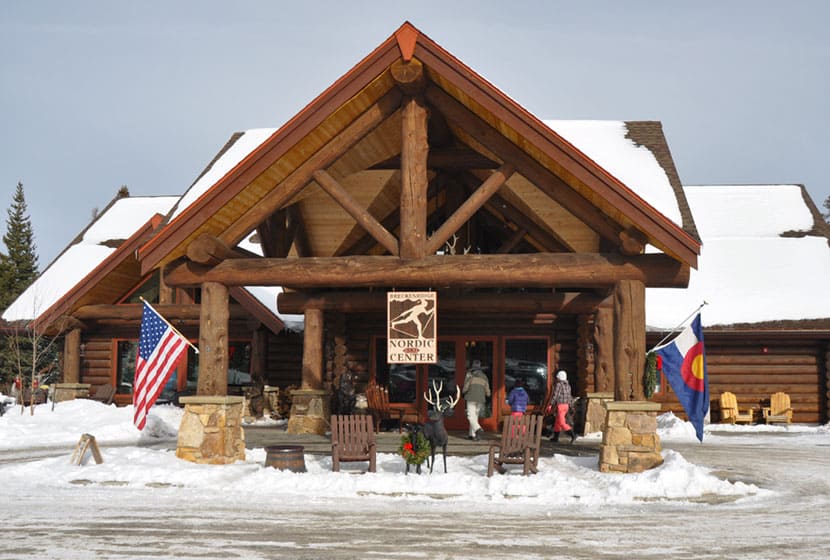
This winter our family wanted a new way to get out and enjoy the outdoors of Colorado. We’ve hiked many winter trails, but we’ve recently wondered what it would be like to enjoy snow-covered trails on cross country skis. But, how do you even get started–especially as a family? When I’m new to something, I find it’s wise to get a coach, an expert to help me start in the right direction. So, before buying a bunch of equipment, and perhaps creating bad habits, we decided to first take a lesson, test out some skis, and find out if we would enjoy it. We chose the Breckenridge Nordic Center for two reasons:
- First, from their website, I sensed they had a real family-friendly character.
- Second, the trails looked absolutely beautiful.
So, if you're wondering what it looks like to get started with cross country skiing, I think you'll learn what you need to know reading through our family's experience in getting started.
The Breckenridge Nordic Center
It’s pretty normal, when trying out a new sport, like cross country skiing, to feel uneasy and apprehensive, wondering if you’ll stick out as the person who obviously has no idea what he is doing. Instead, we felt welcomed into the living room of new-found friends. The staff was warm and helpful, helping us get fit into our skis and shoes. I had no idea there were different types of cross-country skis. We decided to keep it simple and to learn on classic skis, which are best suited for groomed traills on mostly level and gently sloping terrain.
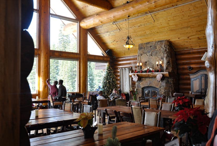
The lodge looks like something out of the Tyrollean countryside, complete with massive log beams, a spiral staircase, windows looking out to the mountains, and a fire in the hearth. Our kids felt relieved to find we could eat lunch at the lodge. So, after our lesson we returned for get warm and to energy-up for more skiing.
It’s a popular destination, so parking can fill fast. We arrived around 9:45 (on a Monday) and still were able to get a spot. However, the town of Breckenridge runs a shuttle that makes regular stops at the Nordic Center. Take the Black Route using one of the Breck Free Ride lots and ask the driver to drop you off at the Breckenridge Nordic Center. If you have a lesson scheduled, allow for the extra time needed to park and ride. Figure in the extra time on the weekends because of ski traffic.
Learning to Cross Country Ski
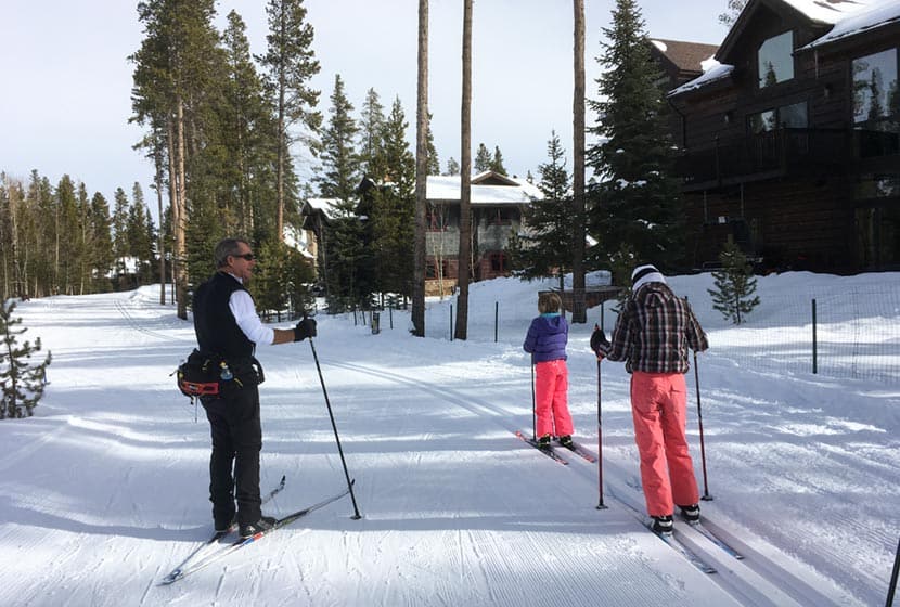
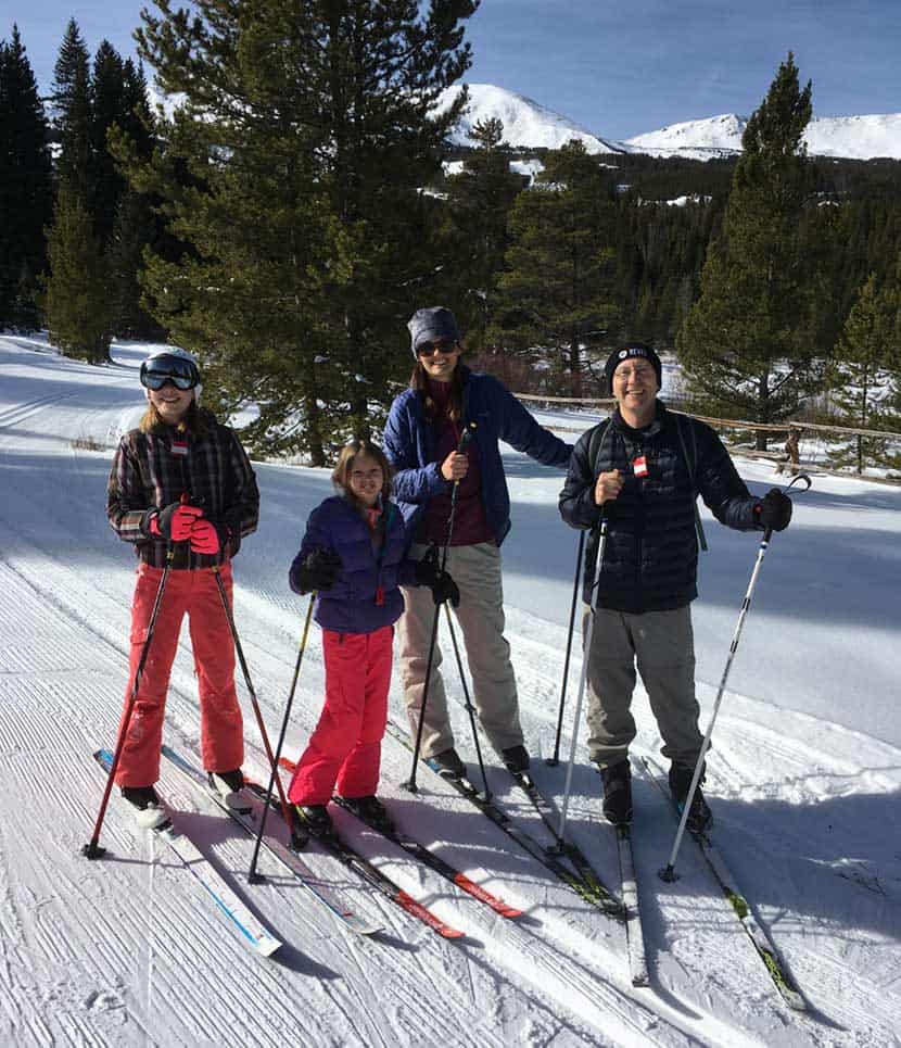
“I’m going to miss him.” That was the comment made by our youngest daughter after our instructor, Gary, concluded our lesson. A retired local science teacher, Gary was amazing at helping our kids move from never-been-on-skis-in-my-life status to gaining the skills and confidence to enjoy their time on the trails. When we would move from one skill to the next, he would say, “Your next challenge is…” He was incredibly patient and his language helped our girls stay motivated.
Gary differentiated the cross country ski instruction for the adults, too. He first invested time with in our kids, knowing we would catch on a bit faster. Then, while our children were practicing and gliding down the trail, he would join back up with my wife and I to help us to add new skills and to coach us on our form.
Taking a Break: Warmth, Lunch, and Rest
Winter sports are demanding. After our lesson, we popped off our skis and headed back into the lodge to get some lunch and a bit of rest. Walking in cross country ski boots is way more comfortable than downhill skis. The lunch menu had two homemade soups: a caramelized onion potato soup and a tomato artichoke. Brats, hot dogs, chips, and plenty of drinks, too (including some Colorado brews). Sitting near the fire, we thawed out, filled our bellies and got ready to head out back into the snow.
Having run several businesses and led teams, I’m always aware of the staff dynamics of organizations. The staff at BNC stood out because they genuinely enjoyed one another. I observed them going the extra mile to help customers and to keep things tidy around the lodge. It’s those little things that add up to make a place memorable.
Skiing the Trails
Learn from My Two Mistakes
When we went back out on the trails, we made two mistakes. I mention them here hoping to convert them to cross country skiing “tips.” The first is a typical Colorado blunder, I forgot to put water bottles in my daypack. The second was that we decided to explore a new trail loop that required navigating some steeper terrain–bad idea. If I could rewind, we would have repeated the loop our instructor took us on for the lesson. On the Trail Map, this easy loop is the Troll Forest to Gold Digger loop, going counter-clockwise to make the loop.
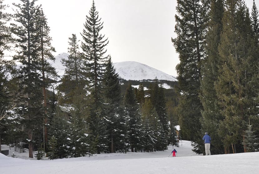
The Trails
The nordic trails were beautifully groomed, winding through towering spruce and fir trees, by mountain cottages, and with views out to the mountains that make Breckenridge such a glorious Colorado destination. With 2000 acres, there are plenty of trails. The intermediate and advanced trails require a lot more uphill and downhill skills as well as additional leg power. We covered the approximately 3 miles of easy trails that afternoon. As mentioned above, we skied the intermediate segment linking the two sides of the Troll Forest trail. It is worth it, but if you are a beginner, it’s good to know that the steep segment leading down to Ken’s Kavern tunnel is way easier to navigate by taking off your skis and hiking it–especially for young children.
If you plan on skiing the Troll Forest Loop (and I definitely recommend it), ski the circuit clockwise to make the most of the tracks and to maximize the gentle downhill segments. Otherwise, it’s uphill most of the way.
Tips for Your First Time Cross Country Skiing
- Start at a nordic center on groomed trails: This was definitely the optimal setting for learning and an easy entry into getting familiar with the equipment.
- Bring a small daypack for water and snacks
- If you're bringing kids, bring your patience, too. Our kids picked it up quickly, but I wish I had adjusted my expectations a bit.
- If you're considering cross-country ski equipment, take a few minutes to make sure you find a comfortable pair. Take a photo of your shoe and the size tag for future reference (they come in European sizing).
- Make a full day of it: We left at 8:30 and got home around 5:30. On the weekend, I'd recommend going earlier and to a longer drive home because of ski traffic.
- Be aware of moose that may wander through or bed down in the area. Remember they are territorial, so it's important to give them space and to not approach them.
- Dress in layers. It's a workout, so you'll get warm more quickly than you'd think.
Breck Nordic Center Details
- See the Pricing Page for detailed info, but the basics are: an adult trail pass is $25 per day, and a ski rental package is $23. Kids under 12 ski free and a kid's rental package is $10 (at the time of this writing 12/19).
- Check out the Trail Map to get a feel for all your skiing options
- BNC also offers Snowcat Tours up into the mountains and hosts Private Events at their O Be Joyful Lodge.
- Be sure to check out their FAQ page. It's really helpful for planning your trip.
- Location: 9 Grandview Drive, Breckenridge, CO 80424
- Contact: 970-453-6855, BestNordicSki@gmail.com
- Hours: Daily 9am-4pm
Dayhikes Near Denver would like to thank the owners and staff at BNC for hosting us and for a complimentary day learning to cross country ski at their facility.